Goathland, Beck Hole and Darnholm
Heritage railways and waterfalls in superb moorland countryside
Google Maps Open Source Maps| Statistics and Files | ||
|---|---|---|
| Start: Goathland | Distance: 5.1 miles (8.2 km) | Climbing: 228 metres |
| Grid Ref: NZ 82779 00717 | Time: 3 hours | Rating: Moderate |
| GPX Route File | Google Earth File | About Goathland |
| Statistics | |
|---|---|
| Start: Goathland | Distance: 5.1 miles (8.2 km) |
| Climbing: 228 metres | Grid Ref: NZ 82779 00717 |
| Time: 3 hours | Rating: Moderate |
| GPX Route File | Google Earth File |
Ordnance Survey Explorer Map (1:25,000)
The Walk: Goathland in the North York Moors National Park, is an ancient settlement surrounded by moorland. Some 500 feet (150 metres) above sea level, in late summer the stone buildings bask in a sea of purple heather. From the time of Henry III to the present day, the common land in and round the village has belonged to the Duchy of Lancaster. Today, Goathland is one of Yorkshire's most popular villages. Many of its visitors come to see the steam trains of the North Yorkshire Moors Railway, which stops at the station here.
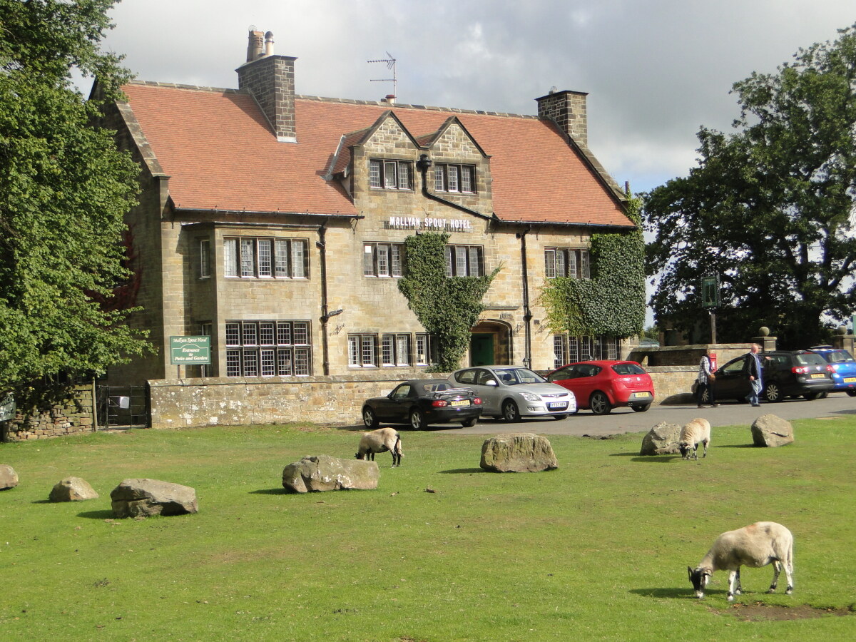 Mallyan Spout Hotel in Goathland
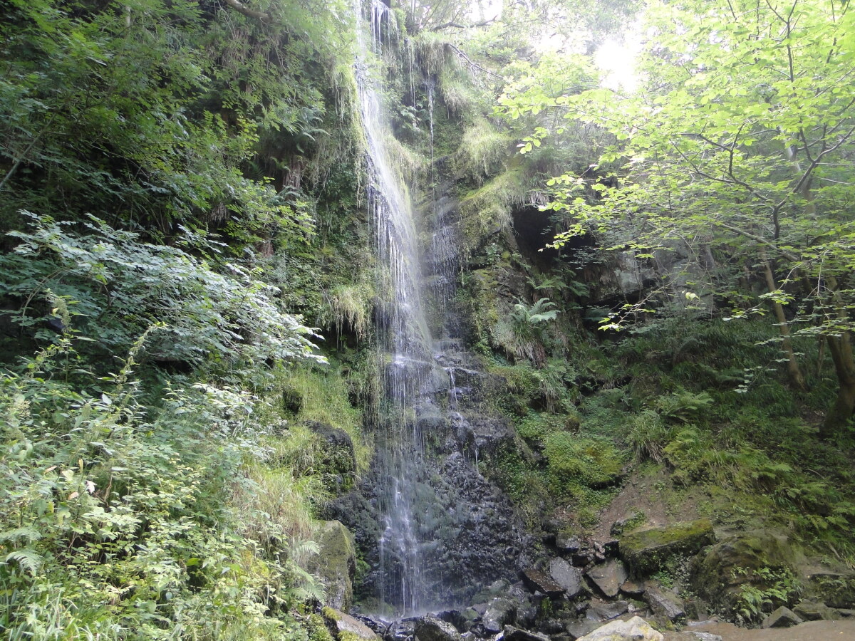 Mallyan Spout
The route goes around the edge of the village, but it is worth exploring the centre before you start. The houses straggle along a wide street, with open grassland on either side. The grass is kept neatly trimmed by black faced sheep, which wander freely and are quite tame. The flagged causeways along the wide verges probably date from the mid 17th century. The starting point is the late Victorian Church of St Mary, which contains two ancient stone objects of interest; a Saxon or early Norman font, and a 12th century altar slab found in the churchyard.
From Goathland, the route leads down the steep path to the valley of the West Beck and to Mallyan Spout. This fine waterfall, in a lovely setting of fern covered rocks, can be quite spectacular after heavy rain. The water tumbles 70 feet (21 metres).
You continue downstream through woodland. By Incline Cottage, the original course of the Whitby to Pickering Railway can be seen. It is now used as a walking trail. In the early years of the railway, carriages were uncoupled at the foot of the one in five incline, and hauled to the top by a horse-powered rope system. A stationary steam engine eventually replaced the horses, but this did not prevent Charles Dickens from commenting that he had travelled on "a quaint old railway along part of which passengers are hauled by a rope."
The railway line was dogged by a number of mishaps, including a derailment when an entire train plunged into a swamp near Goathland. On another occasion, a train laden with herring, went out of control and left a fishy smell hanging over the area for weeks. The Beckhole Incline was closed after a fatal accident in 1864, when the rope snapped and the coaches overturned at the bottom, killing two commercial travellers, and injuring 13 other people. A safer route between neighbouring Grosmont and Goathland was opened in 1865.
Beyond the track bed is the hamlet of Beck Hole, one of the gems of Yorkshire. Nestling in a wooded fold in the moors, the cottages of Beck Hole cluster round a village green where sheep wander and a locals play quoits. The focal point of Beck Hole is the Birch Hall Inn, which also serves as a village shop and a cafe.
It is surprising to discover that in 1858, two blast furnaces and thirty three stone cottages were built here, for no trace of the iron industry, or the homes of the 180 workers remain today. Production ceased after only two years following a series of disastrous incidents, including the collapse of one of the furnaces.
The Moorland path above Beck Hole follows the Eller Beck Valley, though the river is mostly hidden far below among the trees. At the foot of a natural hillside amphitheater, up from Thomason Foss, the beck drops over Water Ark Foss.
You will have to scramble down the hillside paths from the main route to view the force, but the railway which also winds through the valley is more easily visible. The path drops to cross the beck by a footbridge under the skew railway bridge, and there is a magnificent view from the opposite slope along the line as it curves south towards Darnholm.
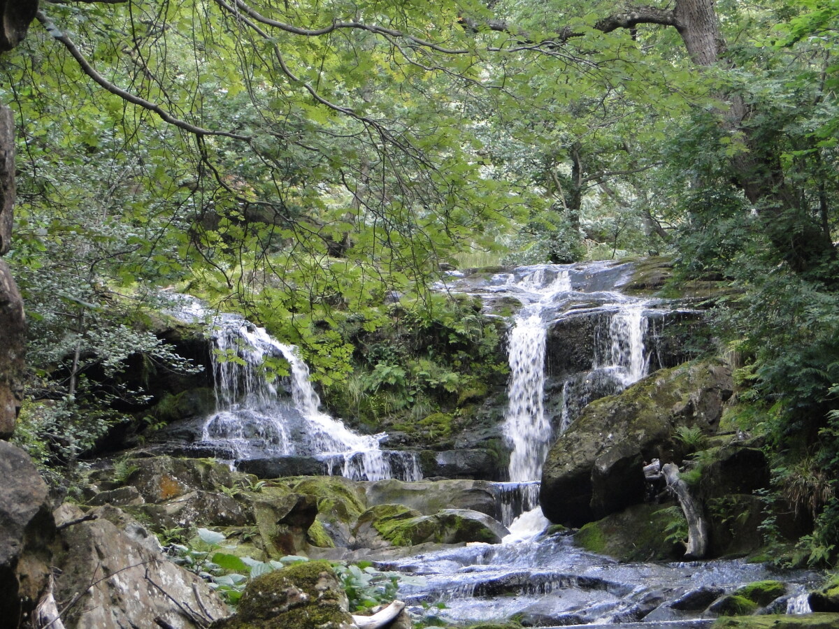 Thomason Foss
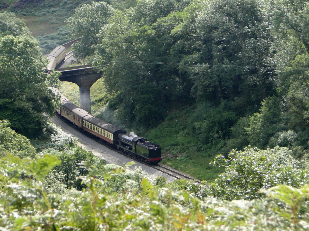 North Yorkshire Moors Railway
The road at Darnholm ends at a shallow ford over the Eller Beck, and the grassy banks by the stepping stones are ideal for a picnic. On a hot day it is refreshing to paddle in the clear pebble strewn stream.
The path continues up a steep slope and along the top of Mill Scar. The railway cutting below was made in 1865 to carry the new line replacing the Beckhole Incline. Its construction was not without problems. Huge boulders had to be blasted away and rock falls were so frequent that watchmen had to patrol the line every night.
At Goathland Railway Station, you can view engines and rolling stock owned by the North Yorkshire Moors Railway. If your timing is right, you will see a train steaming to the station, and it is fun to stand on the footbridge wreathed in clouds of steam and smoke. Even when there are no trains there is plenty to see, including the signals, a tiny signal box, water cranes and a goods shed, which is used for the restoration of carriages.
The route climbs back onto the open moorland, and there are fine views of the railway rising to the south through the heather. Directly ahead on the moors is the alien looking bulk of the Fylingdale's Early Warning Station.
Close to the station stands the Lilla Cross, a Bronze Age monolith that was turned into a Christian cross to commemorate a 7th century thane, Lilla, who died trying to save the life of King Edwin. The War Memorial in Goathland is a replica of the Lilla Cross.
You pass underneath the railway again, and walk past a reminder of Goathland's ancient past. Abbot's House is built on the site of a hermitage mentioned in records from 1100. You cross the disused incline railway again, then return across fields surrounded by gloriously colourful moorland slopes, to Goathland's church and back to the starting point of the walk.
Acknowledgments: Text derived from the Out and Out Series; Discovering the Countryside on Foot. Pictures courtesy of Wikipedia.


