Mallerstang: Aisgill, Outhgill and Pendragon Castle
Trains, Waterfalls and solitude in a valley among the fells
Google Maps Open Source Maps| Statistics and Files | ||
|---|---|---|
| Start: Aisgill | Distance: 10.2 miles (16.5 km) | Climbing: 368 metres |
| Grid Ref: SD 77800 96281 | Time: 4-5 hours | Rating: Hard |
| GPX Route File | Google Earth File | About Mallerstang |
| Statistics | |
|---|---|
| Start: Aisgill | Distance: 10.2 miles (16.5 km) |
| Climbing: 368 metres | Grid Ref: SD 77800 96281 |
| Time: 4-5 hours | Rating: Hard |
| GPX Route File | Google Earth File |
Ordnance Survey Explorer Map (1:25,000)
The Walk:
Mallerstang valley runs deep between Wild Boar Fell, rising to 708 metres in the West, and the equally high sheer escarpment of Mallerstang Edge to the east. Through it flows the infant River Eden, and clinging to the fellside above is the Settle to Carlisle Railway line, where steam trains can sometimes be seen puffing up the steep gradients at the highest point of the British rail system.
This exploration of the valley begins at Aisgill Moor Cottages, on the border between Cumbria and North Yorkshire. It should begin early in the morning, so the sun is over your shoulder on the way north, lighting up the valley ahead, and the western fells. On the return, the eastern fells will be lit. And with Mallerstang, despite it being in Cumbria, being the most northerly and remote valley of the Yorkshire Dales National Park, you have the best chance of enjoying a reflective walk of peace and solitude.
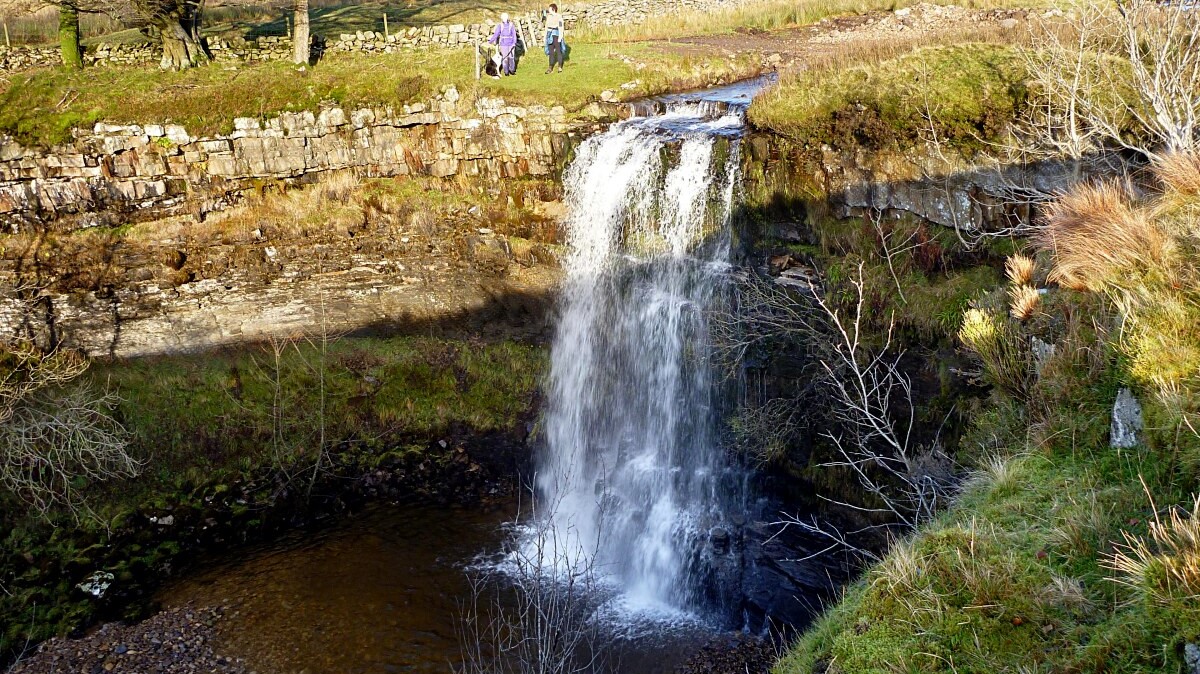 Hellgill Force
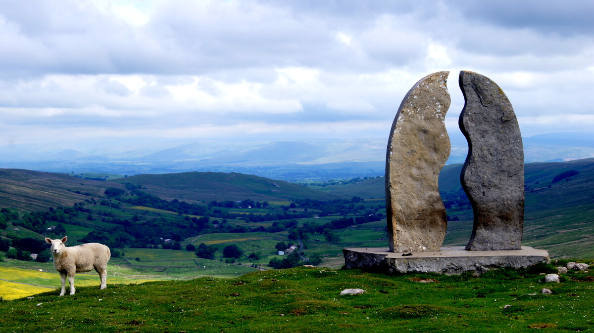 Water Cut stone sculpture by Mary Bourne
Aisgill Moor Cottages, just inside Cumbria, were originally built to house the track maintenance staff of the Midland Railway. From the cottages, the walk climbs alongside Hellgill Beck, the source of the River Eden, which passes through a deep gorge, whose sides have been worn concave by the winter torrents. This leads to the Highway, a flat grass road along the hillside which was originally a Roman road. It was used by Lady Anne Clifford in the in the 1660s as she went to and fro between her various castles.
Note, on the climb to the Highway, take a short detour to Hellgill Force, a stunning waterfall which has cut into the rock strata and formed a perfectly clear drop pool at the base of the cascade. Afterwards, being so close to the start of the walk, it can be the ideal setting for a post walk picnic.
The Highway is flanked by limestone outcrops, or pavements, and numerous shake holes and potholes. At first the valley bottom is not visible, but after a while the Highway meets the edge of the valley, and you can look straight ahead down the full length of Mallerstang. Also, around where the view opens out, you arrive at the 'Water Cut' a stone sculpture which was designed by Mary Bourne and installed by local farmers as part of the Eden Benchmarks project.
The way down from the Highway is a long slope in parts rough going and steep. After heavy rain, four streams have to be forded. At other times there is just a scramble over wet boulders. Next up is a short walk through pleasant woodland to Mallerstang Church, restored by Lady Ann Clifford in 1663. Her coat of arms is inside. By the door are shelves on which bread had been distributed since the 18th century, in accordance with a charitable bequest.
To the north is the only village in the valley; Outhgill. It has no shop or pub, but some very pretty houses. One of these was the home of the blacksmith, who was the father of Michael Faraday, the scientist.
A little further up the road, a field path leads to a waterfall in a grotto below Castlethwaite Farm. The water appears from a hole in the rock face and cascades down about 20 feet of stone stairway. It is hardly dramatic, but very well hidden in a dark and curious setting.
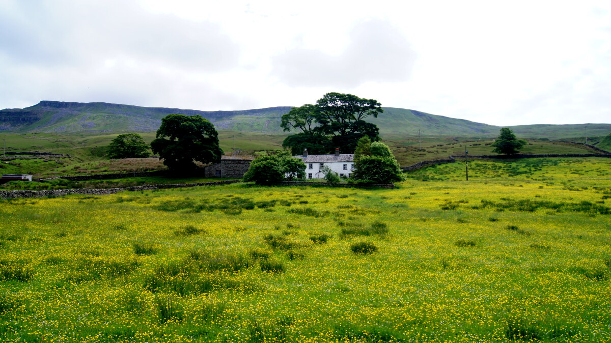 Buttercup meadow in Mallerstang
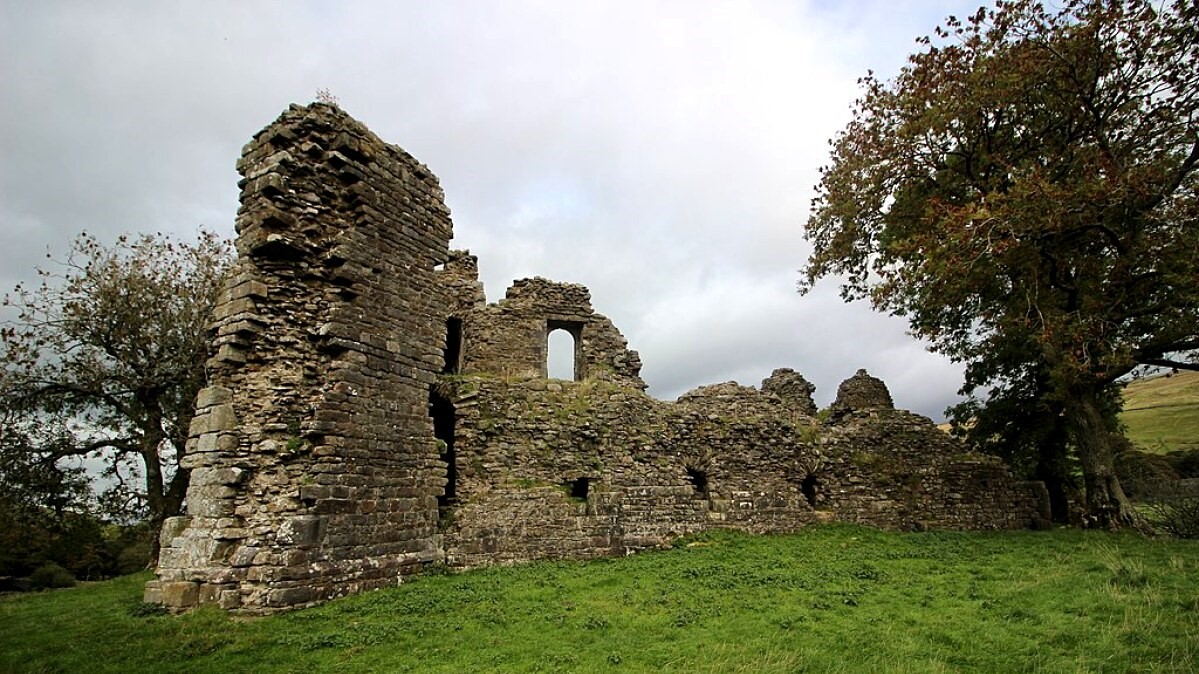 Pendragon Castle
The turning point of the walk is Pendragon Castle, a small picturesque ruin surrounded by a deep dry moat. It was supposedly the home of Uther Pendragon, father of King Arthur, but the existing building is only 12th century. It was the seat of the Lords of the Manor, the most notable being Hugh de Morville, one of the three knights who murdered Thomas á Beckett. The castle was restored by Lady Anne Clifford in 1660. It stands on private ground, but access is permitted through a roadside gate.
There is a gentle stroll along the foot of the fells on the west Bank of the river, with long vistas up and down the wider end of the valley to Shoregill, a farm which, along with its outbuildings, has been converted into holiday homes. Next, you return to Mallerstang Farm and climb the fellside to walk alongside the railway, with splendid views across the valley before dropping down again to Ings Heads.
From Ings Head, it is a few minutes walk across fields to view Hanging Lund, a fellside waterfall behind some farm houses. It is not worth the detour after a spell of dry weather, in which case you should continue along the road to Aisgill Viaduct.
This elegant structure spans a deep cleft in the hillside, down which three gills pour. There are paths leading up on either side to the high ground above the viaduct, a favourite perch for steam train buffs. From here it is a delightful stroll back to the start of the walk at Aisgill Moor Cottages.
Acknowledgments: Text derived from the Out and Out Series; Discovering the Countryside on Foot. Pictures courtesy of Wikipedia.


