Morpeth
A town that bears witness to centuries of border raids
Google Maps Open Source Maps| Statistics and Files | ||
|---|---|---|
| Start: Bridge Street | Distance: 3.7 miles (6.0 km) | Climbing: 77 metres |
| Grid Ref: NZ 20018 85889 | Time: 2 hours | Rating: Easy |
| GPX Route File | Google Earth File | About Morpeth |
| Statistics | |
|---|---|
| Start: Bridge Street | Distance: 3.7 miles (6.0 km) |
| Climbing: 77 metres | Grid Ref: NZ 20018 85889 |
| Time: 2 hours | Rating: Easy |
| GPX Route File | Google Earth File |
Ordnance Survey Explorer Map (1:25,000)
The Walk: At the time of the Norman Conquest, the area where Morpeth now stands was a minor river crossing in the wilds of the north country. Once William I was established he set about consolidating his hold on the northern parts of his new kingdom, building up defences against the possibility of an invasion by the Scots. In 1080, he granted the baronetcy of Morpeth to the de Merley family, who built a motte and bailey castle on the south side of the River Wansbeck to guard the crossing. From those early beginnings, Morpeth became part of his extended northern defences of Newcastle, and grew into a town of some importance. Today it is the county town of Northumberland.
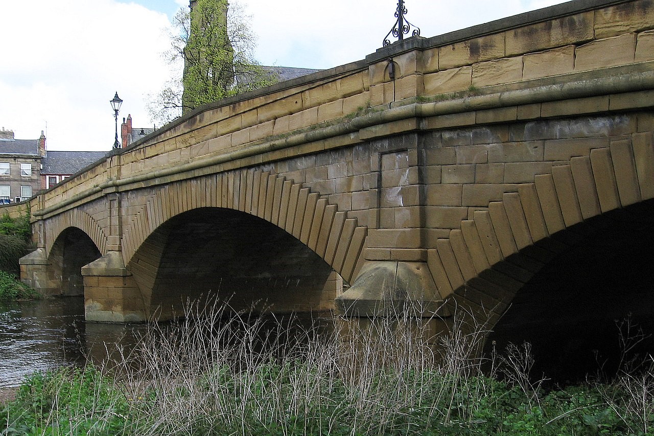 Telford Bridge
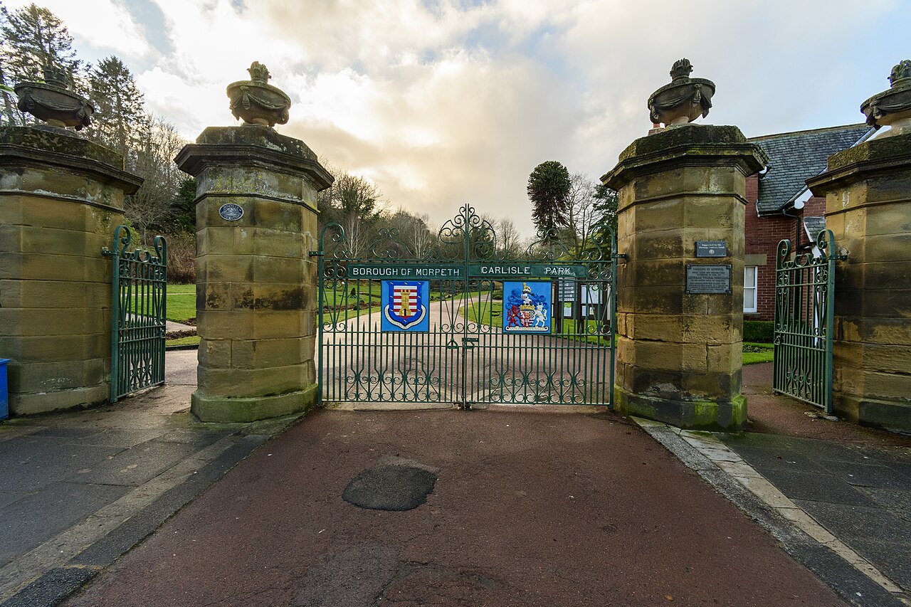 Gates To Carlisle Park
The town suffered greatly from disputes and cross border raiding during the Middle Ages. It is said that Scottish brigands entered Morpeth with the regularity and impunity of men going to market. As a result, some of the town's earliest buildings are now ruined shadows of their former selves, requiring some imagination to see them as they once were.
Fortunately, there is still much to see on this walk around the town, beginning on the northern bank of the river at the Chantry in Bridge Street. Originally part of All Saints Church, the Chantry was founded in the 13th century. One of its early functions was to collect the tolls from the bridge crossing.
It was later used as a grammar school, and now houses the tourist information office, a craft centre, the Northumberland Wildlife Trust shop and a particularly interesting bagpipe museum. Here you can follow the history of bagpipes from around the world, with special emphasis on the Northumbrian small pipes.
The original bridge has now gone and a Victorian footbridge rests self consciously on the old stone piles. Modern road traffic crosses the river a little way downstream on an elegant stone bridge built by Thomas Telford in 1831. A short walk to the south of Telford Bridge is the Courthouse, built in 1822 by the Newcastle architect John Dobson. It is a sturdy stone building, made more imposing by glowering battlements and was once used as the town prison.
Opposite the Courthouse is the entrance to the most colourful part of Carlisle Park. From early spring to the end of autumn it is awash with changing colours. Its immaculate little flower beds have won the national category prize in a number of annual Britain and Bloom competitions. In the park is the unmistakable mound where the original castle stood. A little further up the hill is the site of a second castle, believed to have been built in the 14th century. Though in a more command insight than the Norman building, it was all but destroyed during the Civil War. Only the gatehouse and some remnants of curtain wall still stand.
Further south, on the Newcastle road, is St Mary's or High Church, one of the finest in the county. Most of it dates from the 14th century, including the glass in the east window. There is an attractive lych gate, and the churchyard contains the grave of one of Morpeth's most famous citizens, the suffragette Emily Davidson, who threw herself under the King's horse at Tattenham Corner during the 1913 Derby to draw attention to her cause. She died from her injuries four days later and is buried in the northwest corner of the churchyard, close to a tall white obelisk. The epitaph on the tombstone is "deeds not words".
The walk swings around Morpeth Common and through the Kirkhill area before dropping down into a riverside meadow to the ruins of Newminster Abbey. The abbey was a Cistercian Foundation and was built in 1137 under the patronage of Ranulph de Merley. It had close connections with Fountains Abbey in Yorkshire. Like most religious buildings in the border country, it suffered badly during Anglo Scottish conflicts and was finally destroyed during the Dissolution. All that remains is a rather sad, but very atmospheric collection of ruins standing among trees and undergrowth.
Access to the site and the path leading to it are both concessionary and care must be taken to stay on the path when you visit the abbey grounds. At this point, those with the time and inclination can leave the main route and follow the signposted footpath west along the river valley to Mitford, where a ruined castle overlooks a lovely church.
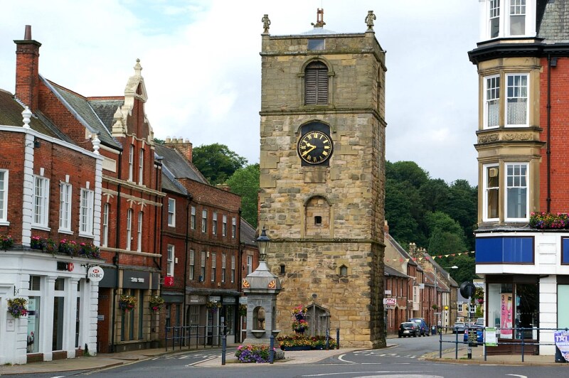 Morpeth Clock Tower
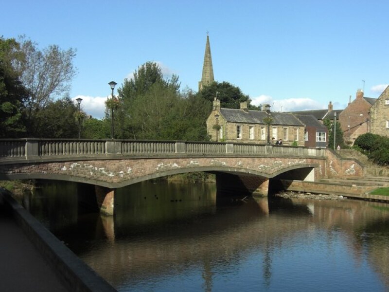 Oldgate Bridge
The main route goes back along the river towards Morpeth, then crosses a footbridge and climbs up to the north side of the town. As you descend again to the town centre, you pass the imposing Church of St James, set at the end of a tree lined drive, headed by an elegant stone screen. Unlike most Victorian churches, it is built in the Norman rather than the Gothic style.
Newgate Street leads down to the Town Hall, designed by John Vanbrugh in 1714, when the road at the side, which runs down to the market, did not exist. The roads creation has exposed the red brick side of the Town Hall building, which detracts from the elaborate stone front. However, it is still an impressive sight.
The route turns right into Oldgate, in the middle of which is a clock tower, 15th century in origin, but added to and altered later. It now stands curiously isolated, appearing conscious of the need to remain studiously aloof from the functional red brick buildings on either side.
A little further along on the right is a fine Georgian house that was once owned by Vice Admiral Lord Collingwood, the man who took command of the fleet at Trafalgar after Nelsons death. So successful was his naval career that he is said to have spent only one year at home between 1793 and 1820.
The walk leaves Oldgate over a modern road bridge, and turns left to follow the river. This lovely, leafy path with the gently flowing River Wansbeck on one side and Carlisle Park on the other, leads back to the Chantry to complete the walk.
Acknowledgments: Text derived from the Out and Out Series; Discovering the Countryside on Foot. Pictures courtesy of Wikipedia.


