Dollar and Castle Campbell
Into the Ochils, a walk from Dollar in Clackmannanshire to romantic Castle Campbell
Google Maps Open Source Maps| Statistics and Files | ||
|---|---|---|
| Start: Dollar | Distance: 2.1 miles (3.4 km) | Climbing: 189 metres |
| Grid Ref: NS 96316 97975 | Time: 1-2 hours | Rating: Easy |
| GPX Route File | Google Earth File | About Dollar |
| Statistics | |
|---|---|
| Start: Dollar | Distance: 2.1 miles (3.4 km) |
| Climbing: 189 metres | Grid Ref: NS 96316 97975 |
| Time: 1-2 hours | Rating: Easy |
| GPX Route File | Google Earth File |
Ordnance Survey Explorer Map (1:25,000)
The Walk:
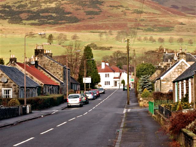 Dollar
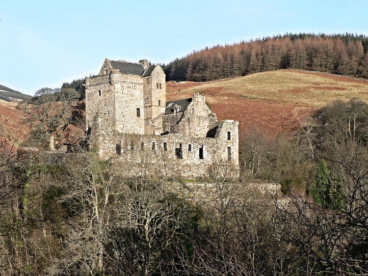 Castle Campbell
The walk begins in the small town of Dollar on the northern edge of the lowlands and leads up the glen of Dollar Burn to the impressive Castle Campbell. Partially ruined, stern, romantic and in an unrivalled setting, it is everything a castle should be, and is surrounded by tales and legends, embracing a who's who of history. John Knox preached at the castle, Mary Queen of Scots visited it, Montrose's men sacked it and Cromwell's General Monck burnt it.
The walk follows Dollar Burn up to the castle and the Ochil scarp ensures it is uphill all the way. Cherry trees line the early walk upstream and the old church can be seen above the Middle Bridge, built so the first rector of the famous Dollar Academy could cross from manse to school.
The steep sided glen has a certain grandeur and is most impressive after rain when the gorges echo wildly with torrents of water. Woodcocks love the rich tree cover and the waters are the habitat of bold Dippers. Wooden walkways and bridges are built within the gorge itself, the sides of which rise up to around 180 feet/ 56 meters. The 15th century castle is built above it, although this cannot be seen from the gorge. All along the burn there is a succession of pretty waterfalls and quite corners. Beyond the route is an exceptionally tranquil spot where they can be viewed at leisure.
From the castle entrance, with its hanging tree, a tiny road leads to a white cottage which has a commanding view of the lowlands and the hill of White Wisp. Many consider this to be the best view of the castle. As the road descends the secretive quarry of Gloom Hill lies to the left, its abandoned walls making good sport for rock climbers. The road drops steadily downhill to the old town and so back to the Burnside and the starting point of the walk.
Acknowledgments: Text derived from the Out and Out Series; Discovering the Countryside on Foot. Pictures courtesy of Wikipedia.


