Tentsmuir Nature Reserve and Tentsmuir Sands
Enjoy a walk out through a shoreline forest, returning via a deserted beach
Google Maps Open Source Maps| Statistics and Files | ||
|---|---|---|
| Start: Tentsmuir Nature Reserve | Distance: 3.7 miles (6.0 km) | Climbing: 5 metres |
| Grid Ref: NO 49874 24187 | Time: 2 hours | Rating: Easy |
| GPX Route File | Google Earth File | About Tentsmuir |
| Statistics | |
|---|---|
| Start: Tentsmuir Nature Reserve | Distance: 3.7 miles (6.0 km) |
| Climbing: 5 metres | Grid Ref: NO 49874 24187 |
| Time: 2 hours | Rating: Easy |
| GPX Route File | Google Earth File |
Ordnance Survey Explorer Map (1:25,000)
The Walk: This stretch of coastline in south-east Scotland is home to sea birds and seals, and the forest fringes the shoreline. The walk begins beside the deserted beach where the opening scene of Chariots of Fire was filmed, and continues into Tentsmuir forest which is rich with its own wildlife. The forest was acquired by the Forestry Commission in the early 1920's. Planting started in 1922 and since then the forest has grown to around 4,000 acres. The trees are mostly Scots Pine and Corsican Pine. Tentsmuir, situated between the Tay and Eden rivers derives its name from old writings which describes fishermen pitching their nets on the dunes, known locally as 'muir' (heath).
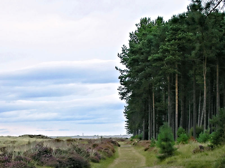 Path beside Tentsmuir Forest
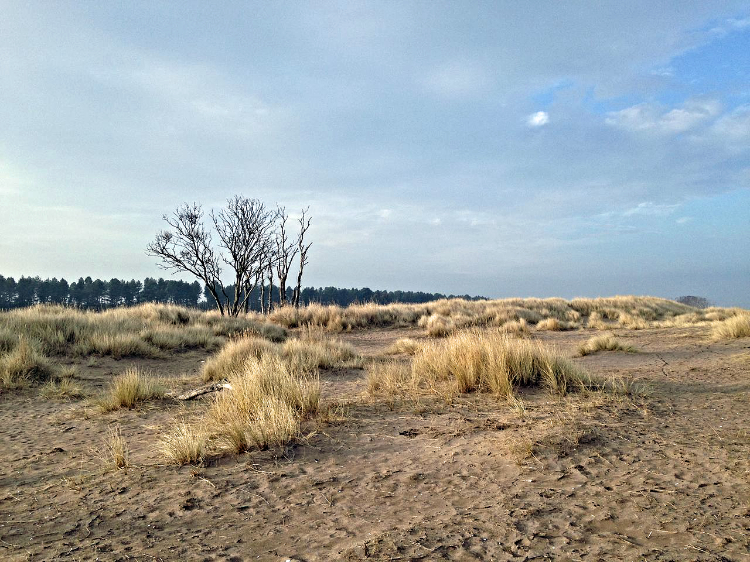 Tentsmuir Sands
The plantations and their surroundings provide a habitat for a wide diversity of plant and animal life. Next to the car park where the walk starts is Tentsmuir Sands. This coastline, with its high dunes, includes a national nature reserve. The start of the walk is a good time to look for birds active amongst the pines. Particularly common is the coal tit, which likes the coniferous woodland and is easily identified. Also look out for squirrels, rabbits and if you are lucky, roe deer.
The first of two ponds encountered on the walk is Heron Pond which the forestry commission developed. Unfortunately the pond can dry out in spells of little rain. At the most northerly point of the walk is the ice house and the second pond. At the end of the 19th century attempts were made to introduce salmon fishing here on a commercial basis but success was not guaranteed and the project was later abandoned. Thus the ice house, built to keep the salmon fresh was disused too.
After leaving the forest and embarking on the return journey the scene changes completely. First by walking amongst the sand dunes forming the fringe of Tentsmuir Point National Nature Reserve and later while walking on the sands by the waters edge, hopefully watching waders sift through the sand for food. The cries of gulls and/ or curlews should be present. Further out, on the sandbars, seals can frequently be seen. both the common seal and grey seal. All in all, this is a refreshing walk by the seashore back to the starting point.
Acknowledgments: Text derived from the Out and Out Series; Discovering the Countryside on Foot. Pictures courtesy of Wikipedia.


