Castle Tioram and Loch Moidart
Explore Castle Tioram and Loch Moidart's picturesque shoreline
Google Maps Open Source Maps| Statistics and Files | ||
|---|---|---|
| Start: Cul Doirlinn | Distance: 3.1 miles (5.3 km) | Climbing: 337 metres |
| Grid Ref: NM664721 | Time: 2 hours | Rating: Moderate |
| GPX Route File | Google Earth File | About Castle Tioram |
| Statistics | |
|---|---|
| Start: Cul Doirlinn | Distance: 3.1 miles (5.3 km) |
| Grid Ref: NM664721 | Time: 2 hours |
| Climbing: 337 metres | Rating: Moderate |
| GPX Route File | Google Earth File |
Ordnance Survey Explorer Map (1:25,000)
Summary: The best times to undertake this walk are in summer of late autumn, when the mixed woodlands provide an eye-catching backdrop to the fascinating Castle Tioram. The impressive appearance of this stronghold is enhanced by its setting on a small island in Loch Moidart with Eilean Shona providing an excellent backdrop. At low tide the castle can be reached dryshod by a sandbar and this gives rise to the castle's name Tioram (pronounced 'chee-rum') which is Gaelic for 'dry'.
The Walk: The oldest parts of the castle were built in the 13th century and until it was burned in 1715 it was the principal seat of the Chief of Clanranald. Its ivy clad walls, still intact, reach a height of 60 feet (18 metres) in places and enclose a two tiered courtyard some 80 feet (24 metres) across.
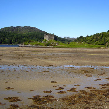 Castle Tioram at low water
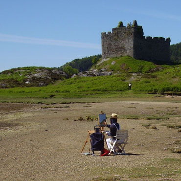 Artist at work near Castle Tioram
To explore the castle, it is best to enter by a narrow passage in the north wall that leads to the keep in the south-west corner. There is a three storeyed hall in the east corner and the kitchen is in the south-east corner. Here there remains an old oven and a well - the latter reputedly bottomless, but now choked. Remnants of spiral staircases climb to the parapets.
After exploring the interior of the castle, a walk around the outside gives an idea of the impregnability. Behind it a steep little path leads down to a small bay on the west shore of the island from where the castle looks very impressive indeed.
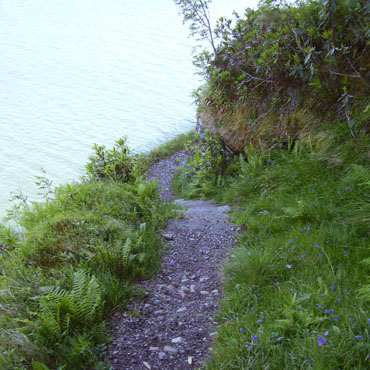 Narrow path above Loch Moidart
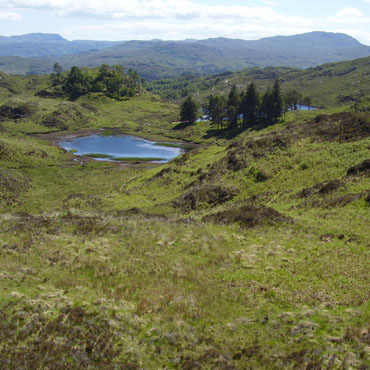 The view south towards Loch Blain
Loch Moidart is a lovely sea loch, studded with sandy bays and tree clad islands. A 19th century path known as the Silver Walk (after a cache of old silver coins that were found during the construction) follows the loch's rocky shoreline north of the castle. The path has been paved with rock steps in places, but has deteriorated over the years and is now an adventurous and often boggy walk, requiring good balance while wearing good footwear.
In early summer this is the spot for lovely displays of rhododendrons and woodland scenery. There are close up views of the loch and the two beautifully wooded islands of Riska and Eilean an Fheidh. These islands enclose a sheltered stretch of water where boats anchor and it is even possible to see seals seeking shelter from the open sea.
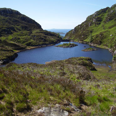 Looking west down the valley
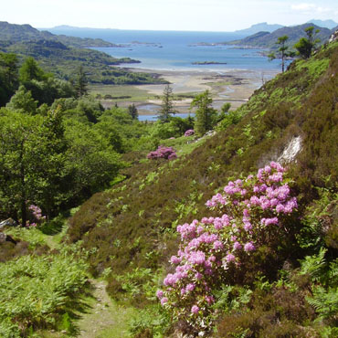 To the Sound of Eigg
From the shores of Loch Moidart a path climbs 500 feet (150 metres) on to the moor to link the Silver Walk with the roadside near Castle Tioram. The path is overgrown and boggy in parts, but it passes through an eerie, abandoned village from where there are superb views from the path over Loch Moidart. A little further on are views to two lovely moorland lochans and after turning from walking southwards to westwards you can gaze out to sea taking in the distant islands of Eigg and Muck.
Acknowledgments: Text derived from the Out and Out Series; Discovering the Countryside on Foot. Pictures courtesy of Wikipedia.


