Hillend Country Park, Caerketton Hill, Allermuir Hill and Swanston
A short walk up the most northerly hills in the Pentland range
Google Maps Open Source Maps| Statistics and Files | ||
|---|---|---|
| Start: Hillend | Distance: 4.0 miles (6.4 km) | Climbing: 409 metres |
| Grid Ref: NT 25008 66984 | Time: 2 hours | Rating: Moderate |
| GPX Route File | Google Earth File | About the Pentland Hills |
| Statistics | |
|---|---|
| Start: Hillend | Distance: 4.0 miles (6.4 km) |
| Climbing: 409 metres | Grid Ref: NT 25008 66984 |
| Time: 2 hours | Rating: Moderate |
| GPX Route File | Google Earth File |
Ordnance Survey Explorer Map (1:25,000)
The Walk: The major attraction of this walk is the tremendous views obtainable from virtually the entire route. Right from the start, as you rise up the steep sides of Caerketton Hill, the vista of Edinburgh and the rolling farmlands of Midlothian gradually unfold. From the top of Caerketton Hill one can see the Moorfoot Hills, the whole of Edinburgh and clearly across the Firth of Forth to Fife. While these are exceptional in themselves, the most extensive views are from the higher Allermuir Hill.
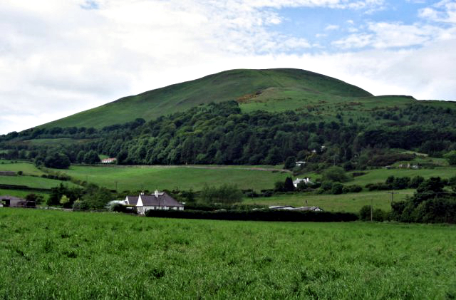 Pentland Hills as seen from Hillend
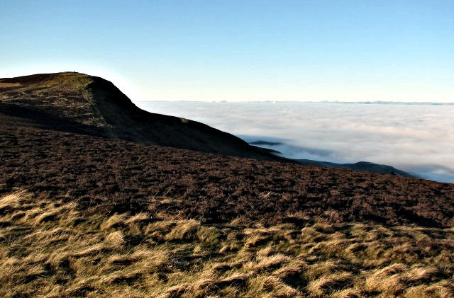 Caerketton Hill
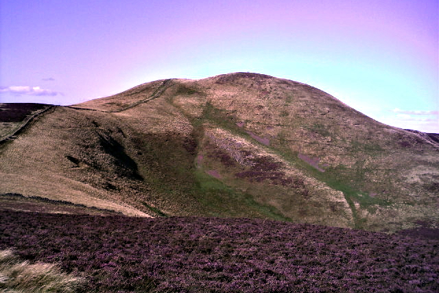
From the start at Hillend, the climb to first Caerketton Hill and then Allermuir Hill is a steady yomp upwards. Nice and steady, easy done with a break to explore the remains of an Iron Age hill fort. It consisted of stone walls which have long since been scavenged so what remains of the fort to see is just a faint sign of level terracing.
After summiting Caerketton Hill, continue on the path westwards through Caerketton Craigs before descending a rocky slope to Windy Door Nick which lives up to its name on blustery days. From here a short climb leads to Byerside Hill and soon after another short ascent leads to the summit of Allermuir Hill and consequently the end of the climbing on this walk. It is all downhill now, but hold on a while. Stay on top of Allermuir Hill for now.
A viewfinder here helps identify the major topographical features in the vista below. To the east is Bass Rock and the open sea, to the south-west the tops of the remaining Pentland Hills and to the north-west the Forth Bridges and the Ochil Hills. On very clear days, especially in winter, it is even possible to see Ben Lomond mountain, 60 miles (96 km) away.
 Allermuir Hill
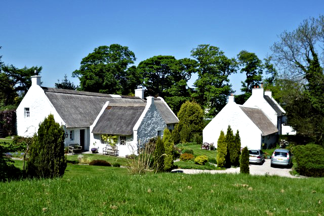 Cottages in Swanston
On the descent from Allermuir Hill, you will pass Swanston, summer home of the young Robert Louis Stevenson, author of such classics as Kidnapped, Treasure Island and The Strange Case of Dr Jekyll and Mr Hyde. This picturesque hamlet seems almost untouched by time, white washed cottages with thatched roofs and colourful gardens surround a village green through which trickles Swanston Burn. Incidentally you will have followed the watercourse down from its source where water gathers in the north facing gap between Allermuir Hill and Caerketton Hill.
Robert Louis Stevenson loved Swanston and the Pentland Hills. The Swanston school house and farm can be recognised in many of his novels and of the views from the hills you have just crossed he wrote with great affection: "You look over a great expanse of champaign sloping to the sea... So sit, like Jupiter on Olympus, and look down from afar on men's life".
Acknowledgments: Text derived from the Out and Out Series; Discovering the Countryside on Foot. Pictures courtesy of Wikipedia.


