Tailburn Bridge, Grey Mare's Tail, Loch Skeen and Lochcraig Head
Visit the most famous waterfall of southern Scotland as well as a beautiful loch
Google Maps Open Source Maps| Statistics and Files | ||
|---|---|---|
| Start: Tailburn Bridge | Distance: 5.5 miles (8.9 km) | Climbing: 650 metres |
| Grid Ref: NT186145 | Time: 3 hours | Rating: Hard |
| GPX Route File | Google Earth File | About Moffat |
| Statistics | |
|---|---|
| Start: Tailburn Bridge | Distance: 5.5 miles (8.9 km) |
| Grid Ref: NT186145 | Time: 3 hours |
| Climbing: 650 metres | Rating: Hard |
| GPX Route File | Google Earth File |
Ordnance Survey Explorer Map (1:25,000)
The Walk: Grey Mare's Tail is one of the highest waterfalls in Scotland, dropping 200 feet (60 metres) into the glen of Moffat Water. Above the main waterfall, a series of smaller falls descend from the delightful setting of Loch Skeen, situated in a beautiful corrie in the Moffat Hills. The Grey Mare's Tail and the surrounding area is a nature reserve with wild goats which graze the steep crags around the falls.
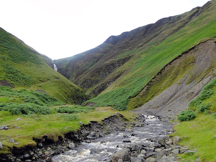 The approach track from Tailburn Bridge
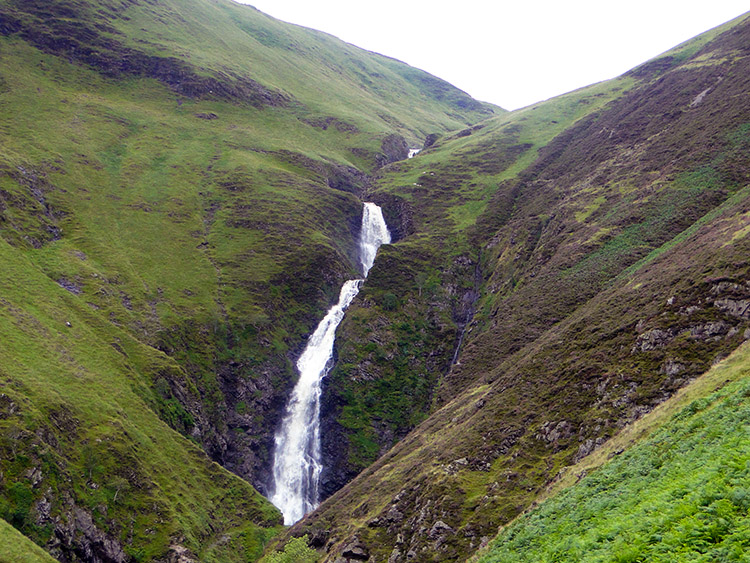 Grey Mare's Tail
The walk ascends steeply from the eastern side of the road bridge across Tail Burn, which emerges from the deep gorge it has carved out below the Grey Mare's Tail. Notices request the public not to stray from the path due to the problems of soil erosion - and the risk of slipping on the steep slopes of heather, grass and scree which the path crosses higher up.
The path has been repaired with wooden steps on the lower slopes of Bran Law but eventually becomes a long, rocky path heading up to the higher valley. The hillsides are heavily grazed by sheep. There are excellent views of the falls and down the valley towards Moffat, with the river meandering like a silver thread along the valley floor, and forestry plantations clinging to the steep slopes above. The path gradually gains height until it looks down on the top of Grey Mare's Tail which plunges over the lip of the hanging valley and disappears into the gorge below. The name of the waterfall is a reference to Tam O'Shanter's grey mare, Meg, who lost her tail to witches.
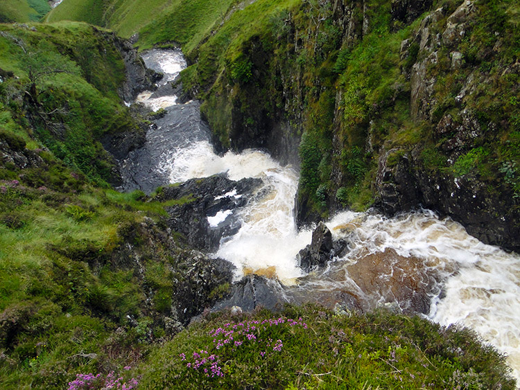 Grey Mare's Tail seen from above
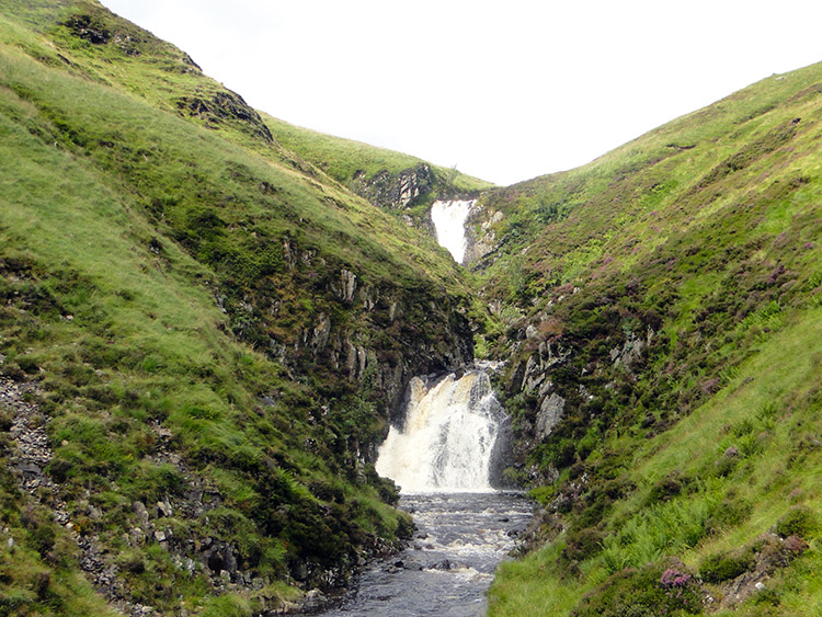 Cascades feeding Grey Mare's Tail
The landscape here is a very good example of how glaciers shape the land. A glacier once flowed from the corrie above Loch Skeen and joined a much larger glacier in what is now Moffat Dale, which cut deeply through a fault line during the last ice age. When the ice melted, a deep glen with a classic hanging valley as its tributary was left behind.
The Grey Mare's Tail makes up the resulting difference in the levels of the two glens. Today, this same process can be seen in glaciated regions like the Alps, and it is easy to visualise glacial action in Moffat Dale more than 10,000 years ago.
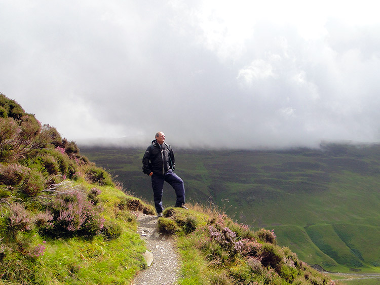 Feeling elated on the high ground near Loch Skeen
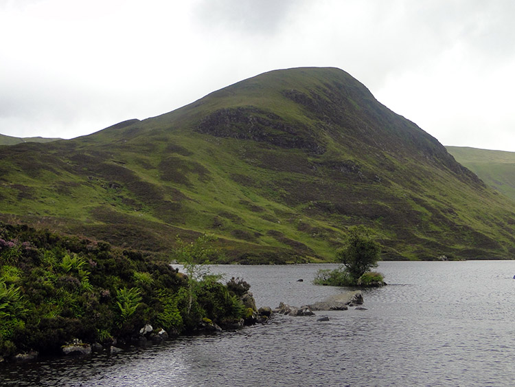 Loch Skeen and Mid Craig
This area of the Moffat Hills has been designated by the Nature Conservancy Council as being of conservation interest and the 2,510 acres (1,016 hectares) of the Grey Mare's Tail and Loch Skeen are now owned by the National Trust for Scotland. The wet and inaccessible sides of the gorge are a flourishing habitat for plant species such as heather, roseroot, harebell, woodrush, scabious, goldenrod, dog's mercury and wood sage.
The gradient of the path relents to a more gentle angle as it continues up the valley above the Grey Mare's Tail past several, lesser, but nevertheless impressive falls. The landscape is mainly heather moorland. Sometimes the path has been built up with large rocks where it crosses boggy areas of the underlying peat.
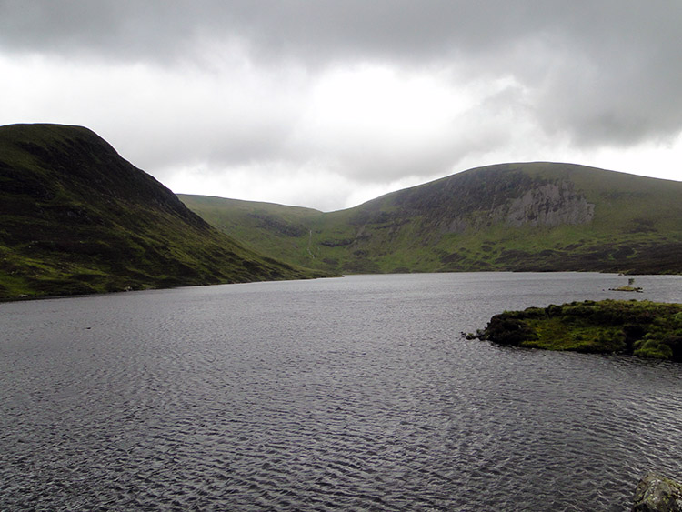 Loch Skeen with Lochcraig Head in the distance
 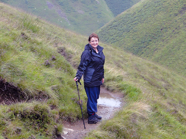 Lil celebrates her walk to Loch Skeen
Eventually the path levels out and leads gently between old glacial moraines, now clad in deep heather before reaching the top of the burn as it spills over the lip of Loch Skeen. There is a superb view of the rolling hills surrounding the loch, and a tiny islet with a solitary birch tree nearby. The lime rich hills have a rich flora which contrasts with the acid peat cover. The crystal clear waters of the loch contain brown trout. Common gulls nest by the loch and ravens frequent the crags above. Other hill birds to be seen include ring ousel and red grouse while dipper, grey wagtail and common sandpiper may be seen at the water's edge. Fox, otter, mink and deer are also found here.
The walk around the loch can either be taken around the waters edge or over the hills tops. The files provided here are for the higher option. After the circumnavigation of your choice, the walk back is on the path by which you came. Take care when you descend alongside the Grey Mare's Tail. It can be slippery on the steeper sections of the path at the best of times and certainly so when conditions are wet.
Acknowledgments: Text derived from the Out and Out Series; Discovering the Countryside on Foot. Pictures courtesy of Wikipedia.


