Carisbrooke Castle
An Isle of Wight stroll from Carisbrooke village to the hilltop castle
Google Maps Open Source Maps| Statistics and Files | ||
|---|---|---|
| Start: Carisbrooke | Distance: 1.7 miles (2.8 km) | Climbing: 87 metres |
| Grid Ref: SZ 48569 88224 | Time: 1 hour | Rating: Easy |
| GPX Route File | Google Earth File | About Carisbrooke Castle |
| Statistics | |
|---|---|
| Start: Carisbrooke | Distance: 1.7 miles (2.8 km) |
| Climbing: 87 metres | Grid Ref: SZ 48569 88224 |
| Time: 1 hour | Rating: Easy |
| GPX Route File | Google Earth File |
Ordnance Survey Explorer Map (1:25,000)
The Walk: The ancient village of Carisbrooke winds uphill above the valley of the Lukely Brook. Its oldest building is a Roman Villa situated in the grounds of the Vicarage. And the narrow High Street is dominated by the towering ramparts of the castle to the south and by the Norman church of St Mary to the north. Once a Benedictine Priory stood to the north of the church but in was suppressed as 'foreign' in 1415. Some of its stones were used in the building of Priory Farm and the great tower of St Mary's Church.
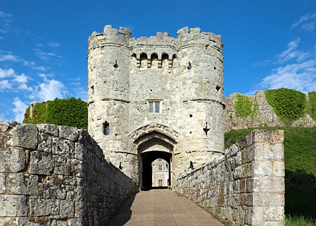 The gatehouse entrance to the castle
 The interior of Carisbrooke Castle
Carisbrooke was once famous for its mills. The old pond of Priory Mill has been turned by the Southern Water Company into a beautiful, willow-fringed lake, with benches and picnic tables along its banks. It is a cool haven on a hot day - a refuge for mallard, swans and even the occasional kingfisher. After visiting the lake, the walk passes a stream and enters Spring Lane. This path leads up to a beech wood where jays and magpies scold high up in the branches.
Beyond the beech wood lie the wide turf moats of the castle's outer defences where the blue spikes of viper's bugloss grow on the walls, with cowslips beneath them. Inside grows such rarities as green alkanet and the white orchid, autumn lady's tresses. Kestrels hover over ancient bastions and towards evening, little owls screech out from the battlements. And from the moat there is a wide view of central Wight. The lane walks ahead provide a taste of this green unspoilt country.
A steep chalk track leads towards Carisbrooke Castle. Though parts of the castle date back to Saxon times, it is most famous as the enforced home of King Charles I during the later stages of the civil war. Within the walls there are seven acres of buildings and ruins to explore. The north side of the castle car park provides an impressive panoramic view of Carisbrooke. The Lukely Brook below runs through its lush water meadows, a silver thread that once drove three mills and maintained a thriving watercress industry. Above rise the red tiled roofs of the village, with fields spreading away beyond to Parkhurst Forest, where kings once hunted. The walk ends in Castle Street, a picturesque lane of old cottages with the Lukely Brook running along part of its length, a place where fine views of the church and Carisbrooke Castle are enjoyed.
Acknowledgment: Text derived from the Out and Out Series; Discovering the Countryside on Foot. Pictures courtesy of Wikipedia.


