Friday Street, Leith Hill and Wotton Common
From a tranquil lake to the highest point in south-east England
Google Maps Open Source Maps| Statistics and Files | ||
|---|---|---|
| Start: Friday Street | Distance: 4.5 miles (7.2 km) | Climbing: 188 metres |
| Grid Ref: TQ 12686 45766 | Time: 2-3 hours | Rating: Moderate |
| GPX Route File | Google Earth File | About Leith Hill |
| Statistics | |
|---|---|
| Start: Friday Street | Distance: 4.5 miles (7.2 km) |
| Climbing: 188 metres | Grid Ref: TQ 12686 45766 |
| Time: 2-3 hours | Rating: Moderate |
| GPX Route File | Google Earth File |
Ordnance Survey Explorer Map (1:25,000)
The Walk: This woodland walk in a secluded part of Surrey known as Little Switzerland combines a wealth of history with some of the finest scenery in the south of England. The walk also takes in Leith Hill, the highest point in south-east England, offering fine views across the Weald.
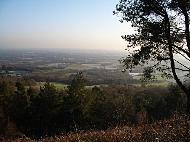 The view from Leith Hill
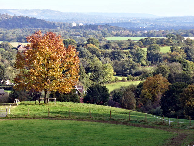 View towards Dorking from Wotton Common
Only a few minutes from the car park at the start of the walk is Friday Street lake, nestling in a circle of tree-clad hills. Until late Tudor times this now peaceful valley resounded with the clamour of an iron foundry, its hammers powered by water from the lake and its furnaces fed by charcoal from the surrounding forest. By the 17th century it had acquired its present tranquil aspect and the diarist John Evelyn, whose family owned nearly Wotton Manor, fished in its clear depths. A passionate lover of trees, he wrote Sylva, the influential book on arboriculture, in 1664. Evelyn commenced the planting of many unusual species in the woods near his family home.
Entering the woodland, the path runs beside the little stream that feeds the lake. The woods are a mixture of beech and pine, with some oaks and mountain ash. Height is gradually gained and, emerging at the top of Leith Hill, the panorama of the Weald opens out below. At a height of 967 feet (290 meters), this is the highest point in south-east England, affording a view of the sea through the Shoreham Gap to the south, and of St Paul's Cathedral through the Mole Valley gap to the north. The 65 foot (20 meter) tower originally named Prospect Place, was built by Richard Hull of Leith Hill Place in 1766. Friends were entertained in the upper room where telescopes were provided to enjoy views over the beautiful countryside of Surrey.
When the tower is open, the energetic can climb to the top, which brings you above 1,000 feet (300 meters), the minimum height at which a mere hill becomes a real mountain. On top of the tower are indicators of distant viewpoints, presented in memory of the famous rambler 'Walker Miles', a founder of rambling clubs with the reputation of being a great countryman. Leaving the tower, the walk crosses some of the heathland on top of Leith Hill and then follows a lovely woodland track leading gently downhill to the pretty hamlet of Broadmoor. a short, but exhilarating uphill climb then follows before the final descent through Severells Copse to the lake and car park at Friday Street.
Acknowledgment: Text derived from the Out and Out Series; Discovering the Countryside on Foot. Pictures courtesy of Wikipedia.


