Westerham and Chartwell
From a village green, through ancient woods to Chartwell
Google Maps Open Source Maps| Statistics and Files | ||
|---|---|---|
| Start: Westerham | Distance: 4.4 miles (7.0 km) | Climbing: 168 metres |
| Grid Ref: TQ 44691 54015 | Time: 2 hours | Rating: Easy |
| GPX Route File | Google Earth File | About Chartwell House |
| Statistics | |
|---|---|
| Start: Westerham | Distance: 4.4 miles (7.0 km) |
| Climbing: 168 metres | Grid Ref: TQ 44691 54015 |
| Time: 2 hours | Rating: Easy |
| GPX Route File | Google Earth File |
Ordnance Survey Explorer Map (1:25,000)
The Walk: Beautiful scenery combines with a wide variety of fauna and flora on this circular walk from the village of Westerham. The walk passes near Quebec House and Chartwell, the famous homes of two national heroes. Each season lends its own particular charm to this area and whatever the weather conditions, the high ground of the Greensand Ridge provides easy and very pleasant walking.
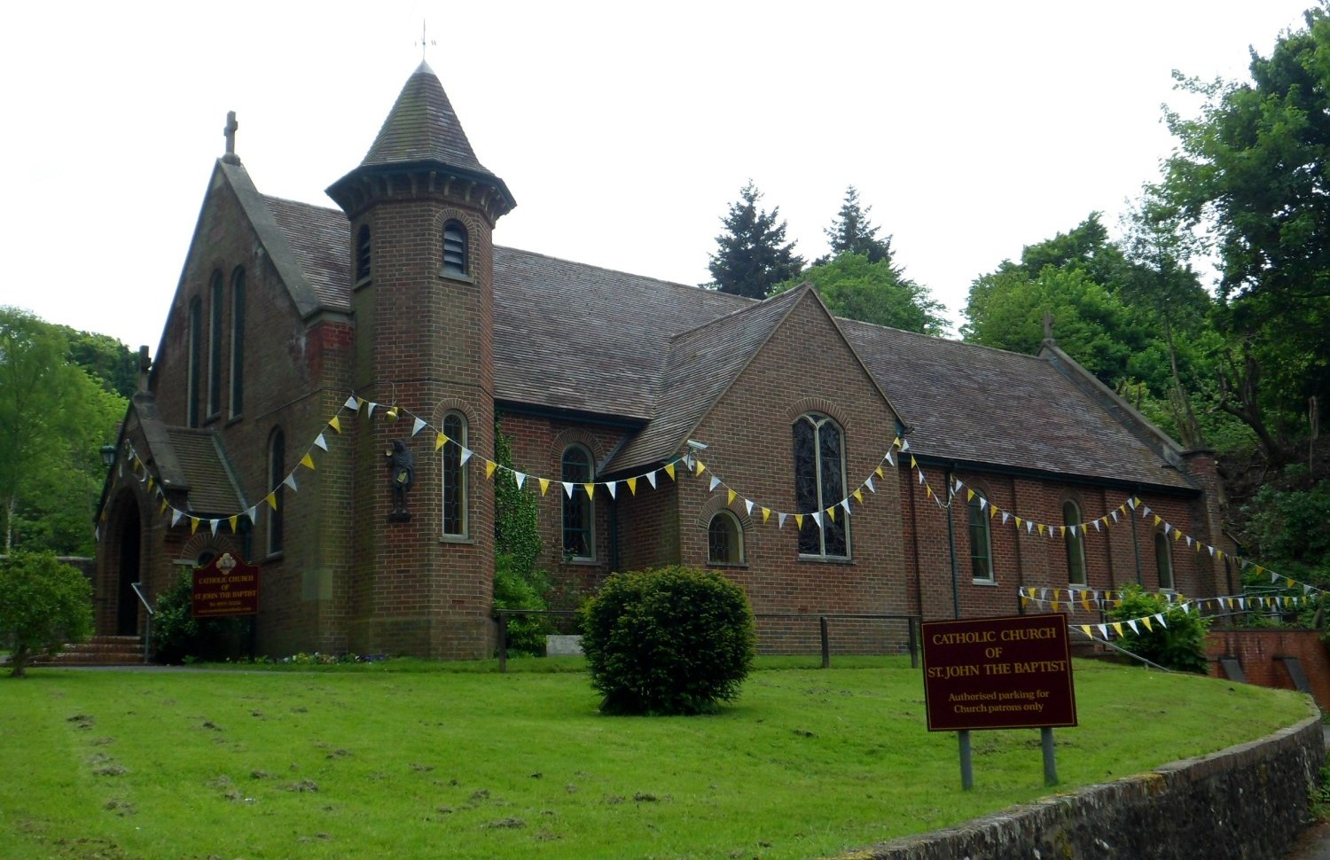 Hosey Hill Church
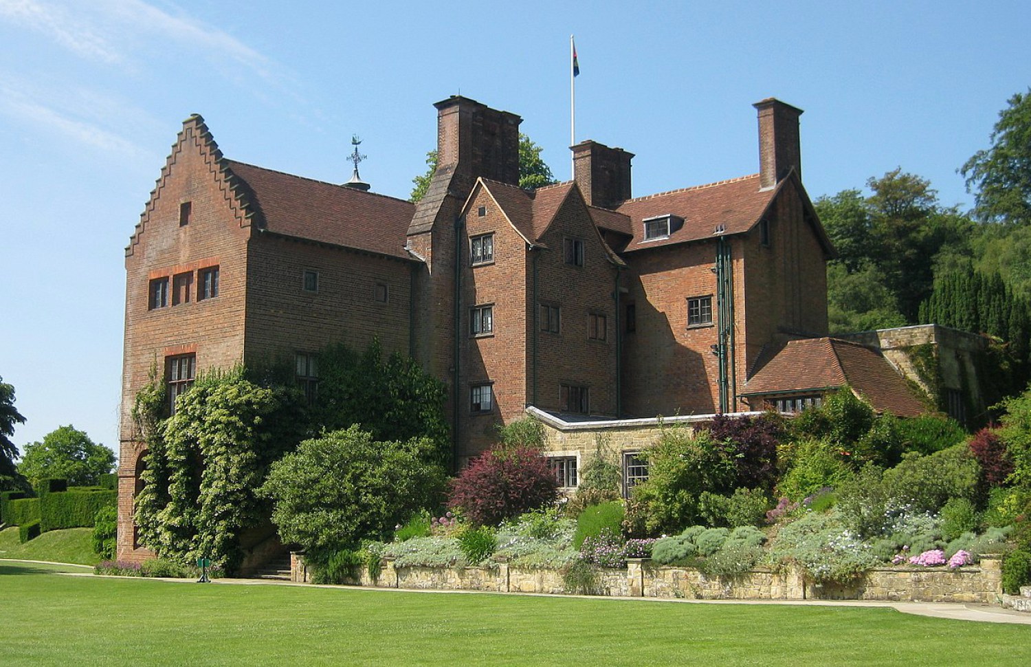 Chartwell House
The walk starts from the village green in the centre of Westerham where the impressive statues of Winston Churchill and General James Wolfe can be seen. Churchill the statesman gazes in the direction of his beloved home, Chartwell, whilst Wolfe, the victor at Quebec, defends the green from advancing traffic with sword raised. His home, Quebec House, is close by.
A narrow lane opposite the green leaves the bustle of the High Street for more tranquil surroundings. After crossing the tiny River Darent there is a fine view to Westerham to look back on, and across the intervening valley is the steep scarp of the North Downs.
After walking through the first stretch of woodland the path soon emerges on a lane on Horn's Hill. This leads to a footpath which leads down into the valley where Chartwell is situated. This was Churchill's home from 1924 until the end of his life. It was here that the gifted statesman painted and built his famous brick wall.
On the other side of the valley, above the trees, is the open ground of Crockhamhill Common, on top of Mariners Hill. Here, views are distant and sites for picnics ideal. Leaving the common, the route now enters the Squerryes estate where a fine stretch of woodland supports an abundance of birdlife and wild flowers.
From April Cottage the path follows the line of an old boundary marked by an embankment topped with beech trees. The path opens into a delightful valley. Centuries ago this was the deer park of the manor of Squerryes. To the west, high up in the trees are the remains of a prehistoric fort, its existence still traceable by ditches and embankments.
A walk down the gently sloping valley leads to a track besides a series of fishing ponds. After passing through the lodge gate, the remains of the old watermill are visible in the tumbling waters of the Darent. From here a lane returns to Westerham.
Acknowledgment: Text derived from the Out and Out Series; Discovering the Countryside on Foot. Pictures courtesy of Wikipedia.


