Alfriston, Lullington Church, Long Man, Wilmington and Cuckmere River
From the Cuckmere River Valley along the South Downs
Google Maps Open Source Maps| Statistics and Files | ||
|---|---|---|
| Start: Alfriston | Distance: 4.2 miles (6.8 km) | Climbing: 150 metres |
| Grid Ref: TQ 52043 03157 | Time: 2 hours | Rating: Moderate |
| GPX Route File | Google Earth File | About Alfriston |
| Statistics | |
|---|---|
| Start: Alfriston | Distance: 4.2 miles (6.8 km) |
| Climbing: 150 metres | Grid Ref: TQ 52043 03157 |
| Time: 2 hours | Rating: Moderate |
| GPX Route File | Google Earth File |
Ordnance Survey Explorer Map (1:25,000)
The Walk:
Many consider that Alfriston is Sussex's prettiest village. It lies in the Cuckmere valley, that lovely gap between the Downs carved by the meandering Cuckmere River.
The South Downs rise steeply out of the valley and along their crests are the highways of the prehistoric people who once loved here. Iron Age man farmed the high ground and was buried in the numerous tumuli that are visible today as grassy mounds.
Nearby, at Wilmington, on a slope where the Downs curl around to create a fold, a human fugure is casrved into the chalk: The Long Man. It is the largest representation of the human form in Western Europe, standing 230 feet (70 metres) high - carved at an unknown date for an unknown purpose.
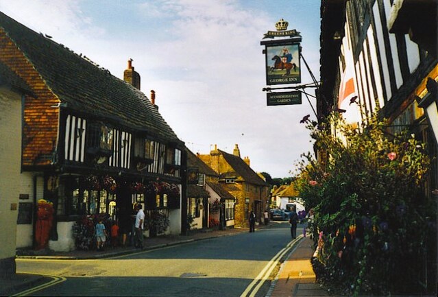 Alfriston village centre
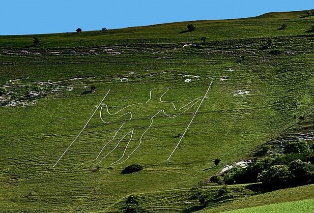 Long Man of Wilmington
A walk down Alfriston village street is to step into the past. The market cross is in tiny Wellington Square, while to the right is a pub with two names - The Market Cross and The Smugglers - the latter name comes from its association with smuggling. The inn has secret passages and one of its former licensees was a notorious local smuggler. Continuing a few steps further are the George and Star inns. The fierce Dragon like form outside the Star was the figurehead of a ship wrecked near Cuckmere Haven.
The path between flint walls on the route is called a 'twitton' in Sussex. This path leads to a meadow called The Tye, in front of St Andrews Church, known as 'The Cathedral of the Downs' because of its size. The path continues down to the Cuckmere River, where about three miles downstream the river flows into the sea at the foot of the Seven Sisters cliffs.
The route then goes through fields and passes tiny Lullington Church. Seating only 23 people, it is one of the smallest churches in the country. A walk along a stretch of a country road and a climb up onto the Downs reveals an exhilarating panorama. Prominent to the west along the line of hills are Firle Beacon and Chanctonbury Ring, a ring of beech trees, both local landmarks. To the north lies the blue haze of The Weald. Plunging dry valleys mark this part of the Downs. To the right, the valley is called Ewe Down, a reminder of the South Down sheep for which the area is famous.
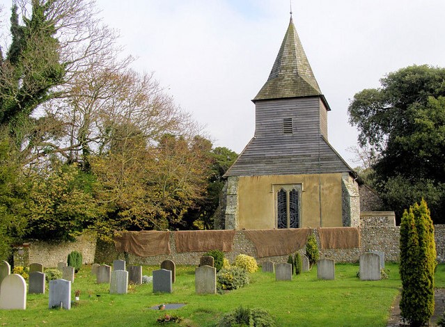 St Mary and St Peter's Church, Wilmington
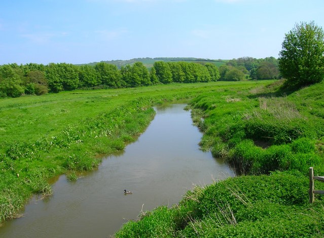 Cuckmere River at Alfriston
Rounding the side of Windover Hill, The Long Man of Wilmington comes into view. From the air the figure is elongated, but assumes correct human proportions through optical illusion at eye level. It's origins are unknown - it may like the tumuli above it date from the Iron Age (3500 BC), or it may be of Roman or even Saxon origin. Are the staffs the figure holds agricultural implements? Or are they the staffs for the Roman eagles?
A bridlepath descends to the village of Wilmington. Here are the ruins of the 13th century Benedictine Priory which is now owned by the Landmark Trust who utilise it for holiday accommodation. The walk passes through the churchyard of Saint Mary and St Peter's with its massive ancient yew. Beyond a field path leads to Milton Street and Milton Court Farm. The Long Bridge across the Cuckmere is reached by another field path and a short stroll along the bank of the gentle Cuckmere, beside the water meadows, leads back to Alfriston.
Acknowledgment: Text derived from the Out and Out Series; Discovering the Countryside on Foot. Pictures courtesy of Wikipedia.


