Carshalton to Collier's Wood via the Wandle Trail
A leafy riverside walk through London's suburbs
Google Maps Open Source Maps| Statistics and Files | ||
|---|---|---|
| Start: Carshalton Station | Distance: 5.1 miles (8.2 km) | Climbing: 10 metres |
| Grid Ref: TQ 27760 64843 | Time: 2-3 hours | Rating: Easy |
| GPX Route File | Google Earth File | River Wandle |
| Statistics | |
|---|---|
| Start: Carshalton Station | Distance: 5.1 miles (8.2 km) |
| Climbing: 10 metres | Grid Ref: TQ 27760 64843 |
| Time: 2-3 hours | Rating: Easy |
| GPX Route File | Google Earth File |
Ordnance Survey Explorer Map (1:25,000)
The Walk:
This surprisingly green route takes you through the south-western suburbs of Greater London. The walk is linear, beginning at Carshalton Station. When the route is completed, a tube and a bus will return you to your starting point. The direction is easily followed, for most of the way you just keep by the river - usually on the west bank. You will hardly notice, as the gradient is so gentle, that it is entirely downhill. There is, however, one climb, up a flight of steps when crossing a railway line.
The River Wandle is one of the shorter tributaries of the River Thames. It rises in the foothills of the North Downs from two sources, the ponds at Waddon and Carshalton, then flows for just 12 miles through the London Boroughs of Croydon, Sutton, Merton and Wandsworth, to join the Thames upstream of Wandsworth Bridge.
The river and its verdant banks attract a multitude of wildlife. Plants such as starwort and wild celery abound, while rare species include blue anemone, lesser water parsnip, azolla the water-fern and the potamogeton waterweed.
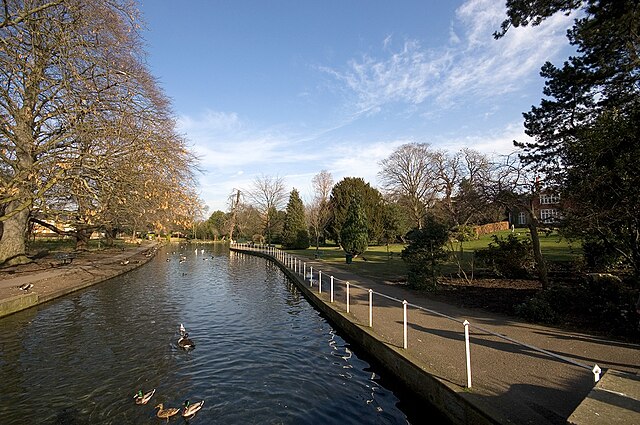 River Wandle at Carshalton
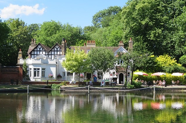 Honeywood House by Carshalton Ponds
Lining the river on this walk are some magnificent trees such as limes, horse chestnuts and willows, and also the largest known London plane by the Upper Pond at Carshalton. The wilder parts of the river support birds that are quite rare in urban areas - even kingfishers are sometimes seen.
As you enter Grove Park from North Street, you can see the two Carshalton Ponds that today form one of the river sources. Once it rose further south, but excessive industrial usage has lowered the water table. Nowadays, the flow of water that enters the Upper Pond has to be maintained by recirculation through pumps and pipes from further downstream.
There are several buildings of interest around Carshalton Ponds. At the far end of the Upper Pond is a white house called Honeywood, now a heritage centre. Beyond Honeywood is The Lodge, now an Ecology centre. All Saint's Church was recorded in the Domesday Book - its visible structure is mainly 18th century, but the Lady Chapel dates back to the 12th century. Close to the church are some interesting Regency cottages.
Soon after leaving Grove Park, you arrive at Wilderness Island, where the two branches of the Wandle from Waddon and Carshalton unite. Until this point, they can only really be described as streams. Downstream from here, river is more apt. Here too is the pump house which recirculates the water back up to Carshalton Ponds.
At several points along its course, the River Wandle divides and sub-divides into several channels. Some were artificially created as mill races, taking water from the main channel to power one or more mills. The first split in the river you encountered on this walk takes place just past Hack Bridge, when you cross Culver's Island, and there are others at Watermeads, Ravensbury Park and Morden Hall Park.
Culvers Island was once a major centre for calico production and on leaving you can see the grinding wheels from one of the mills, which now mark the entrance to a housing development. A little further downstream beyond Goat Bridge, the powerful stream emerging from the opposite bank is the outflow from Beddington Sewage Works. To your left now is Poulter Park, at the far end of which is Bishopsford House, a listed building of some architectural merit.
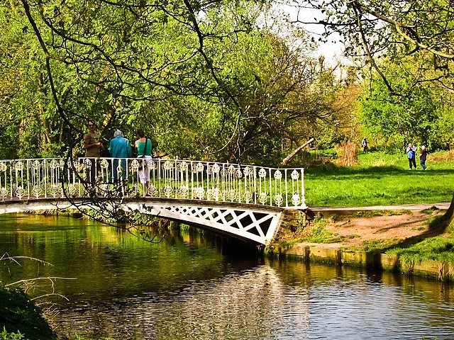 Morden Hall Park
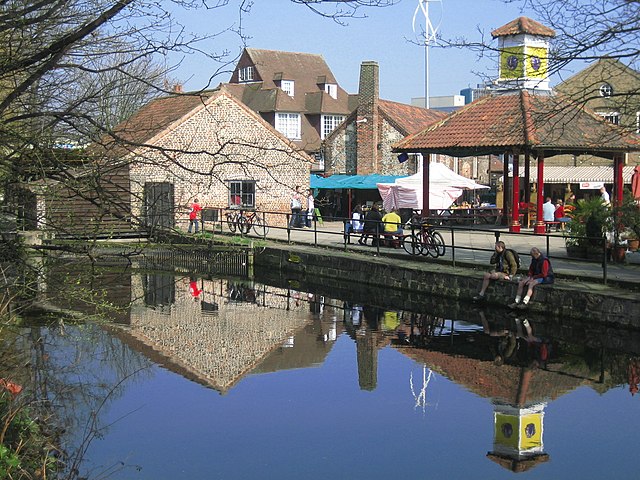 Merton Abbey Mills
At the sharp right hand bend in the river by Bishopsford House, known locally as Bennetts Hall, you have to leave the riverbank to pass Watermeads, a nature reserve and bird sanctuary belonging to the National Trust. This was not accessible to the public for 100 years, as breeding birds could be disturbed, but sensitive access was granted in 2015. Much of the land in the reserve was donated by grateful pupils in memory of a teacher called Miranda Hill, who died in 1910.
At Mitcham Bridge, you cross to the east bank, to pass through Ravensbury Park, an attractive open space. It was once the grounds of a medieval manor house, dominated by tall trees on islands between several river channels.
Morden Hall Park is one of the few remaining areas of London still in its natural state. It is owned by the National Trust and includes wetlands and meadows.
After crossing the railway line just outside Morden Hall Park, you pass through Bunces Meadows, a narrow riverside open space. From here you follow the path on the west bank all the way to Merton and Collier's Wood.
At the end of the walk is Merton Abbey Mills. The ground it occupies once belonged to Merton Priory, demolished by Henry VIII in 1538. The craft centre here contains the former workshops of William Morris and Arthur Lasenby Liberty - of the London Regents Street store fame, which produced printed calico and textiles. There is also a working waterwheel which is from Liberty Mill, possibly the best known mill on the river. This is a pleasant place to stop near the end of the walk for refreshments and exploration.
A riverside path will take you on from Merton Abbey Mills to Merton High Street and Collier's Wood Station. The walk you have just done is part of the Wandle Trail, created to follow the route of the river from Croydon to Wandsworth.
Acknowledgment: Text derived from the Out and Out Series; Discovering the Countryside on Foot. Pictures courtesy of Wikipedia.


