Pennington, Oxey and Keyhaven Marshes
Through a nature reserve by the sea which provides a year-long haven for birds
Google Maps Open Source Maps| Statistics and Files | ||
|---|---|---|
| Start: Sea Wall Car Park | Distance: 5.4 miles (8.7 km) | Climbing: 17 metres |
| Grid Ref: SZ 31888 92699 | Time: 3 hours | Rating: Easy |
| GPX Route File | Google Earth File | North Solent Marshes |
| Statistics | |
|---|---|
| Start: Car Park | Distance: 3.4 miles (5.4 km) |
| Climbing: 40 metres | Grid Ref: SU 26789 04653 |
| Time: 2 hours | Rating: Easy |
| GPX Route File | Google Earth File |
Ordnance Survey Explorer Map (1:25,000)
The Walk: Flat but fascinating, these marshes include both salt and freshwater wetland that attracts birds from many parts of the world. Salt production was an important industry here for about 600 years. The area is of sufficient importance to make it a part of a SSSI - site of special scientific interest.
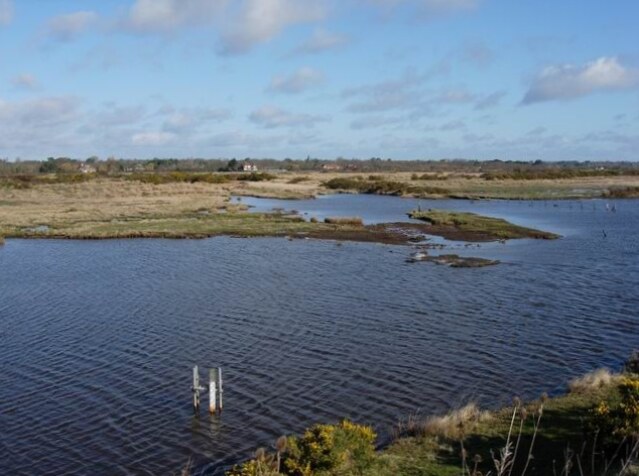 Pennington Marshes
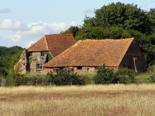 Traditional sea boiling cottage
Almost as soon as you leave the Sea Wall car park, you pass some of the ponds which make this area of such importance for bird conservation. At least 258 bird species have been recorded in the area. In summer, the saltmarsh islands are used for breeding black-headed gulls, terns, oyster-catchers, ringed plovers, redshanks and mallard. Many other species use the freshwater marshes.
In winter, many birds that breed in the far north come south to avoid the snow and extreme cold. Some that overwinter in this area are brent geese, shelduck, widgeon, teal and sometimes goldeneye, long-tailed duck and shoveler.
On this walk you will see signs of the dykes and salt ponds of an earlier salt industry. Salt was first produced here in the 12th century, and the industry survived for 600 years. Seawater was drawn into trenches, then shallow ponds called saltpans. It was left to evaporate until reduced to a strong saline solution. This was boiled so only the salt remained. By the 18th century, there were one 163 saltpans in use in the area and between 1724 and 1766, 4,600 hundred tons of salt were produced.
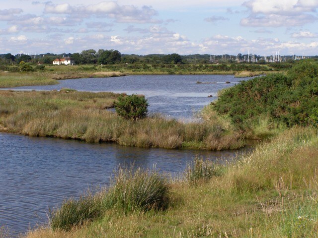 Brackish lagoons of Oxey Marshes
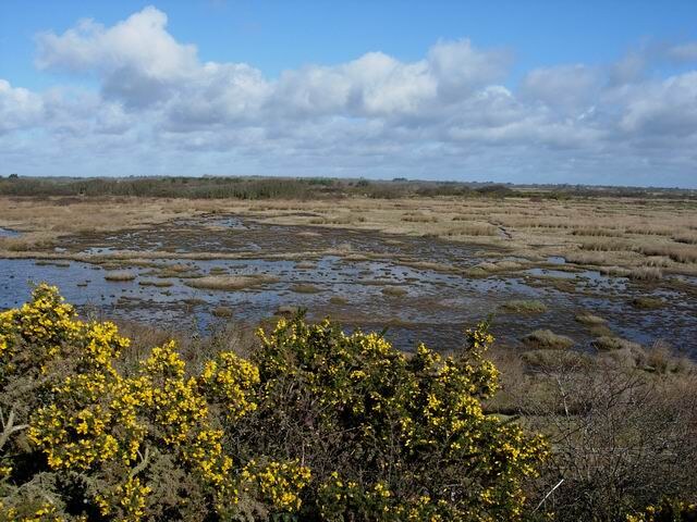 Keyhaven Marshes
If you decide to take a break along the walk, the 17th century Chequers Inn, with real ale and excellent food is an ideal stopping point, soon after you pass the office of the Lymington and Keyhaven Nature Reserve. The reserve is run by Hampshire County Council, who publish a booklet available from the reserve office.
Part of the walk goes along the top of a sea wall, parts of which are more recent than others. During the winter of 1989 and 1990, Lymington was severely flooded and the old sea wall was breached in a number of places.
Part way around the walk, you may wish to extend it by exploring the village of Keyhaven which has a small number of cafes and a pub. It is a fishing village, but the trade has been in decline for a period of years and its main draw now is tourism, especially sailing.
Another option to extend the walk is by following the Solent Way to the tip of Hurst Spit where Hurst Castle stands guard over the narrow strait between here and Fort Albert, 0.8 of a mile away on the Isle of Wight. Hurst Castle was commisioned during the reign of Henry VIII and Fort Albert during the Napoleonic Wars. Both are visible from the North Solent Marshes walk.
Acknowledgment: Text derived from the Out and Out Series; Discovering the Countryside on Foot. Pictures courtesy of Wikipedia.


