Eynsford, Shoreham and Lullingstone Castle
Through an immortalised valley in north-west Kent
Google Maps Open Source Maps| Statistics and Files | ||
|---|---|---|
| Start: Eynsford | Distance: 7.8 miles (12.6 km) | Climbing: 198 metres |
| Grid Ref: TQ 54021 65503 | Time: 4 hours | Rating: Moderate |
| GPX Route File | Google Earth File | About Eynsford |
| Statistics | |
|---|---|
| Start: Eynsford | Distance: 7.8 miles (12.6 km) |
| Climbing: 198 metres | Grid Ref: TQ 54021 65503 |
| Time: 4 hours | Rating: Moderate |
| GPX Route File | Google Earth File |
Ordnance Survey Explorer Map (1:25,000)
The Walk:
Here is a walk to satisfy all tastes. The gentle scenery around the River Darent provided inspiration for 19th-century artist Samuel Palmer to depict idyllic rural scenes. This delightful circular walk gives the opportunity to see a whole range of agricultural practises from hop growing to sheep rearing.
Beginning in the attractive village of Eynsford it passes through a former medieval Deer Park to reach the equally pretty village of Shoreham. Here, beside the river is Palmer's former house. For today’s visitor, the same ancient inns still offer the traditional hospitality they did in his day. The walk follows the Darent stream past Lullingstone Castle and the remains of a Roman villa. A visit to one or both of these would complete a very satisfying day.
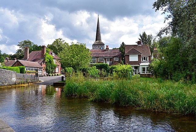 The village of Eynsford
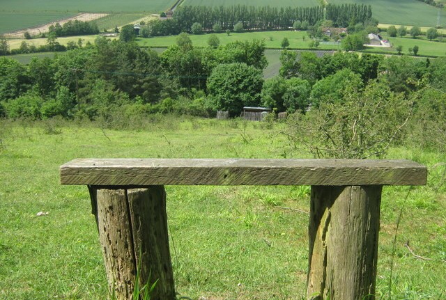 Lullingstone and Preston Hill Country Park
Eynsford is a village, which as its name suggests, has grown up beside a ford, still in use, across the Darent. The 12th-century church of St Martin, with its conspicuous slender spire and Norman doorway, overlooks the ford and the old bridge. The clock on the church tower is inscribed with two lines of a poem by Robert Browning, offering the message of eternal hope "Grow old with me, the best is yet to be".
After crossing the bridge a little road transports you past several old houses, including the crazily angled black and white timbered Toll Bar Cottage. Beyond, if you are lucky, you may find the unexpected sight of Home Farm’s herd of shaggy highland cattle grazing in lush water meadows. A gentle climb is rewarded by the panorama of the village and valley laid out below. Soon after, the former medieval Deer Park of Lullingstone is entered. Many of its trees are around 400 years old and a few even older. The ancient woodland provides an excellent habitat for wildlife, including such species of birds as nuthatches, woodpeckers and sparrowhawks.
Much of the former park has now been converted into a golf course. On leaving the woods a field path brings us to an open slope above the valley. All around, a wide view of the hill in spring is cloaked in drifts of violets. At the foot of the slope, a shady lane rises to a hill above Shoreham and leads to a path running high above the village. Beside the large cross cut into the chalk of the hill, a memorial to those of the village who fell in both world wars, the grassy slope is an ideal picnic spot. But for those who prefer a glass of ale and a meal, Shoreham has some ancient inns dispensing traditional hospitality. In the village ,a turn in the High Street leads down to a bridge. This is an exquisite setting and little wonder Palmer favoured it. You pass his house, Water House, as you walk along the riverbank towards a little footbridge and the former mill house.
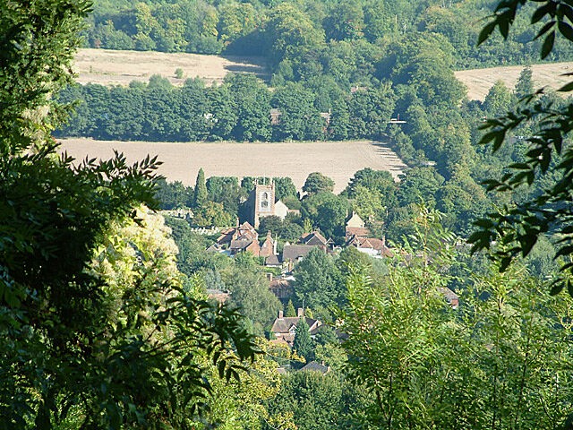 The village of Shoreham
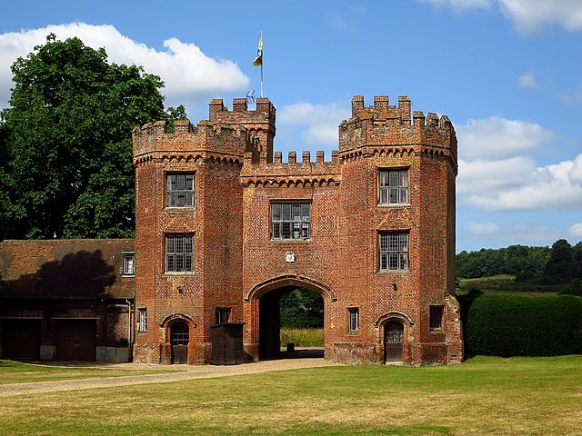 Lullingstone Castle
The past leaves the meandering stream and passes beside hop fields to rejoin the river once more at Kingfisher Bridge. Here there is a visitor centre that dispenses information and refreshments. ontinuing along the riverbank and past the lake, the magnificent Henry VII gatehouse of Lullingstone Castle is reached. Built in 1497, it is of massive proportions and is believed to be one of the earliest brick gate houses in England. Beyond was once a moat and a further gatehouse that gave entrance to the Manor House which is now the court of the present house. The exterior level area to the west of the gatehouse is the site of the jousting ground. Sir John Peche, who built the original manor house, took a leading part in the royal joust and his plumed helmet can be seen on view in the state drawing room.
The little Norman church of St Botolph, seen through the gateway, is open to the public and contains some fine tombs of the castles early occupants. The church also has very fine displays of stained and painted glass, ranging from the 14th to the 18th centuries.
The narrow road beside the river leads past the famous Roman villa of Lullingstone. Built on a low terrace above the River Darent, it dates from AD80 to AD90, and was transformed in the late second century to a more luxurious dwelling. Most of the remains on view are from the fourth century, including two fine mosaic floors. It was an early site of Christianity - a chapel dates for AD370 - this is one of the earliest Christian chapels and the only chapel to be found within a private Roman villa.
The little road transports you back beneath the arches of the 19th century viaduct, across the valley and back to the start in Eynsford.
Acknowledgment: Text derived from the Out and Out Series; Discovering the Countryside on Foot. Pictures courtesy of Wikipedia.


