Walbury Hill, Combe, Buttermere, Ham Hill, Inkpen Hill and Gallows Hill
Over windswept downs, through sheltered valleys and woodlands
Google Maps Open Source Maps| Statistics and Files | ||
|---|---|---|
| Start: Car Parking Area | Distance: 6.2 miles (10.1 km) | Climbing: 242 metres |
| Grid Ref: SU 36920 62095 | Time: 3 hours | Rating: Moderate |
| GPX Route File | Google Earth File | North Wessex Downs |
| Statistics | |
|---|---|
| Start: Car Parking Area | Distance: 6.2 miles (10.1 km) |
| Climbing: 242 metres | Grid Ref: SU 36920 62095 |
| Time: 3 hours | Rating: Moderate |
| GPX Route File | Google Earth File |
Ordnance Survey Explorer Map (1:25,000)
The Walk:
The walk is through typical Wessex Downs countryside. At one time, much of southern England consisted of a great dome of chalk that through the long ages of geological time was gradually broken up and shaped by the weather. The River Kennet now divides this section of chalk hills from the Berkshire Downs to the north. Here the north facing slope of Inkpen Hill drops away in a sleep escapement, while to the south the countryside has been more gently moulded into a landscape of softly curving hills that swoop down to sheltered hollows.
From the ridge, you can look down on just such a hollow in which a farm sits snugly protected from the weather. The path leads on along the edge of the escarpment and at once passes through a gap that marks the entrance to the Iron Age hill fort of Walbury Hill. The way leads through to the centre of the old fortress, now occupied by fields of grain and emerges by a small stand of beech trees.
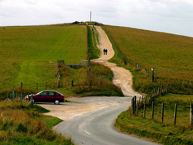 Gallows Hill and the car parking area
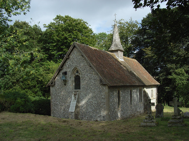 Church of St James the Great, Buttermere
The path now leaves the broader track of the escapement, with its shining nodules of flint, for coarse grassland dotted with gorse. An old holloway, sunk deep into the hill and sheltered by trees, leads down from the wide windsept expanses of the downs to the valley. There it joins another broad track shaded by a large mature trees. It brings you out at the hamlet of Combe.
The attraction of tiny villages such as this derive in good measure from their intimate relationship to the country around them. here is no good building stone here, but the clay of the valley can be used for brick making. There is timber in the woods, and everywhere one can see the hard nodules of flint in the ground. So you can see walls of flint, reinforced by bands of brick; weather-boarding can be added or tiles hung on a gable end. Roofs can be thatch or bright red tiles.
The other centre of life here is the old manor house and the church, reached along narrow Church Lane, which runs between high banks topped by mature beech trees. The church of St Swithin is a simple but very attractive little building with flint walls and and a timber tower. The porch bears the date 1652 but the church is much older than that. Begun in 1160. it is well worth a visit. Inside the church on the nave floor is a group of 17th-century tombstones, each engraved with a coat of arms, and the simple font has a Saxon bowl resting on a medieval base. One of the bells in the tower was cast in 1430. Next to the church is Manor Farm on the site of the old manor house, surrounded by a high wall with a rather attractive gazebo in the corner.
The walk now leaves the road for another broad track. Its banks are again topped by trees, but now birch rather than beech predominates, and beneath the branches the green of grass and moss is speckled with wild flowers. It is particularly attractive in spring when primroses are in bloom. The path itself has reached through the topsoil of the chalk so that while it is firm and pleasant under foot in fine weather, it becomes slimy in the wet.
From Combe, you head down hill towards Combe Wood. The nature of this woodland becomes obvious even before you enter it. You leave the field by the side of a patch of maize grown to feed the woods valuable inhabitants. They make themselves heard long before you see them, for above the hollow, the hooting call of wood pigeons comes and also the harsher voice of the pheasant. The woods are well maintained and coppiced, but the primary purpose these days is provide a home for the game birds.
Combe Wood gives way to Buttermere Wood, and then you reach the tiny hamlet of Buttermere, where there is another simple little flint church. Nestling in a hollow and surrounded by yew trees, this is the Church of St James the Great, reputedly the smallest church in the county.
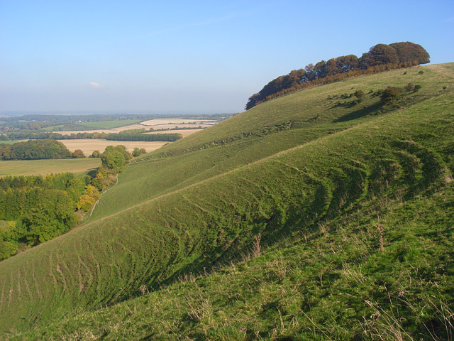 Ham Hill
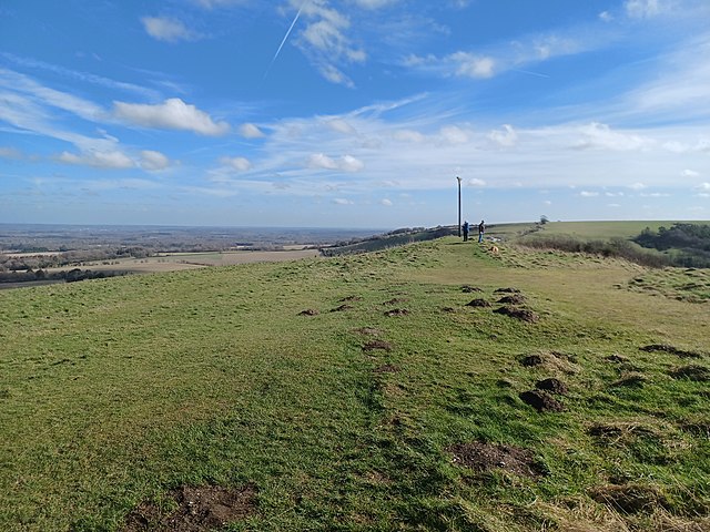 Gallows Hill
The final part of the walk follows a path along the edge of the escapement, which offers wide views over the Kennet Valley. The first hill you come to is Ham Hill, which is home to a nature reserve, the banks of the hill also designated as an SSSI - Site of Special Scientific Interest - for their rich variety of plants and wildlife. In spring, cowslips, early purple orchids and violets provide food for the caterpillar of the Duke of Burgundy butterfly. In July, the yellow-green, powerfully scented musk orchid, a nationally scarce species has been found on Ham Hill, as have burnt orchids. Twayblades, common spotted, fragrant and pyramidal orchids are scattered throughout the reserve. Birds such as chaffinch and yellowhammer nest in the bushes, so the rare Roman snail, Britain’s largest, needs to keep a low profile.
From Ham Hill, you walk on the airy path to Inkpen Hill, where, if conditions are right, you will find water in Wigmoreash Pond. This is a dew pond, essential for sheep grazing on these fast draining chalk downs.
The final part of the walk is to reach the high point of Gallows Down, with its Neolithic Long Barrow. The prehistoric burial site is not the only point of interest here - rearing up above it is the sombre shape of Combe Gibbet. The Lord of Combe Manor had an ancient right to condemn felons to death without the accused having any right to trial. If the lord declared them guilty, they were brought to this lonely spot and hung, after which their bodies were left as a grim warning to others.
Acknowledgment: Text derived from the Out and Out Series; Discovering the Countryside on Foot. Pictures courtesy of Wikipedia.


