Harting Downs and Beacon Hill
Enjoy fine views along the chalk ridge of West Sussex downland
Google Maps Open Source Maps| Statistics and Files | ||
|---|---|---|
| Start: Car Parking Area | Distance: 3.5 miles (5.6 km) | Climbing: 208 metres |
| Grid Ref: SU 79056 18076 | Time: 2 hours | Rating: Moderate |
| GPX Route File | Google Earth File | Harting Downs |
| Statistics | |
|---|---|
| Start: Car Parking Area | Distance: 3.5 miles (5.6 km) |
| Climbing: 208 metres | Grid Ref: SU 79056 18076 |
| Time: 2 hours | Rating: Moderate |
| GPX Route File | Google Earth File |
Ordnance Survey Explorer Map (1:25,000)
The Walk: The spectacular ridge of the South Downs in West Sussex is crowned by a string of strategically sited prehistoric fortifications, which provides some of the most dramatic views in the country. This route takes you across a stretch of National Trust downland to the summit of one of these citadels, then loops back through chalk woodland to finish with a gentle stroll back to the car park. The nearby village of South Harting is well worth a visit, with its fine architecture, imposing copper-spired church and several traditional pubs.
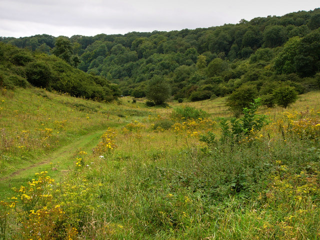 Harting Downs
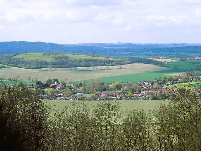 View to South Harting from Harting Downs
From South Harting, the road makes a stiff winding ascent up the steep northern slope of the ridge before reaching the summit and beginning the long, gentle run down towards Chichester. The National Trust has built a car park at the highest point with superb views across the low lying vale of the River Rother to the north. The car park is where you start your walk. Beneath your feet is relatively hard chalk, but you look out over soft clay that has been cut down by the forces of erosion over the millennia to produce a sheltered valley landscape of deep rich fertile soils, in contrast to the thin soils of the chalk downland.
The cross-dykes on the narrowest part of the downs are the eroded outer defences of the Iron Age hill-fort on Beacon Hill. They would have been much higher when they were built 2,000 years ago as a barrier to two-horse chariots, which were the main weapons of warfare in Britain before the Roman invasion.
The hill fort itself has also been eroded by centuries of wind, frost and, more recently, agriculture. Now overgrown, the chalk rampart would have been surmounted by a strong timber stockade. Within the rampart, the soldiers and their families lived in timber houses.
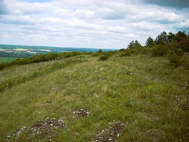 Beacon Hill
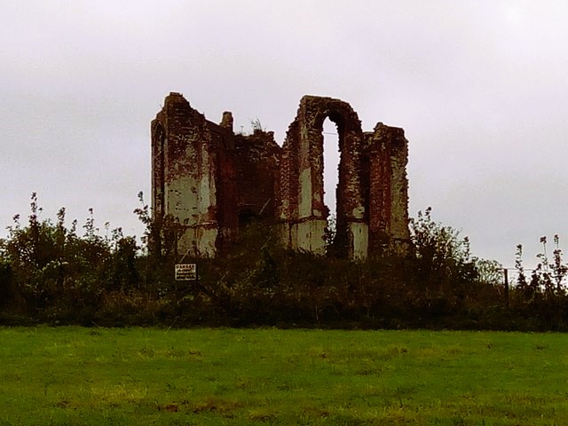 The Vandalian Tower
The dew pond in the valley below the hill fort is one of many on the chalk downs, dug then lined with clay to collect rainwater for livestock. Without the clay, any rainwater would have sunk straight into the porous chalk. Dew ponds were necessary for livestock here as there are no natural ponds and very few streams on the downland. Many of these artificial ponds date from around the early 18th century, when sheep farming became the big business. Incidentally, a positive spin off from the intensive sheep farming is today's landscape of closely crop turf, which is such a joy to walk on.
Back at the start of the walk, you will see the ruined Vandalian Tower on Tower Hill, which is the remains of an Admiralty semaphore station, one of a chain built in the early 19th century to transmit messages visually from the Admiralty Office in London to the fleet stationed at Portsmouth.
Acknowledgment: Text derived from the Out and Out Series; Discovering the Countryside on Foot. Pictures courtesy of Wikipedia.


