Berwick, Alciston, Charleston Farmhouse and Firle Beacon
A retreat for the Bloomsbury group in secluded area of Sussex
Google Maps Open Source Maps| Statistics and Files | ||
|---|---|---|
| Start: Bostal Hill | Distance: 7.2 miles (11.6 km) | Climbing: 283 metres |
| Grid Ref: TQ 49343 05055 | Time: 3-4 hours | Rating: Moderate |
| GPX Route File | Google Earth File | South Downs |
| Statistics | |
|---|---|
| Start: Bostal Hill | Distance: 7.2 miles (11.6 km) |
| Climbing: 283 metres | Grid Ref: TQ 49343 05055 |
| Time: 3-4 hours | Rating: Moderate |
| GPX Route File | Google Earth File |
Ordnance Survey Explorer Map (1:25,000)
The Walk: Small wonder that the central figures of the Bloomsbury Group should seek the seclusion of Sussex as a base for their literary and artistic endeavours. Even today, along the top of the Downs, or on the byways in their shadow, there is a sense of remoteness. The view at the start of the walk, high above the Low Weald of East Sussex, takes in the sea and the little port of Newhaven. From here, ferries look like toy boats on a lake. Northwards is the green carpet of the lowlands; in the foreground, the churches and farms resemble model villages.
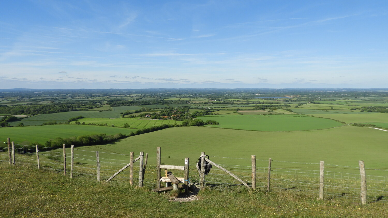 The view from Bostal Hill
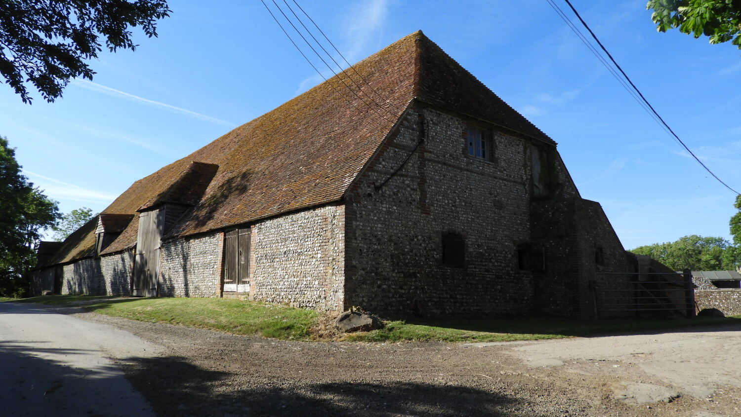 Great Tithe Barn in Alciston
The walk, eastwards along the crest of the Downs, is fairly level. To the south, dry valleys, called 'bottoms' in this part of Sussex curl away seawards. Their sides, dotted with countless sheep here and there, have inexplicable hollows filled with gorse. Whether these were created by nature, or by enemy bombers of World War Two jettisoning their load before their return flight, is not certain. Ahead, the cliffs above Cuckmere Haven come into view. After one mile of this exhilarating walk along what seems to be the top of the world, a circular grassy mound, some 30 feet in diameter, is passed. Standing in the field beside the path, it is a tumulus, one of the many ancient burial mounds to be found along the South Downs. In prehistoric times, this route offered a measure of safety from the dangers of the thickly forested Weald below.
Shortly after passing the tumulus, a turn to the left is made through a gate and up a track to another group of less prominent tumuli. You are now standing at the top of the scarp, overlooking the Weald. A gently sloping path goes down this lovely hillside. In spring, the hawthorn trees are white with blossomh and cowslips are everywhere. In summer, the deep blue of scabious and the purple of knapweed paint the ground in different colours. Just after you pass the overgrown remains of a small chalk quarry, a reminder of an important industry here, the spire of Berwick's church appears ahead. St Michael and All Angels is built on the site of a prehistoric barrow, a sacred burial point adopted by early Christians. The villages of Alfriston and Alciston nearby both have churches similarly sited.
During World War II, exploding bombs destroyed many of the stained glass windows. The Bishop of Chichester, who was keen that there should be a close association between the church and the arts, proposed that the church would be made lighter and brighter by using plain glass in the windows, and having wall paintings. This was in the tradition of Sussex churches.
A friend of the Bishop, the architect Sir Charles Reilly, suggested that Duncan Grant should be asked to execute this work. It became a joint work with Vanessa Bell and later additional paintings were done by her son Quentin and her daughter Angelica. Grant and Vanessa Bell were members of the Bloomsbury Group and lived near by at Charleston Farmhouse. Painted on plasterboard at Charleston, the murals were completed in 1942 and dedicated in the following year. From the north porch, a path runs across the churchyard and adjoining fields to reach the little cottage pub, the Cricketer's Arms.
The path to Alciston runs parallel to the Downs, which loom large on the left. They reach their highest point 712 feet above sea level at Firle Beacon, overlooking Charleston. Next to Alciston Church once stood the Manor House. This has gone, but the Great Tithe Barn still stands. So too does the remains of the Tudor brick dove coat. A lane from the church passes several delightful thatched houses and more long barns.
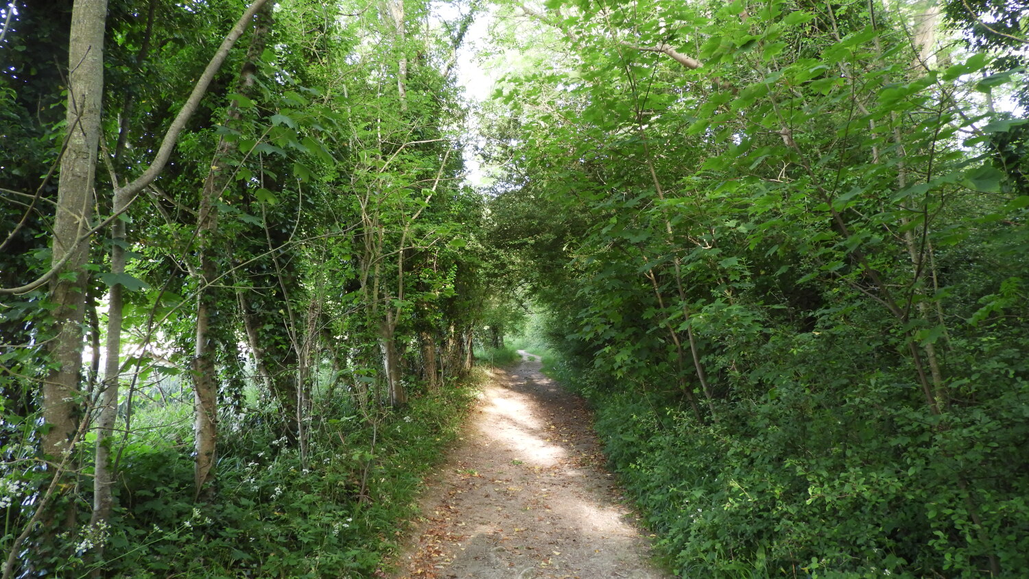 Track leading to the Downs from Charleston Farm
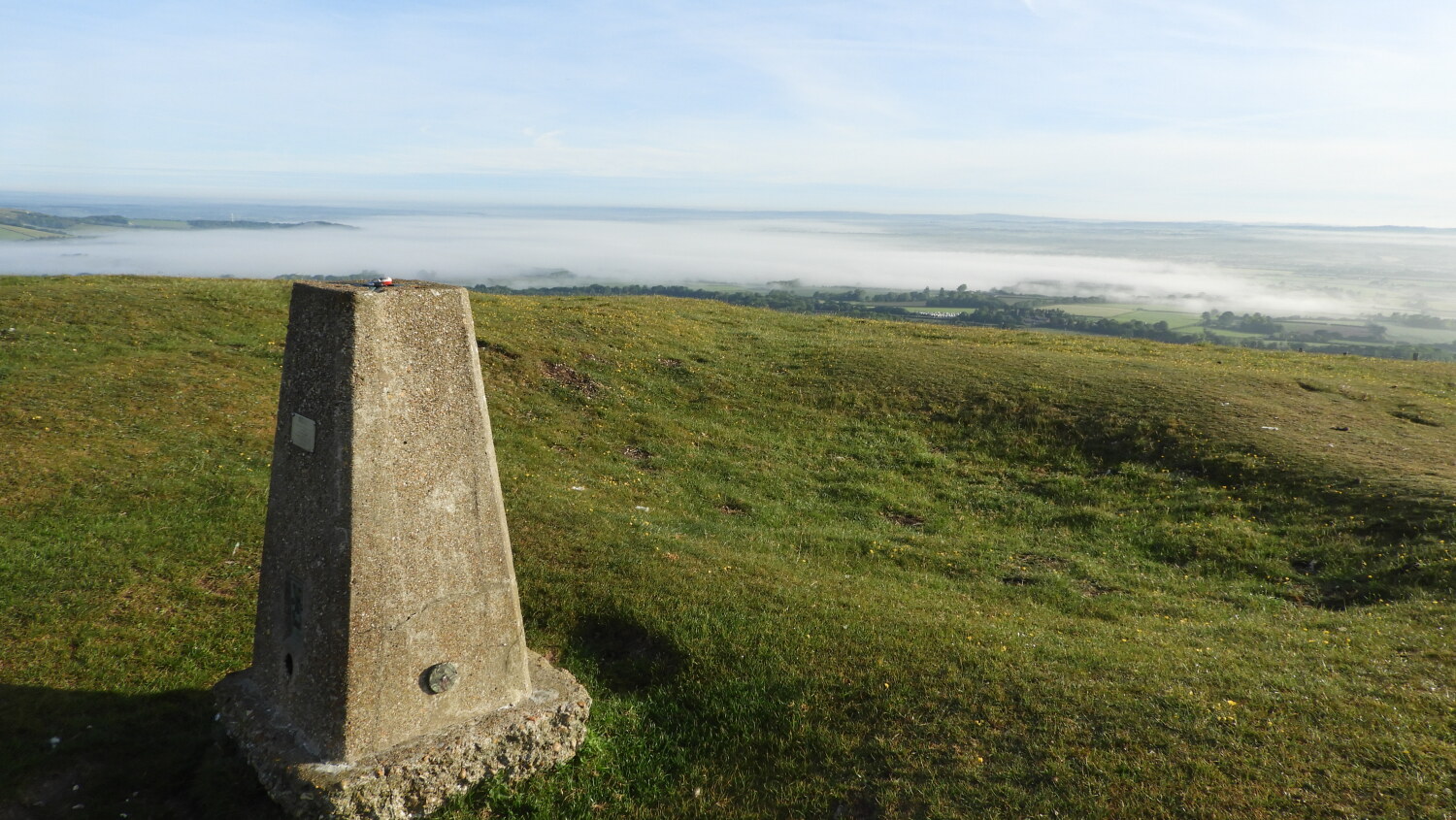 Firle Beacon
Field paths across meadows, still beneath the shadow of the Downs, lead to Charleston Farmhouse. It was here that the Bloomsbury Group congregated and where Duncan Grant and Vanessa Bell painted almost every surface within the farmhouse. It is now owned by the Charleston Trust and preserved as a memorial to the group's genius.
A chalk track now heads straight towards the Downs, the ground rising the closer you get. Along the crest of the hills, more tumuli dot the landscape. A steep path affords magnificent views. Soon the turf of the summit is gained and once more views extend to the sea. The starting point of the walk is seen a short distance to the left but it is to the right we go. The final highlight of the walk is a short there and back walk to the trig point on Firle Beacon, the aforesaid highest part of the South Downs. Enjoy the views, and look back to the route of your walk down below as Berwick, Alciston and Charleston Farmhouse can all be clearly seen.
Acknowledgment: Text derived from the Out and Out Series; Discovering the Countryside on Foot. Pictures courtesy of Wikipedia.


