Burley, Castle Hill, Vales Moor, Long Pond and Shappen Hill
Through the forest to a fine hill fort with magnificent views
Google Maps Open Source Maps| Statistics and Files | ||
|---|---|---|
| Start: Burley | Distance: 5.8 miles (9.3 km) | Climbing: 169 metres |
| Grid Ref: SU 21285 02911 | Time: 3 hours | Rating: Moderate |
| GPX Route File | Google Earth File | About Burley |
| Statistics | |
|---|---|
| Start: Burley | Distance: 5.8 miles (9.3 km) |
| Climbing: 169 metres | Grid Ref: SU 21285 02911 |
| Time: 3 hours | Rating: Moderate |
| GPX Route File | Google Earth File |
Ordnance Survey Explorer Map (1:25,000)
The Walk: Smuggling was a flourishing industry in the New Forest until the end of the Victorian era and centered around the village of Burley. This walk follows a smuggler's track to the finest of all New Forest hill forts with beautiful views over the Avon Valley. Continuing in the steps of smugglers, the walk follows their sunken tracks along the top of a long moorland ridge to return past the site of a battle with a dragon.
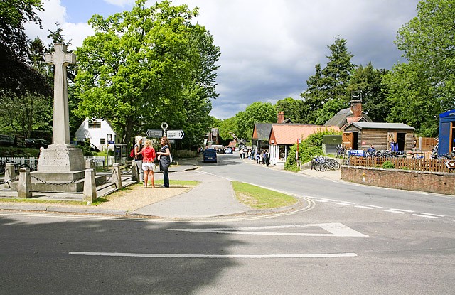 Burley village centre
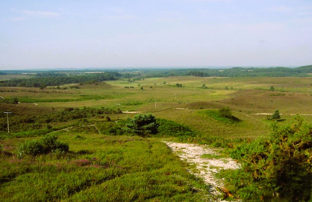 The view from Castle Hill Fort
The walk starts just outside Burley, a village that dates back to the Iron Age and its name means 'a fortified place in the clearing'. This probably refers to its fine hill fort, which dominates a ridge near Burley.
Burley clusters around its manor, which survived William the Conqueror's annexation of the forest as his own hunting ground in 1079. Today its main street is a jumble of thatched cottages and shops selling souvenirs and local crafts. Yet once the village was so remote that it depended for its livelihood on the herd of pigs whose diet was supplemented by Burley's yearly crop of acorns and beech mast. Ponies and donkeys still run freely and join visitors in admiring the work of local artists and inspecting the local handmade pottery.
Many of the houses in the village are very old, half-timbered and have their original large open fireplaces. The fireplaces often had movable hearths beneath which smugglers could store contraband goods - little barrels of neat spirits, tobacco and silks. The Queen's Head pub was a well known meeting place for smugglers and most of the tracks around the village were made by them. Some of the tracks are sunken so that the ponies laden at the coast - at places like Highcliffe or Barton - could be led unobserved through this remote area.
Leaving the village behind, the route continues towards Burley Hill and climbs through the wood. This wood is privately owned but a right of way, marked in green on the map, runs through it. Most of the forest, by tradition, is open to all to walk freely, so there is no need to mark rights of way. Nevertheless, walkers are advised to stick to the well defined tracks and paths.
Following the track along the top of the ridge, the walk reaches Burley Iron Age Fort. From its embankment, there are splendid views over rolling moors to the Avon Valley. On a clear day you can see Christchurch Priory and the gently curving outline of the Wiltshire Downs. The road below, running from Burley Street through Crow and Knaves Ash to the Avonn, is an old Saxon warpath, later used by smugglers.
There is a sunken smuggler's track beside the main track along the ridge. This route was frequently used by smugglers. It led north to Picket Post, where they had a cache in an underground cellar. For many years the gang was led by the Warne family who lived at Knaves Ash close by. One of the women - Lovey Warne - kept watch for the customs men. If they were about, she would stand wearing a conspicuous red cloak on the top of Verely Hill, visible just east of the ridge. Her comrades could then take evasive action.
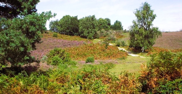 Smuggler's Road on Vales Moor
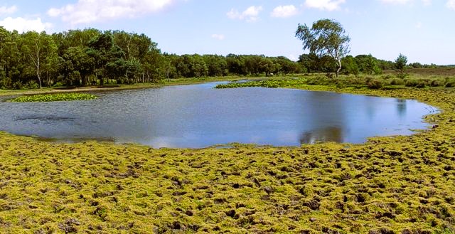 Long Pond near Burley
The last important feature to be seen from the route is Burley Beacon. This is one of the beacon hills that stretched across England where fires could be lit to give warning in times of danger. During the Napoleonic Wars, they were manned continuously by beacon keepers who lived in huts close by.
Burley Beacon has a special story attached to it, a fight with a devouring dragon. A forest legend tells how this creature, the Bisterne Dragon, had its lair on Burley Beacon. Every day it came down into the Avon Valley at Bisterne, demanding a pail of milk and menacing men and animals. There is a document in Berkeley Castle that gives more substantial evidence to the legend. It tells how the dragon was killed by Sir Morris Barkley, the son of Sir John Barkley of Beverston. The courageous man armed himself and encountered the devouring dragon. At length, he overcame and killed it, but died himself soon afterwards.
Forest legend adds that he was helped by two dogs. There is still evidence of the event to be seen today. It is possible to walk down Dragon Lane in Bisterne and there are effigies of the dogs, old English mastiffs, at Bisterne Park, while a sculpture of a dragon can be seen above the door. Close by are two Dragon Fields and in the Forest, stands the Green Dragon Inn.
Near Burley, there is a haven for wildlife. There are herds of fallow, roe and red deer. The heathlands are home to curlews, merlins and hen harriers. The old woods shelter the greater and lesser spotted woodpeckers and the larger green woodpecker. Plants including heather, ling and cotton grass mark the moorland and the boggy areas. Also, towards the end of the walk you pass Long Pond, home to wildfowl and wetland plants. Another pond, Whitten Pond, is a little further to the south.
Acknowledgment: Text derived from the Out and Out Series; Discovering the Countryside on Foot. Pictures courtesy of Wikipedia.


