Amberley, North Stoke, South Stoke and Houghton
Across unspoilt water meadows to an open-air museum
Google Maps Open Source Maps| Statistics and Files | ||
|---|---|---|
| Start: Amberley Station | Distance: 6.9 miles (11.1 km) | Climbing: 144 metres |
| Grid Ref: TQ 02677 11806 | Time: 3 hours | Rating: Easy |
| GPX Route File | Google Earth File | About Amberley |
| Statistics | |
|---|---|
| Start: Amberley Station | Distance: 6.9 miles (11.1 km) |
| Climbing: 144 metres | Grid Ref: TQ 02677 11806 |
| Time: 3 hours | Rating: Easy |
| GPX Route File | Google Earth File |
Ordnance Survey Explorer Map (1:25,000)
The Walk:
The chalk ridge of the South Downs is cut by several rivers flowing south to the sea. The River Arun is one of the most attractive as it loops in great meanders across flat peaceful meadows, beneath sheer short cliffs, and passes the fairy tale fortress of Arundel Castle.
A little further upstream, it flows within site of the more modest castle at Amberley, a village overlooking the water-meadows known as the Amberly Wildbrooks.
Until the 1960's when the river embankments were raised to their present level, the flat valley floor of the River Arun was regularly flooded in winter. At this point, the river is tidal, and a high tide combined with heavy rain can turn the placid waters into a formidable torrent.
This problem was made much worse in the 19th century by the excavation of several new channels as part of the Arun Navigation scheme. One of these skirts the hamlet of South Stoke, leaving a great loop of the original river bed virtually dry, except for a small misfit stream. The new cut isolated South Stoke from its farmlands and the bridge known as White Bridge was built by navigation engineers to allow access to the meadows.
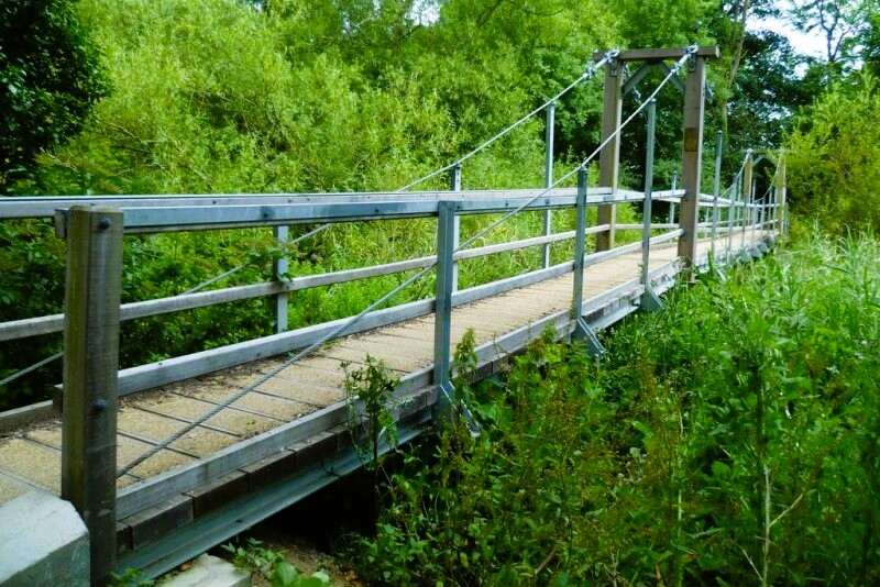 Gurkha Suspension Bridge,
 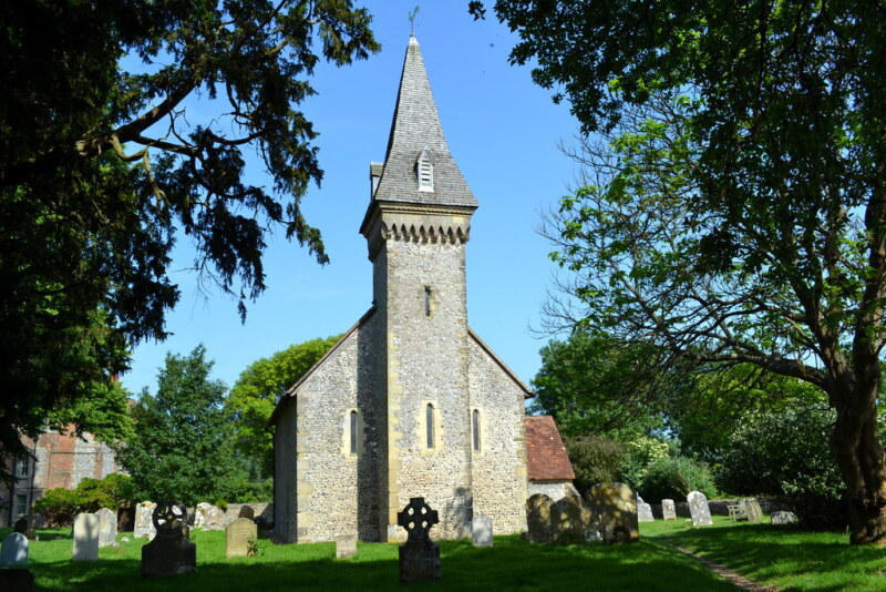 St Leonard's Church, South Stoke
South Stoke itself is tiny, with an appropriately miniature church sporting a whimsical 'frilly cap' beneath its slender Victorian spire. The Dukes of Norfolk, residents of Arundel Castle, were partly to blame for restricting the size of the hamlet. In 1806 the Norfolks used their influence to enclose the common grazing lands above the west bank of the river to create Arundel Park. This deprived the farmers of South Stoke of their valuable sheep pasture, and therefore much of their former prosperity.
During the English Civil War, the inhabitants of South Stoke and the surrounding area were strongly royalist. Residents of Houghton are still proud today of the fact that in 1651 the future King Charles II, in flight after his defeat at the Battle of Worcester, stayed at the George and Dragon. He eventually made his way to Shoreham and escaped to France in a fishing boat, an event commemorated by the annual 'Royal Escape' in which yachtsman retrace his route from Shoreham to the Normandy port of Fécamp.
In July 1978 the Minister of Agriculture rejected an application to drain Amberley Wildbrooks and turn it into productive agricultural land. This was seen as a victory for the cause of conservation since the Wildbrooks are among the few large areas of wetland meadows surviving in south-east England. They have now been preserved as unimproved rough pasture and provide a haven for wildfowl, frogs and a host of wetland plants.
Centuries ago, the Wildbrooks would have been impassable marshland, but a long established network of ditches drains off the surface water, while leaving the ground sufficiently wet to support pockets of marshland plants such as ragged robin, marsh marigold, reedmace and yellow flag. The water also encourages the grass to grow in the spring, given an early bite for the cattle that was much appreciated by the local farmers in the past. Today, you may still see the dark red brown Sussex cattle grazing on the Wildbrooks, along waterfowl such as Bewick's swan.
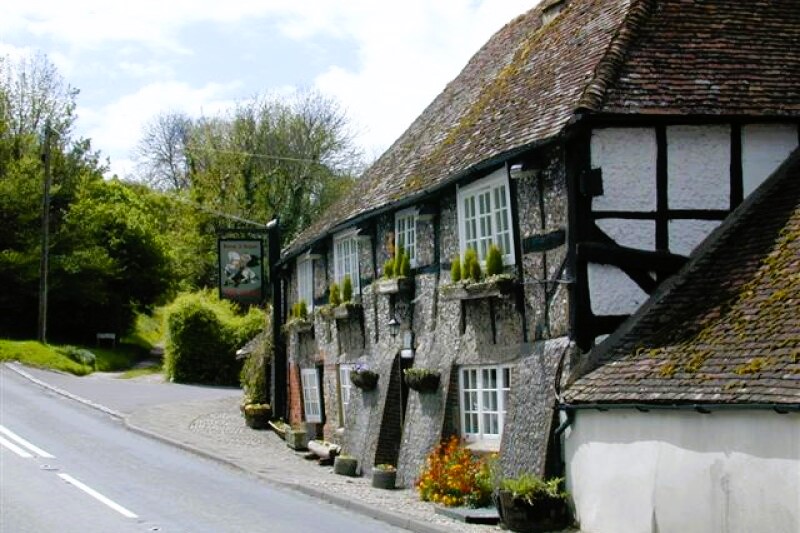 George and Dragon, Houghton
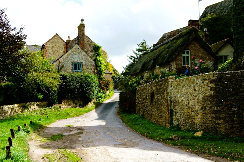 Church Lane, Amberley
Amberley Castle is perched clear of the Wildbrooks on a low cliff, its seemingly impregnable walls rising sheer from the rock face. In fact, it is not a true fortress but a fortified manor which was once a country residence used in summer by the Bishops of Chichester.
Much of the original 12th-century manor house still survives within the battlemented walls, which were built following the granting in 1377 of a 'licenced to crenellate' (to our battlements), a form of 14th-century planning permission. The house itself is private, but part of it is visible from Amberley church, which is well worth visit for its spectacular Norman chancel and 12th-century wall paintings.
Amberley itself is a showpiece village: a vision of mellow stone and thatch, with blossoms billowing over the garden walls in waves of colour. There is a variety of building materials including brickwork, flintwork and timberwork. The buildings range from tiny cottages to substantial stone farmhouses, with some intriguing architectural oddities. Look for the neo-Gothic windows of the old minister's house, next to the chapel.
Crafts such as pottery are the nearest that modern Amberley came to having a local industry, but in the past things were very different. Until the 1960s ambulat was a centre for the production of lime produced from chalk dugout of the hill to the south of the village. The old chalk pits have now been converted into Amberley Museum of such rural industries with working exhibits covering a wide variety of trades, including those of brickmaker, blacksmith an wheelwright.
There are also exhibits connected with the timber trades and an industrial railway exhibition with rolling stock and some striking locomotives in a variety of narrow gauges. Working railways were established at the pits in the 1870's but the focal point is the great bank of kilns in which chalk was burnt. The tops of these kilns are visible as you return down the road to the station and the museum entrance.
Acknowledgment: Text derived from the Out and Out Series; Discovering the Countryside on Foot. Pictures courtesy of Wikipedia.


