Hurley, Ashley Hill and the Dew Drop Inn
From a historic village beside the Thames to a secluded old inn
Google Maps Open Source Maps| Statistics and Files | ||
|---|---|---|
| Start: Hurley | Distance: 6.8 miles (11.0 km) | Climbing: 135 metres |
| Grid Ref: SU 82548 84017 | Time: 3 hours | Rating: Moderate |
| GPX Route File | Google Earth File | About Hurley |
| Statistics | |
|---|---|
| Start: Hurley | Distance: 6.8 miles (11.0 km) |
| Climbing: 135 metres | Grid Ref: SU 82548 84017 |
| Time: 3 hours | Rating: Moderate |
| GPX Route File | Google Earth File |
Ordnance Survey Explorer Map (1:25,000)
The Walk:
This scenic walk begins and ends in the village of Hurley, splendidly sited by the River Thames. It was first settled in Saxon times because the river could be forwarded here, but owes its importance and many of its fine ancient buildings to the establishment of the Benedictine Priory of Saint Mary in 1086.
The priory church, with its Norman porch and windows, is opposite the walled car park where the walk begins, and the quadrangle and refrectory of the former monastic building stand next to it. Also overlooking the car park is the priory's superb 11th century Dovecote, with 750 nesting boxes and a unique pivoting ladder for collecting the eggs. Adjacent to this are two huge tithe barns - the stone built one dates from the Middle Ages and is used for farm storage, while the brick and timber Elizabethan barn has been converted to residential use.
Following the Dissolution of the Monasteries in 1534, the priory buildings passed into the hands of the Lovelace family. Richard Lovelace demolished many of them to provide the stone he needed to build a mansion, Layde Place, nearby. It was there in 1688 that a meeting of Whig and Tory leaders decided to invite the Protestant William of Orange to come to England and take the throne from the Catholic James II. Layde Place was demolished in 1837.
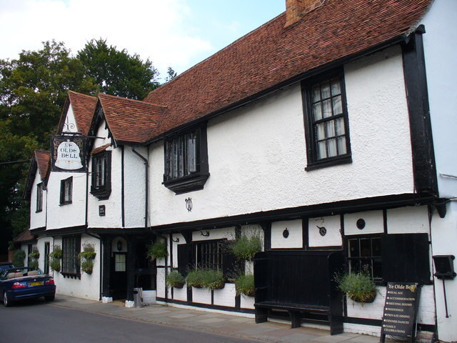 Ye Olde Bell at Hurley
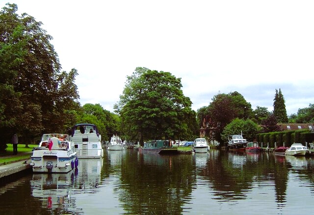 Rivercraft on the Thames at Hurley Lock
The walk skirts the site of the priory along Mill Lane. At the end of the lane is a footbridge across a side channel of the river. To the right, a variety of boats ranging from enclosed punts to venerable single funnel steamers bob about in a little haven in front of a quiet old boatyard, one of the view left along the river which still builds wooden craft.
Ahead is Hurley Lock, occupying one of the many wooded islets which divide this stretch of the Thames into several channels. You walk past the lock and regain the south bank of the river via a high wooden bridge. The middle of this bridge is an excellent vantage point from which to observe the river, the Buckinghamshire Hills to the north, and to the South the chalk downlands of Berkshire, which are clad here and there with some fine groves of beech and oak.
Following the river upstream past a pair of unusual boathouses, the path passes through some lush meadows fringed with tall reeds. Water mint blooms at the waters edge and Canada geese wheel around in front of the long weir. You follow this lovely bankside walk for one and a half miles. Then you turn up a lane to the old Henley turnpike road, now the A4130, and the flower decked Black Boys Inn.
Opposite the inn, a bridlepath bordered with hedgerows steadily ascends the gentle hills rising from the river valley. Note the fields to the left - they were once the trial fields of the Grassland Research Institute. Continuing on, As you gain height, a dry valley runs parallel to the path to your right. Eventually the hedgerows give way to woodland and you enter the nature reserve of Hurley Chalk Pit.
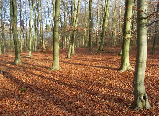 Ashley Hill Forest
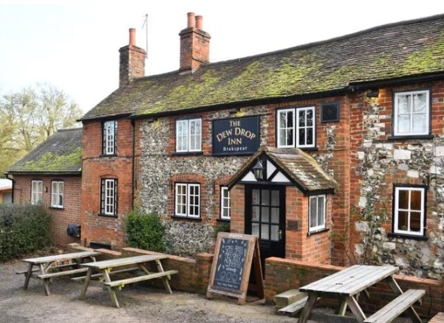 Dew Drop Inn
Beyond through the little wood, the path joins a farm road and the lane leads to the foot of Ashley Hill. The woodland clothing the hill is a remnant of the great southern forest. Fir trees, interplanted with silver birch, have now largely replaced the original ash trees that once grew on this hill. The name Ash-ley means the clearing in the ashwood.
The path climbs steadily uphill to the site of Keeper's Cottage and then plunges steeply down to a track along the side of Pudding Hill.
This pleasant byway soon becomes a lane and in the dell to the left is what must be one of the most secluded pubs in England, the 300 year old Dew Drop Inn. It has a flint faced facade from which pretty floral baskets hang in the summer, but a log fire makes it no less inviting in the winter. The inn has a garden set into a hollow in the hillside, from which there are lovely views down towards the river.
The route continues along the lane at the foot of Ashley Hill, then turns left along a pleasant path edged with blue flowered chicory in summer, across the level fields to High Wood. Here, tall and graceful beeches top the appropriately named Prospect Hill, which affords magnificent views over Hurley and the Thames. The path runs arrow-straight down the steep hillside.
You cross the busy road once more, to the contrasting quiet of Hurley's long village street. Just past the Rising Sun is Ye Olde Bell, which dates from 1135 and lays claim to being the oldest surviving inn in England. It was probably built to accommodate visitors to the priory, and may have gained its name from the Sanctus Bell, rung to announce the beginning of mass. There is supposedly a tunnel leading from the inn's celler to the site of the priory. Ye Olde Bell also has a place in more recent history. US Naval Intelligence was housed in the village in World War Two and General Dwight D Eisenhower was a regular drinker here in the months that led up to the D-Day landings of 1944. Other famous guests have included Elizabeth Taylor, Richard Burton, Cary Grant, Errol Flynn and Dustin Hoffman. From the inn, it is a short stroll past the old post office back to the car park at the start of the walk.
Acknowledgment: Text derived from the Out and Out Series; Discovering the Countryside on Foot. Pictures courtesy of Wikipedia.


