Hindhead Common, Devil's Punch Bowl and Gibbet Hill
Around a beauty spot on the borders of Surrey, West Sussex and Hampshire
Google Maps Open Source Maps| Statistics and Files | ||
|---|---|---|
| Start: National Trust Car Park | Distance: 2.9 miles (4.7 km) | Climbing: 139 metres |
| Grid Ref: SU 89002 35763 | Time: 1-2 hours | Rating: Moderate |
| GPX Route File | Google Earth File | About Hindhead |
| Statistics | |
|---|---|
| Start: National Trust Car Park | Distance: 2.9 miles (4.7 km) |
| Climbing: 139 metres | Grid Ref: SU 89002 35763 |
| Time: 1-2 hours | Rating: Moderate |
| GPX Route File | Google Earth File |
Ordnance Survey Explorer Map (1:25,000)
The Walk:
The Devil's Punch Bowl is in the Greensand, the area of chalk of the Downs and the clays of the Weald. Here, soft sandstone has been eroded away by numerous springs to create a spectacular steep-sided depression that is now in the care of the National Trust.
The western slopes are covered in pine trees, but the other sides remain bracken-covered and bleak. On these steep slopes, and in the bottom of the basin, Victorian naturalists identified several rare ferns, including the flowering fern, sweet mountain fern and marsh fern. The area is also rich in wild flowers. Look for bog pimpernel, sundew and guelder rose, among others.
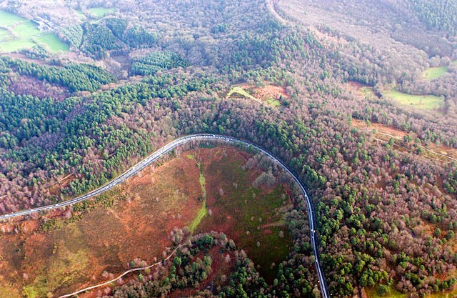 Aerial view of Devil's Punch Bowl
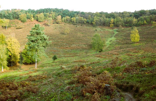 Devil's Punch Bowl as seen on the walk
The walk starts from a National Trust car park by the crossroads village of Hindhead, on the high ground above the Punch Bowl. The route follows the edge of the tree clad western slopes. At first the trees screen the bowl below, but soon a steep downland path goes through the trees, and long views begin to open up. The air becomes more still as you descend - the deeper you go, the quieter it gets.
Almost at the bottom, a turn along a bridleway is followed by another path which goes down to a stream. It is along the sandy banks of this musical little brook that you will find the ferns sought out by the Victorian naturalists. The springs around here have so cut into the sandy soil that the valley floor is narrow, and you begin to climb again through a thin screen of trees as soon as you cross the water.
Very soon, the path enters a beautiful glade. Ahead is the former Hindhead Youth Hostel, made up of three cottages that were once the homes of broom makers. Their craft was once literally a cottage industry here.
Next, you follow a wider track, past the picturesque half timbered buildings of Highcombe Farm, on a tree lined road at a bend. It is worth taking the path through the bracken for a few yards to get a wonderful overview of the Devil's Punch Bowl. A little further along the road, a bridle path to the left gives further long vistas to the north over the Weald.
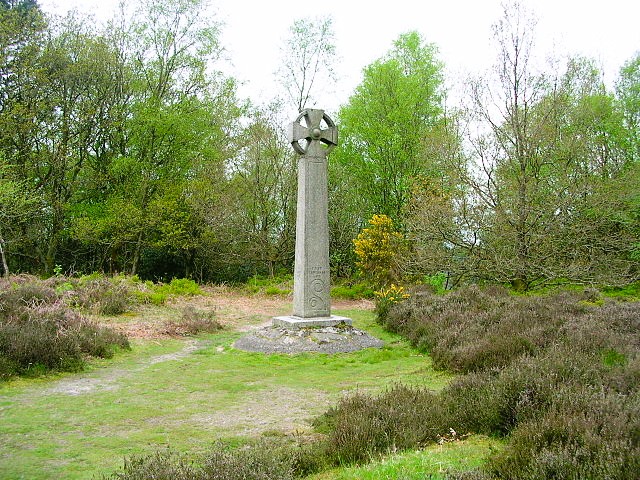 Memorial on Gibbet Hill, Hindhead
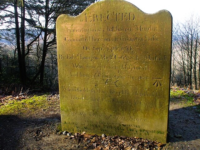 Stone commemorating the murder of an unknown sailor
Soon, you arrive at Gibbet Hill, which was named after an incident in 1786, when the bodies of three men executed for the brutal murder of an unknown sailor were hung here in chains. The men, also sailors, have met their young victim at the Red Lion in Thursley, and offered to travel with him to Portsmouth. Near this spot they killed him, stole his clothes and money, and hurled his body down the slope. The deed was soon discovered and the murderers were arrested later that day at the Flying Bull Inn at Rake.
Shortly after leaving Gibbet Hill, you pass a memorial stone to the victim. It was erected in 1786 by James Stilwell of Cosforth 'in the detestation of the barbarous murder committed here on an unknown sailor'. The stone stands beside a quiet lane that turns just south of the A3 road and leads you back to the start of the walk.
Acknowledgment: Text derived from the Out and Out Series; Discovering the Countryside on Foot. Pictures courtesy of Wikipedia.


