White Cliffs of Dover - Fox Hill Down and St Margaret's Bay
Exploring the English Channel coast between Dover and St Margaret's Bay
Google Maps Open Source Maps| Statistics and Files | ||
|---|---|---|
| Start: National Trust Car Park | Distance: 6.3 miles (10.1 km) | Climbing: 256 metres |
| Grid Ref: TR 33422 42090 | Time: 3 hours | Rating: Moderate |
| GPX Route File | Google Earth File | White Cliffs of Dover |
| Statistics | |
|---|---|
| Start: National Trust Car Park | Distance: 6.3 miles (10.1 km) |
| Climbing: 256 metres | Grid Ref: TR 33422 42090 |
| Time: 3 hours | Rating: Moderate |
| GPX Route File | Google Earth File |
Ordnance Survey Explorer Map (1:25,000)
The Walk:
This delightful walk follows the tops of some of the most familiar cliffs in Britain, at the entrance to the port of Dover. It is good walking most of the way, over close-cropped, springy turf, with views across the busy water of the English Channel. The French coast is visible from some points on a clear day.
You begin at the National Trust car park on Fox Hill Down. Here, there is an information centre and a picnic site, complete with coin-in-the-slot telescopes. Nearby, there is a coastguard station, and also the site of a prison built in 1884, before being converted into army barracks in 1908. During World War Two, a battery of 16 guns was located on the upper terrace. Each of these guns had an 8 mile range out to sea.
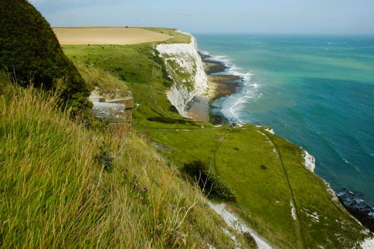 The path along the top of the White Cliffs of Dover
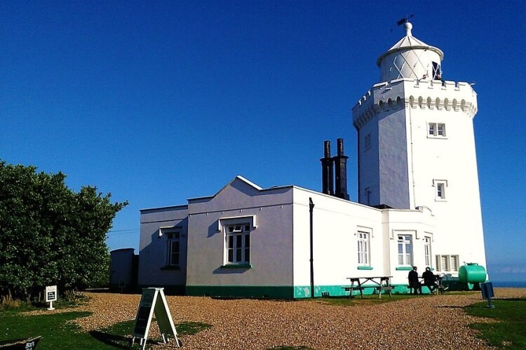 South Foreland Lighthouse
A railway line which was built to carry materials to these installations in the cliff-top is now used as the footpath which this route follows from the car park as it skirts Langdon Bay. Gorse and blackthorn line the way, and skylarks, finches and pipits can all be seen and heard here.
The walk continues on high ground parallel to the shore, through fields sparkling with flints, towards the white tower of the South Foreland Lighthouse. This is also National Trust property. The building, notable as the site of some of Marconi's earliest broadcasts, no longer functions as a lighthouse, instead hosting regular exhibitions about the site and its surroundings.
You continue over Lighthouse Down past an impressive windmill that is now a private house. The cliff edge is dangerously exposed near here, and it is safer to admire the sea views from a little distance. The road down into St Margaret's Bay leads past the Pine Gardens which was created on the site of an old rubbish dump by the St Margaret's Bay Trust, and officially opened as a public garden in 1971.
As well as a fine collection of plants, thriving on this sheltered undercliff site, it contains a small museum and many stone figures. These include busts of three Roman Emperors, inckuding Julius Caesar, who landed at Walmer, just along the coast, and of William I, the last man to successfully lead an invading army into Britain. A 9-foot statue of Sir Winston Churchill, sculpted by Oscar Nemon, gazes out at the white cliffs from a plinth of Balkan granite.
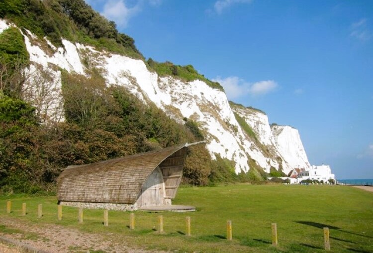 White cliffs at St Margaret's Bay
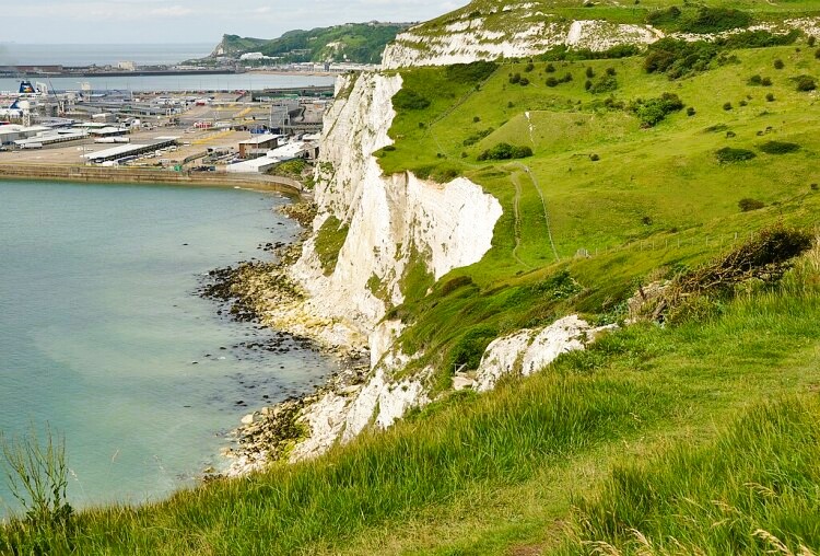 Langdon Hole and Dover Harbour
A narrow road descends steeply to the shingle beach of St Margaret's Bay. There are tall cliffs at either end of the bay, and a pleasant flint faced pub, the Coastguard Inn, from which you can watch the ferries and other craft go by.
The shingle is constantly being carried away from the beach by longshore drift, and a succession of groynes help to keep it in place and reduce possible damage to the promenade. The direction of the drift is clearly indicated by the stones piled up against the wooden groynes.
The return route goes along South Foreland Valley, through a dense growth of bushes and trees that include hawthorn, Mediterranean oak and maple. Blackbirds, finches, robins and warblers find food and cover here.
Once you reach the lighthouse, you switch back to a clifftop path. Look out for nesting birds on the cliffs; kittiwakes, fulmars and herring gulls find them a very desirable residence, while peregrine falcons have bred along this coast in recent years. There is a wealth of wild plants to be seen on the way; a few orchids, horseshoe vetch, sheep's fescue, salad burnet and while cabbage all grow on the tops, as well as in the inland fields.
The path goes inland slightly to curve around Langdon Hole, a dry valley formed by a watercourse that now runs underground in the porous chalk. A steep ascent from this hollow leads back to the old railway line. As you walk along the track bed back to the start, there are fine views ahead over the harbour of Dover.
Acknowledgment: Text derived from the Out and Out Series; Discovering the Countryside on Foot. Pictures courtesy of Wikipedia.


