Silchester Roman Town and Mortimer West End
A walk round the well preserved remains of a Roman town
Google Maps Open Source Maps| Statistics and Files | ||
|---|---|---|
| Start: St Mary's Church | Distance: 4.2 miles (6.8 km) | Climbing: 78 metres |
| Grid Ref: SU 64362 62337 | Time: 2 hours | Rating: Easy |
| GPX Route File | Google Earth File | About Calleva Atrebatum |
| Statistics | |
|---|---|
| Start: St Mary's Church | Distance: 4.2 miles (6.8 km) |
| Climbing: 78 metres | Grid Ref: SU 64362 62337 |
| Time: 2 hours | Rating: Easy |
| GPX Route File | Google Earth File |
Ordnance Survey Explorer Map (1:25,000)
The Walk:
There was a considerable settlement at Silchester before the Romans came. Eppillus, a tribal chief of the Atrebates, settled here in the first century AD, and traces of his town can be seen on this walk. The Roman name for the town, Calleva Atrebatum, means 'woody place of the Atrebates'. The Romans came later in the century, but the walls visible today date from AD260-280.
The walls, 10 feet high in places and 1.5 miles in length, completely encircled the 100 acre site of the town. The town was laid out in a grid with four gates, and contained baths, a forum and later a church. Just outside the walls is an amphitheatre.
When the Romans withdrew from Britain at the beginning of the 5th century, the economy collapsed. The invading Anglo-Saxons were not town-dwellers, and urban life largely ceased in Britain until the 9th century. Then many former Roman towns were occupied, and the remains pulled apart to provide building materials. The Roman buildings at Silchester, however, escaped largely intact as the place remained mostly rural.
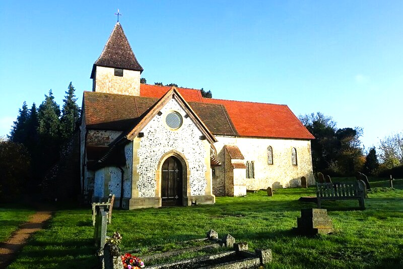 St Mary's Church, Silchester
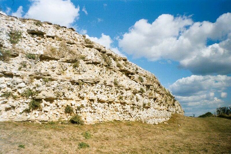 Silchester Roman Town walls
The walk starts by the 12th century Church of St Mary the Virgin, built just inside the wall, but outside the present town. Of particular interest inside are the lovely 14th century tomb of Eleanor Baynard, a 17th century pulpit and a 15th century screen.
The route goes through the churchyard and past some Tudor farm buildings to join a track. The Drove, which runs through the middle of the Roman town to an earthen bank at the western end. If you climb the bank, you can see the size of the town, and its encircling walls. In dry weather, it is possible to see the course of the old streets, picked out by the stunted or parched growth of the grass above them.
You follow the wall, then go between fields on a path alongside one of five Roman roads that radiated from Silchester. Look to the right at the five bar gate across the path and you can see the course of the road passing on the slight embankment over a ditch. You continue along a wider track to a road, where there is a museum dedicated to the town.
A short walk along the road takes you into a conifer plantation. Then between two embattlements that were once sections of a small fort. You come out of the woods into a delightful valley and cross a causeway between two ponds. The one on the left is large and framed by gentle pine-clad hills. Its smaller companion covered with reeds and bullrushes provides a habitat for abundant wildlife.
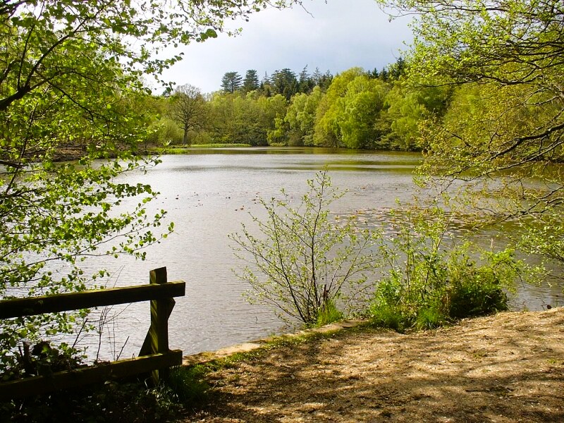 Kiln Pond, Mortimer West End
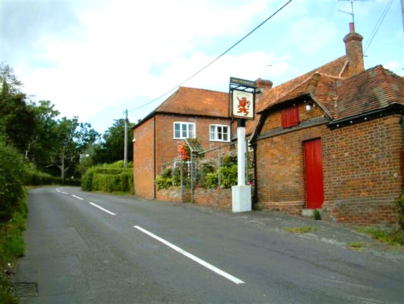 Red Lion, Mortimer West End
The route climbs up out of the valley onto a road where you will soon find a superb country pub, the Red Lion. It has a welcomeing log fire in winter, and in summer you can sit in front of the flower decked exterior, enjoying a view over low rolling hills and streams.
A bridleway climbs one of these hills to a road, which passes through a gap in an earthwork built by Eppillus to follow the Roman wall. This wall, with ironstone and limestone, sandwiched between courses of flint set in a mortar of gravel, sand and lime, is fronted by a ditch.
At Manor Farm, a gate gives on to an open amphitheatre, enclosed by high banks that would have had wooden seats sufficient for about 4,000 people. It is a short walk back past Manor Farm to the church where the walk started. Beyond it, a well preserved section of the wall, including the only survivor of the town's four gates, continues for some distance.
Acknowledgment: Text derived from the Out and Out Series; Discovering the Countryside on Foot. Pictures courtesy of Wikipedia.


