Battle, Fore Wood Nature Reserve, Crowhurst and Crowhurst Park
A walk in woods and valleys around the site of England's most famous battle
Google Maps Open Source Maps| Statistics and Files | ||
|---|---|---|
| Start: Battle Abbey | Distance: 8.5 miles (13.7 km) | Climbing: 365 metres |
| Grid Ref: TQ 74860 15822 | Time: 4 hours | Rating: Moderate |
| GPX Route File | Google Earth File | About Battle |
| Statistics | |
|---|---|
| Start: Battle Abbey | Distance: 8.5 miles (13.7 km) |
| Climbing: 365 metres | Grid Ref: TQ 74860 15822 |
| Time: 4 hours | Rating: Moderate |
| GPX Route File | Google Earth File |
Ordnance Survey Explorer Map (1:25,000)
The Walk:
The town of Battle owes its existence to its abbey, founded by William the Conqueror on the site of the Battle of Hastings in 1066. The high altar of the abbey church occupies the spot where King Harold set up his standard and was killed. The town grew up around it in the Middle Ages, providing essential services to the monks and pilgrims.
The little square in front of the early 14th century gatehouse was once the village green, while many of the buildings that line the High Street are medieval in origin, though their frontages date only from the 18th or 19th centuries.
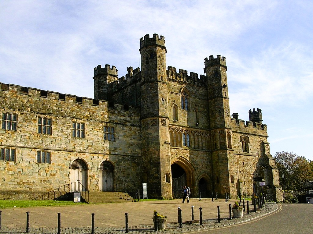 Battle Abbey
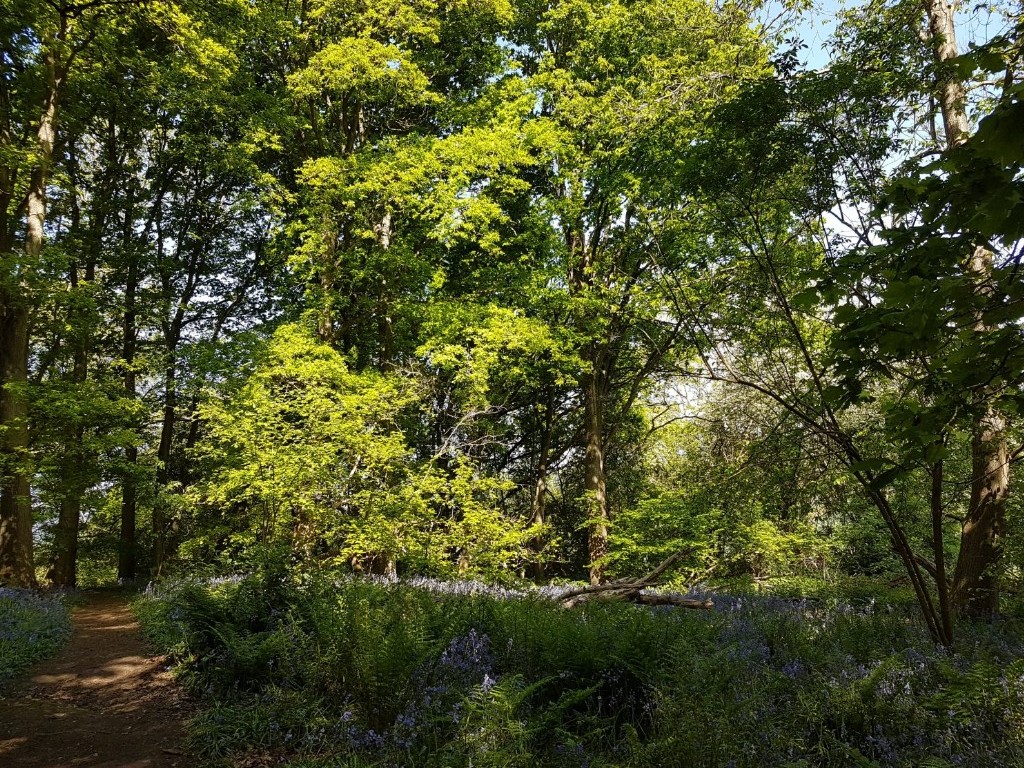 Fore Wood Nature Reserve
The walk starts at the gates of Battle Abbey. To the right are several 17th century cottages, and just beyond the gatehouse is a fine example of a medieval timber framed building, The Pilgrim's Rest. As the name suggests, it once provided accommodation for pilgrims to the abbey. Contained within it is in a remarkable two-storeyed hall.
You follow the perimeter of the abbey grounds into a lovely sloping valley. A spring beside the path has cut a narrow winding channel which feeds the Powdermill Stream. This stream was dammed hundreds of years ago to provide fish ponds, one of which is in the trees on your right. On the other side of the valley is a hill with good views to the left over the battlefield, where the 7,000 man Norman army was drawn up. The nearest troops to the path would have been the Breton Cavalry, who broke through the English positions around the site of the abbey.
The route follows a farm lane to the intriguing named Peppering Eye Farm, which has an attractive tile-hung farmhouse and an oasthouse. A turn off the road leads to Powdermill Stream. The name is a reminder of the extensive gunpowder mills that once lined its banks. The water bubbles over sand between banks lined with wild garlic.
At a bridge you cross into lovely Fore Wood, now a nature reserve owned by the Royal Society for the Protection of Birds. Afterwards, at the village of Crowhurst, you come to the Church of St George, sat on high ground. Although the church was rebuilt in the 19th century, its 15th century tower remains. Far older is the massive yew beside the church door. At over 32 feet in circumference, it is believed to be over 1,000 years old.
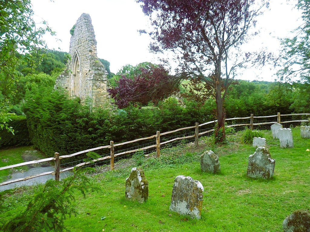 Remains of Crowhurst Manor House
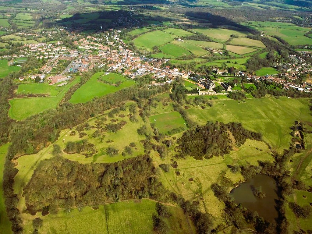 Site of the Battle of Hastings
Standing near the church are the ruins of the oratory of the medieval Crowhurst Manor House, the highest wall with its early English window and portions of the other walls remain. The manor of Crowhurst was held by King Harold and given by William the Conqueror to his cousin Robert, Count of Eu. Robert, in turn, granted it to Walter Fitz Lambert. The church remained in the patronage of English kings for 300 years, while the manor passed in 1412, to the Pelham family, in whose stewardship it remained for the next 500 years.
A little road leads down to Powdermill Stream once again. On this site, a medieval forge was established. The Romans had worked iron on several sites around Crowhurst, and one of their bloomeries was in Fore Wood. The Tudor and Stuart forge-masters used water-power to operate their hammers, and one of these was located at this site. Furnace Cottage, just beyond, is a reminder of this.
A little further on is The Plough, a comfortable pub with a garden and an ingle-nook. From here, there are pleasant views over the wide valley of Powdermill Stream. Just past The Plough, a track leads over the former bed of a long disused railway branch line to Bexhill. Another bridleway takes you to Green Street, where there is a distant view of the stretch of English Channel where William I landed in 1066.
The route back towards Battle follows paths that switchback across hills and valleys. You go through part of Crowhurst Park and several small patches of woodland to join a road leading to two very old farmsteads. Blacklands, on the left, was built in 1679 and still has exquisite mullioned windows. Pyes Farm, opposite, dates from 1630.
At the corner of Powdermill Lane, on the outskirts of Battle, there is a final view of the battlefield and the English positions along the crest of Senlac Hill. You return alongside the abbey wall, past the Prior's Lodge, to which the Prior retired when the abbey was dissolved, back to the start.
Acknowledgment: Text derived from the Out and Out Series; Discovering the Countryside on Foot. Pictures courtesy of Wikipedia.


