Reculver, River Wantsum, St Nicholas at Wade and Saxon Shore Way
A lowland walk around the shores of the Isle of Thanet
Google Maps Open Source Maps| Statistics and Files | ||
|---|---|---|
| Start: Reculver | Distance: 9.2 miles (14.8 km) | Climbing: 48 metres |
| Grid Ref: TR 22627 69238 | Time: 4 hours | Rating: Moderate |
| GPX Route File | Google Earth File | Isle of Thanet |
| Statistics | |
|---|---|
| Start: Reculver | Distance: 9.2 miles (14.8 km) |
| Climbing: 48 metres | Grid Ref: TR 22627 69238 |
| Time: 4 hours | Rating: Moderate |
| GPX Route File | Google Earth File |
Ordnance Survey Explorer Map (1:25,000)
The Walk:
This walk explores what was once the Wantsum Channel, which divided the Isle of Thanet from the remainder of Kent. The channel is now land, albeit low-lying and marshy, but in Roman times it was an important artery protected by forts at both ends. To the south, near Sandwich, was the fort of Richborough; to the north was Reculver, where this walk begins. Both forts had harbours; that at Reculver was close to the spot where the King Ethelbert Inn now stands. When the Romans built their eight acre fort in the 3rd century AD, they manned it with a cohort of 500 strong. Then the fort lay some quarter mile inland, but erosion has devoured half of the site.
When the Roman legions withdrew, the River Wantsum became a key avenue for the occupation of Kent by Jutist tribes. The Kings of Kent established themselves on Thanet. One of these, Ethelbert, who had a Christian wife, provided the means for the re-cristianizing of England by Augustine in 597 AD. Using building materials from the Roman fort, these early Christians built the first Church of St Mary at Reculver in the 7th century. Roman tiles may be seen in the courses of the walls nearest the sea. The early church was sacked by Viking raiders -the two great towers were added when it was rebuilt in 1200.
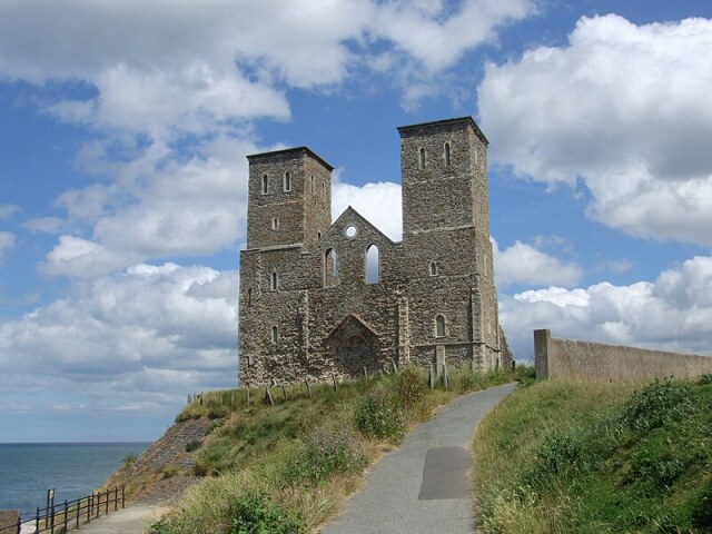 St Mary's Church, Reculver
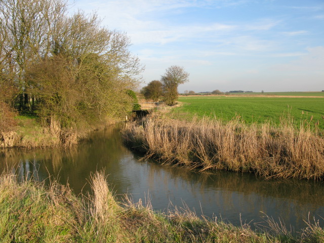 River Wantsum
Over the centuries, the sea ate away the cliffs and began to destroy the village. In 1809, the vicar of Reculver persuaded the villagers to rebuild their church inland at Hillborough. Most of St Mary's was dismantled for its building materials.
The towers, known as the Sisters, were an established landmark and they were bought as a navigational aid by Trinity House, which established shore defences to protect them. Today they perch only a few precarious feet away from the edge of the cliff.
The walk goes through the ruins and along the Northern Sea Wall. Ahead are Minnis Bay and the resort of Birchington-on-Sea. To the right is the drained and dyked Wantsum Channel. Now largely rich arable land, the reclaimed marshes were used in the Middle Ages for grazing sheep, and several banked 'drove roads' cross the low ground.
The slow moving River Wantsum is channelled beside the sea wall. At a lagoon bounded by a shingle bank, the walk turns inland and follows the now unfettered river. The reed lined banks and numerous channels provide nesting places for abundant birdlife, and you may see ringed plovers, sanderlings, short-eared owls, little terns and wheatears. The thistles attract goldfinches, and painted lady butterflies and cinnabar moths are both plentiful in summer.
As you turn away from the river, the ground rises slightly ahead of you. This is the old shoreline of the Isle of Thanet. The edge of the marsh is marked by a little bridge over the Wade Marsh stream. From here, a gently rising lane runs to the cluster of cottages that make up the hamlet of Potten Street. One of these cottages is Nine Nails, one of the many domestic buildings on the Isle of Thanet that is more than it seems at first glance. Curiously roofed, half in thatch, and half in tile, it has a 19th century brick facade masking a half timbered medieval house.
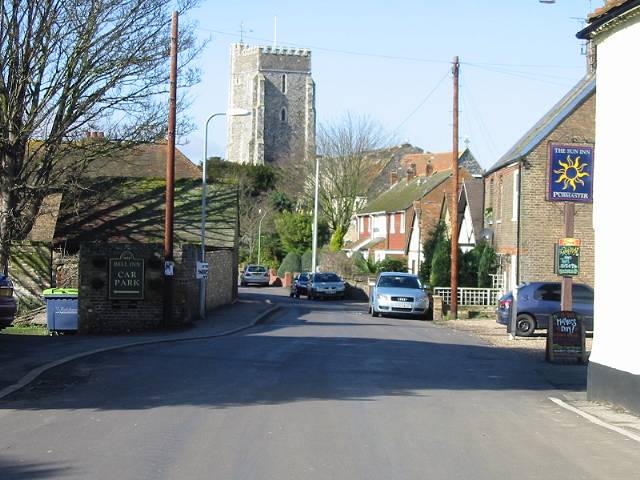 St Nicholas at Wade
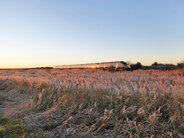 Javelin train crossing Wade Marsh
The view ahead is dominated by the 14th century tower of St Nicholas Church, which rises above the quiet and fascinating village of St Nicholas at Wade. The village is reached by a bridge across the busy Thanet Way. Medieval houses jostle around the church; one of them opposite the church porch, retains an interesting Victorian window display of haberdashery items. A handsome Dutch gabled 17th century house on the corner of Shuart Lane has a replica further along the village street, just beyond the forge.
Sir Nicholas at Wade was a very prosperous place in the Middle Ages, when it was a centre of wool production. Its houses and the splendid proportions of its church bare ample witness to this.
You pass more old houses along Down Barton Road. Ahead, the restored and working Sarre Mill marks an important site of Saxon occupation. In the village of Sarre, graves have yielded an abundance of superb 6th to 8th century jewellery, testament to the wealth and importance of these powerful Kentish tribes. In Sarre there is also Sarre Windmill, now disused, but still worth a look.
A bridlepath leads you on to the tranquil Chislet Marshes. Here, butterflies and wildflowers abound. At Belle Isle, you turn on to Snake Drove, whose name derives from its serpentine course across the marsh. Just before you cross the Whitfield Sewer, you pass the site of an old saltworks, a valuable holding in medieval times.
Snake Drove reaches what was mainland England and turns along a lane leading to the hamlet of Grays where, nearby, is the site of the redundant Chislet Windmill. This smock mill remains unrestored and stands still besides its lovely mill house, which was built in 1727. From here, the Saxon Shore Way long distance footpath leads you across the flat fields to the coast back in Reculver.
Acknowledgment: Text derived from the Out and Out Series; Discovering the Countryside on Foot. Pictures courtesy of Wikipedia.


