East Ilsley and the Ridgeway Path
Discover the fascinating history of a downland village
Google Maps Open Source Maps| Statistics and Files | ||
|---|---|---|
| Start: East Ilsley | Distance: 3.2 miles (5.1 km) | Climbing: 57 metres |
| Grid Ref: SU 49292 81173 | Time: 2 hours | Rating: Easy |
| GPX Route File | Google Earth File | About East Ilsley |
| Statistics | |
|---|---|
| Start: East Ilsley | Distance: 3.2 miles (5.1 km) |
| Climbing: 57 metres | Grid Ref: SU 49292 81173 |
| Time: 2 hours | Rating: Easy |
| GPX Route File | Google Earth File |
Ordnance Survey Explorer Map (1:25,000)
The Walk:
The ancient village of East Ilsley is a pleasant base from which to explore the Berkshire Downs and the Ridgeway. Exhilarating views of the surrounding countryside are in easy reach, and the bracing air quickly blows away the cobwebs.
Some believe that the hill south of East Ilsley was the site of the Battle of Ashdown in 871 AD, where the invading Danes were defeated by King Aethelred and his brother, who later became King Alfred. The Saxons called the area 'Hildes-Laeg' or 'battlefield', and it is from this name that Ilsley is derived.
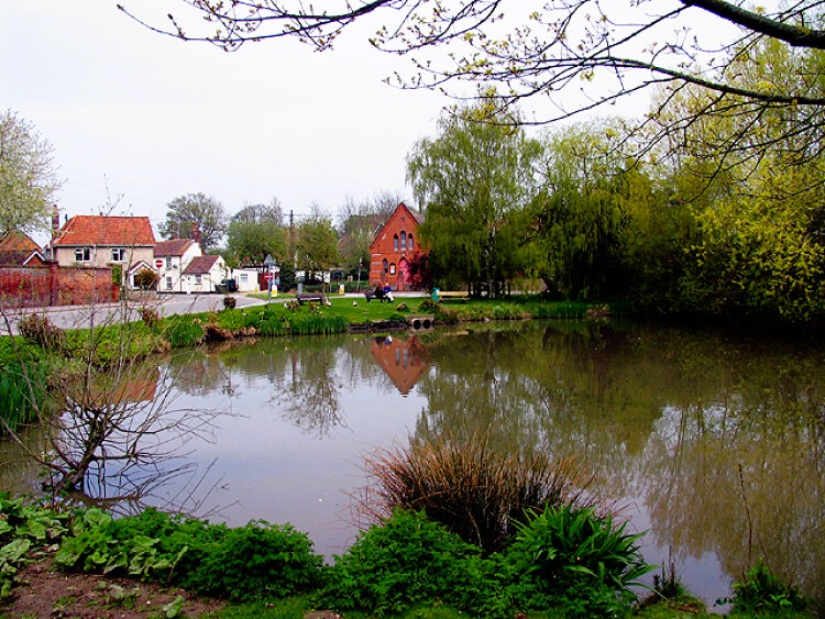 The village pond in East Ilsley
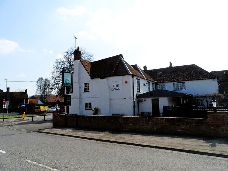 The Swan Inn, East Ilsley
In the 14th century, the manor here passed to the Duchy of Lancaster and the family of Henry IV. Major sheep fairs were held regularly in the town, and at least ten inns catered for the influx of people on market days. One of these is the Swan Inn, where the walk starts. The present building dates from the 17th century and was used to quarter some of Charles I's army when he dined at near Compton.
In the 18th century, East Ilsley became famous for its thoroughbreds, and the celebrated Eclipse was stabled nearby. Racehorses are still trained here to this day - the route passes by Summerdown Stables, then runs alongside a gallop to the top of the downs.
The route meets the Ridgeway, which lays claim to the title of the oldest road in Britain. The high dry chalk ridge that runs from the Chilterns across the downland of Berkshire and Wiltshire, formed a natural trackway for early settlers, and must have been used as a route to and from historic centres such as Stonehenge and Avebury.
The Ridgeway was also a trade route. Flint axes and arrowheads were brought along it in the Stone Age, and gold ornaments and copper and bronze tools in the Bronze Age. Many Iron Age hill forts were built along its length.
The Romans, however, do not appear to have made much use of the route, and the Ridgeway declined into obscurity. Farms and villages sprang up in the valleys below the scarp slope. The roads that grew up to connect them took over from the Ridgeway, which was higher and less convenient. In the Middle Ages, it was used by drovers to avoid turnpike tolls. This was one of the reasons that East Ilsley developed as a sheep market today. The oldest road has been revived as a walker's path.
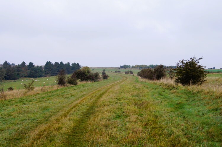 Compton Downs on the Ridgeway
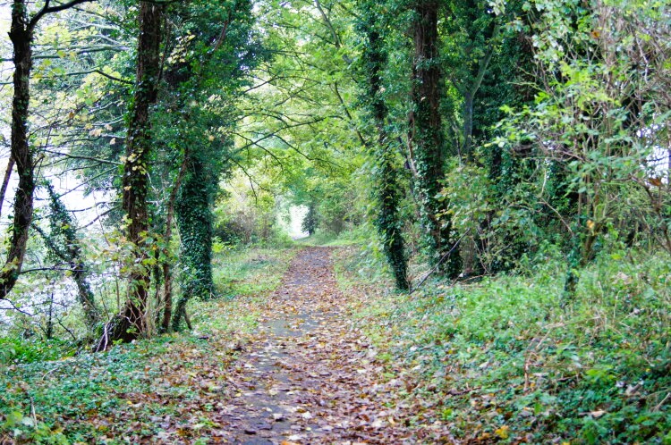 The path from Dennisford Road to East Ilsley
The route follows the Ridgeway from which there are wonderful views of the downs to the north, and of the ancient tumuli that dot the hilltops. The cooling towers of Didcot Power Station are a landmark visible for many miles around.
The hedgerows are a delight in summer, with many species of chalk loving plants in colourful flower. Look for harebells and knapweed, toadflaxs and meliot, betony and red bartsia, meadow cranesbill and chicory, restharrow and wild mignonette. Chalkhill Blue and Meadow Brown butterflies may be spotted and the song of Skylarks is a continuous accompaniment to the walk. During the winter months, flocks of black and white lapwings can be seen flying overhead.
Back in East Ilsley, the Church of St Mary is worth a visit. The first church on this ancient site was probably built in the early 11th century. It is mentioned in the Domesday Book. In 1199, King John gave the church to the Knights Hospitallers, and in about 1240 it was much enlarged, and additions and alterations have been made down the centuries. The oldest remaining part is the south arcade - the interior walls incline outwards an indication of their great age. The heads of a monk and nun at each end of the chancel were carved in the 15th century.
On your way back to the Swan Inn, you pass Pen Meadow, the site of the famous East Ilsley Sheep Fairs, which at one time was second in importance only to Smithfield in London. They were held fortnightly from April to October. The last fair was held in 1934, but the local residents still hold an annual country fair on the same site, creating a link with the past of this pretty village.
Acknowledgment: Text derived from the Out and Out Series; Discovering the Countryside on Foot. Pictures courtesy of Wikipedia.


