Woodchurch and the Weald Woodlands
From a hilltop windmill to a Roman road in a Wealden woodland
Google Maps Open Source Maps| Statistics and Files | ||
|---|---|---|
| Start: Woodchurch | Distance: 5.3 miles (9.5 km) | Climbing: 65 metres |
| Grid Ref: TQ 94269 34765 | Time: 2-3 hours | Rating: Easy |
| GPX Route File | Google Earth File | About Woodchurch |
| Statistics | |
|---|---|
| Start: Woodchurch | Distance: 5.3 miles (9.5 km) |
| Climbing: 65 metres | Grid Ref: TQ 94269 34765 |
| Time: 2-3 hours | Rating: Easy |
| GPX Route File | Google Earth File |
Ordnance Survey Explorer Map (1:25,000)
The Walk: Woodchurch is on a little knowl that overlooked the sea inlet to Tenterden before the draining of the marshes. A great white windmill sits on the hilltop, and below it is the 13th century church built to replace the wooden Domesday church that gave the village its name. The surrounding area is a densely wooded remnant of the old Wealden forest; the sticky clay that nurtured the oaks is still evident on the footpaths after rain.
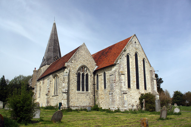 Woodchurch Church
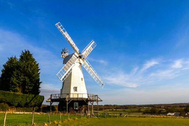 Woodchurch Windmill
Close to the start of the walk is the stone All Saints Church, topped with a shingled broach spire. Two sundials can be found on the south wall. The 3rd oldest commemorative brass in Kent, dated 1333, lies near the pulpit.
From the church, you climb away from the village to a 19th century smock mill which dominates the countryside. Long disused, Woodchurch Windmill has been restored in recent years by a local society and is sometimes open to the public at weekends.
From the windmill the walk leads through farmland into the dense woods between Woodchurch and Shadoxhurst. Strips of conifers and mixed woodland mingle with more mature broadleaved woods.
The track through Kingsland's Wood to Courthope Wood is about 15 yards across, with double banks and ditches on each side. This may have been built as a link road, joining a Roman road that ran eastwards about one mile north of here with the Roman port of Warehorn to the south. Warehorn was on the coast before the draining of Romney Marsh in the Middle Ages. The Weald was once notorious for being impossible to cross in winter because of the mud. The present state of the Roman road gives a good impression of what Wealden travel was like in days gone by.
Place names in the woods give further indications that the track is probably Roman. 'Street' is an Anglo-Saxon word for a paved road, paving being a Roman feature. Streetend Wood lies where the banks and ditches finish, and dates from at least AD 993. Stone Wood also suggests paving stones, while Post Wood may refer to a Roman milestone. The woods are certainly ancient, no ploughs have ever torn upon the banks. In spring, anemones, primroses, bluebells and wood sorrel are found here. All of them point us to an old undisturbed woodland.
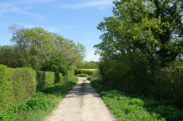 Country lane near Kingsland's Wood
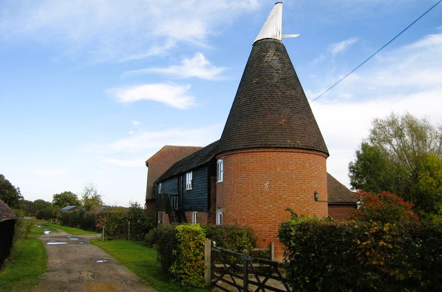 Oast House at Coldblow
Out of the woods, the route follows a green lane bounded by ancient hedgerows of oak, hazel, hawthorne and maple. Coralroot, a local speciality, grows freely on the banks. Ponds and ditches for draining the heavy clay are everywhere, and eels live in many of the ponds. Also, out in the open, you pass the small hamlet of Coldblow which features an attractive Oast House.
You pass through another wood, Cole Wood, before returning to Woodchurch. The old village is strung out around a 10 acre kite shaped green that lies in the angle where two roads meet. Some of this has been built on. White weather-boarded cottages of the 18th and 19th centuries, set behind broadgrassy verges, look over the cricket square. The walls of a wooden building near the square are made of the rounded outsides of trees that were removed in the sawmill before the tree was sawn into planks. You may have noticed a similar building at Cold Blow Farm at the end of the green lane.
The grey, oak timber frame and ochre plaster of the 15th century Henden Place are reminiscent of the grander medieval timber building traditions of the Weald. This is found just a short step from the church and the beginning of the walk.
Acknowledgment: Text derived from the Out and Out Series; Discovering the Countryside on Foot. Pictures courtesy of Wikipedia.


