Stockbridge, Danebury Hill, Fullerton, Leckford and Test Way
Walking to a revealing hill fort and alongside a famous trout stream
Google Maps Open Source Maps| Statistics and Files | ||
|---|---|---|
| Start: Stockbridge | Distance: 11.8 miles (19.0 km) | Climbing: 172 metres |
| Grid Ref: SU 35923 35057 | Time: 4-6 hours | Rating: Moderate |
| GPX Route File | Google Earth File | About Stockbridge |
| Statistics | |
|---|---|
| Start: Stockbridge | Distance: 11.8 miles (19.0 km) |
| Climbing: 172 metres | Grid Ref: SU 35923 35057 |
| Time: 4-6 hours | Rating: Moderate |
| GPX Route File | Google Earth File |
Ordnance Survey Explorer Map (1:25,000)
The Walk:
There has been a bridge across the River Test at the west end of Stockbridge since the 15th century. The town's broad main street, built in 1200 on a chalk causeway across the valley, was wide enough to accommodate the 'stock' of the town's name - sheep and cattle driven down each year from the Welsh hills to the markets and fairs of south-eastern England.
Stockbridge is best known today for trout fishing, although the rights are owned by syndicates, and are not open to the public. The famous Houghton Fishing Club, founded in 1822, meets in the Grosvenor Hotel, whose porch extends into the street.
This building had another function in the 19th century: when the Stockbridge Races were held on land between Danebury Hill and the river, the hotel belonged to Tom Cannon, who trained and raced his own horses, and it was here that the jockeys used to meet.
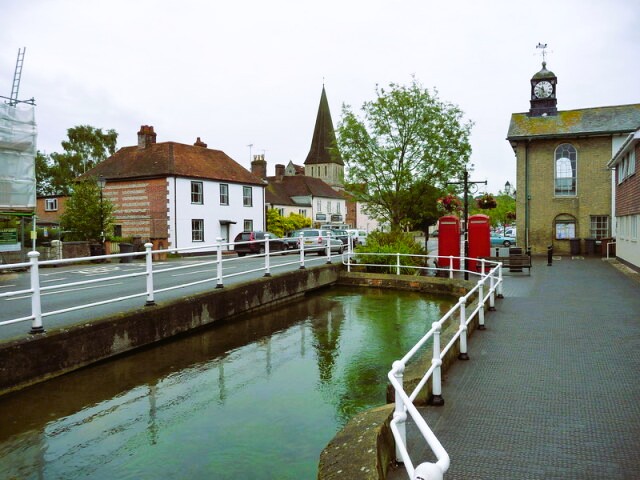 Stockbridge High Street
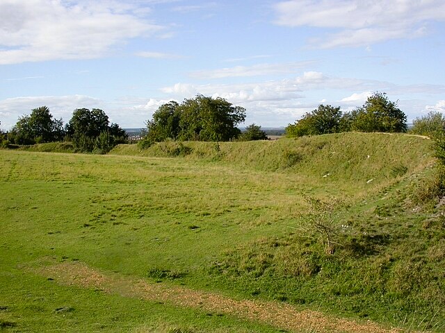 Danebury Hill Fort
The route follows the main road west through the town. On the wall of the former inn called the Drover's House, is a charming reminder of the drove trade. An inscription in Welsh advertises seasoned hay, tasty pastures, good beer and comfortable beds.
You climb Meon Hill along an enclosed track and cross Houghton Down. In the early 19th century there was a racecourse here. A mile to the west are Chathis Hill Stables, a former racing establishment now used by a riding school.
From the track below Blackstake Hill, there is a fine view of Danebury Hill, which you approach via a road. The hill fort crowning the summit was systematically excavated over a period of 20 years by a team of archaeologists, and gives one of the clearest pictures yet of life on an Iron Age settlement.
Danebury was built in around 550 BC and housed several hundred people. Over the centuries the outer walls were made more complex, until huge twisting ramparts round the main gate made hostile entry a dangerous enterprise. The principal weapons used by the defenders were slingshots. Huge ammunition piles of small round stones were discovered near the entrance.
Circular wooden huts were grouped behind the ramparts and in the centre were several religious buildings. The rest of the site was used to store grain, either in pits cut into the chalk, or in raised granaries.
In 100 BC, the fort was abandoned. The main east gate was burnt at this time, which suggests that it succumbed to an attack. The site remained deserted until the Middle Ages, when it became the venue for an annual fair.
Later it was used as a rabbit warren. The remains of trenches and the warrener's hut were discovered by the archaeologists. At the turn of the 20th century, it was a useful place from which to watch the races. Although the racecourses have gone now, the view of Hampshire from the summit are still magnificent.
There are relics of an earlier community along the next stretch, which follows a broad track through the undulating downland scenery. At several places along the path are ancient barrows and burial mounds, dating from the Neolithic to the Bronze Age, 4000 BC to 700 BC. They are often covered in trees or bushes. Farmers generally find it easier to plough around them.
The broad ridges on the side of Hazel Down are known as lynchets and date from the Middle Ages. They were formed when slopes were ploughed. The loose soil slid downhill to make a bank. Sometimes these terraces were large enough to support woodland.
Many plant species grow on the chalk downland, including bastard toad flax, horseshoe vetch and the attractive bee orchid. These in turn are a breeding ground for a multitude of butterflies. On a fine day in summer, the air is full of chalkhill blues and meadow browns.
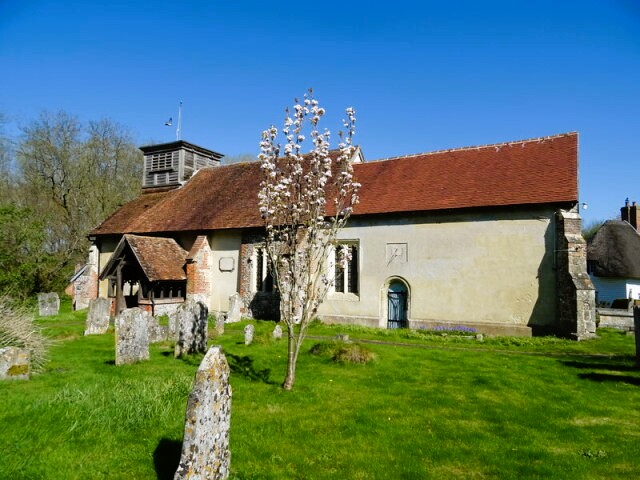 Leckford Church
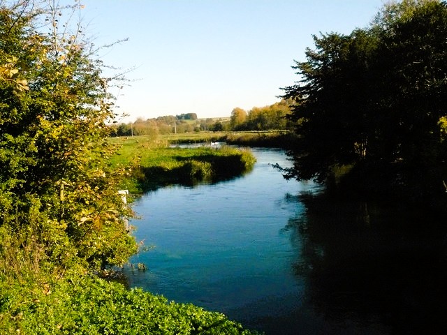 River Test near Stockbridge
The route continues gently down to the flat meadowland by the River Test. Here the scenery is very different from the open chalk hills. There are trees and woods, rich grass and a greenness not found on the higher ground.
You pass several picturesque cottages, including an old mill where a bridge crosses the River Anton, a tributary of the Test. You follow the main road in the vicinity of Fullerton for a short distance, passing the Mayfly pub, a welcome stopping place on a hot day.
Just below Testcombe Bridge, the route joins the Test Way, a long distance path that runs the 50 miles from Totton in Southampton to Inkpen Beacon. In 1794, a canal was opened beside the river here, joining Andover with Southampton, but was not a success and was soon abandoned. A railway was begun in 1857, and a junction at Fullerton was opened in 1885.
Part of the route, which was known as the Sprat and Winkle Line, ran along filled in sections of the canal. The line had a brief rise to fame when, in 1927, it featured in a film of the play 'The Ghost Train'. It closed in the early 1960s and the Test Way now follows its course from Fullerton to Stockbridge.
You continue towards Leckford, a village owned entirely by the John Lewis Partnership. Here there are pheasant rearing pens and fish nurseries which help restock the river. In the 13th century church are the remains of a cloister, reputably part of a hospital owned by a nunnery that existed in the area.
On the west side of the Test, and well worth a visit, is Longstock, an attractive village of thatched cottages. The Longstock Park Water Garden is open to the public throughout spring to autumn and at selected times in the winter.
Behind Charity Farm, on private land, archaeologists have revealed a very interesting chapter in the history of the Test. A channel 300 feet long has been excavated alongside the river. It is thought to be a dock used by invading Danish longships as they made their way upstream from Southampton.
As the walk continues along the old railway line, the river is elusive. It glides from one side of the valley to the other and is obscured by trees and tall reeds in summer. On the wetlands, meadowsweet, dropwart and marsh helleborine grow, and herons compete with the anglers for fish. The odd thatched fisherman's cottage can be seen through the trees, with a view of downland below.
Finally, the route joins the main road and continues along the grassy verge back to Stockbridge.
Acknowledgment: Text derived from the Out and Out Series; Discovering the Countryside on Foot. Pictures courtesy of Wikipedia.


