Mottistone, Longstone and High Downs Isle of Wight Walk
A walk through woods and downlands with views to the sea
Google Maps Open Source Maps| Statistics and Files | ||
|---|---|---|
| Start: Mottistone | Distance: 3.7 miles (5.9 km) | Climbing: 200 metres |
| Grid Ref: SZ 40500 83779 | Time: 2 hours | Rating: Moderate |
| GPX Route File | Google Earth File | About Mottistone |
| Statistics | |
|---|---|
| Start: Mottistone | Distance: 3.7 miles (5.9 km) |
| Climbing: 200 metres | Grid Ref: SZ 40500 83779 |
| Time: 2 hours | Rating: Moderate |
| GPX Route File | Google Earth File |
Ordnance Survey Explorer Map (1:25,000)
The Walk: The Isle of Wight is often described as England in miniature. This walk proves how true that is. You will find an old world manor house with beautiful gardens, oak woods carpeted with bluebells, high downland with magnificent sea views and green fertile valleys that have been farmed since Neolithic times. Traces of these early civilisations remain. Also featured are a Neolithic tomb and megaliths, barrow tomb's raised in the early Bronze Age and a wooded hill crowned with the earthwards of an Iron Age fort. The woods and downs in this beautiful and undisturbed corner of the island contain a rich variety of plant and bird life.
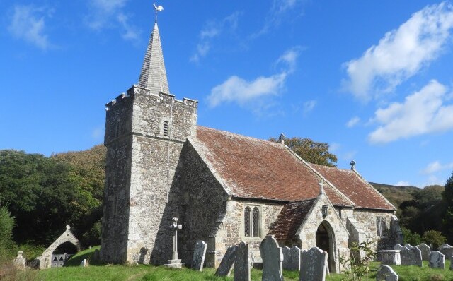 Mottistone Church
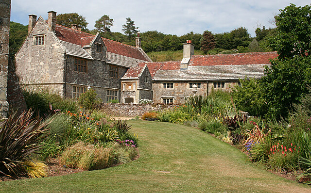 Mottistone Manor
The walk begins from the lovely village of Mottistone. The name 'Mottistone' is probably derived from the Saxon word for a meeting place, a moot, which would be held close to the easily recognised Longstone on the hillside above.
Mottistone Manor at the heart of the village is a lovely, mainly 16th century house, built of multicoloured island stone. It has a recorded history dating back to the Domesday Book of 1086. You have a splendid view of the house and gardens on the walk. Mottistone Gardens are managed by the National Trust and open to visitors.
After you ascend from the village, you reach the Mottistone Longstone. This huge pillar 13 feet high, was another stone beside it. Is the island's only megalith, dating from the New Stone Age, 3,500 to 2,500 BC. Beyond the stone you can trace the outline of a large Neolithic tomb.
Walking towards the down, you pass an area of reforestation. The Forestry Commission are felling a great many trees, mainly Corsican pine. These are being replaced with hardwoods, mainly beech and sycamore.
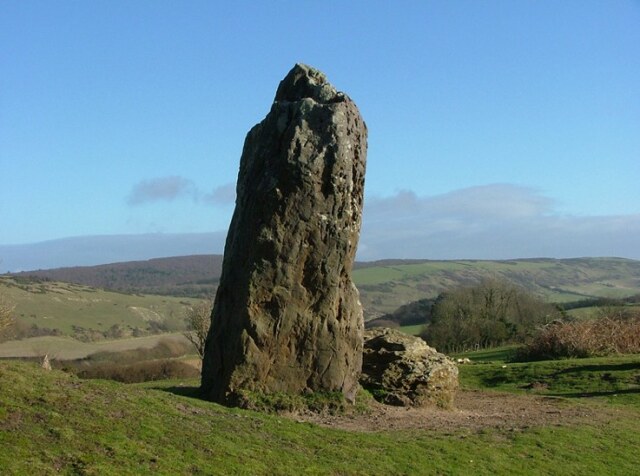 The ancient Mottistone Longstone
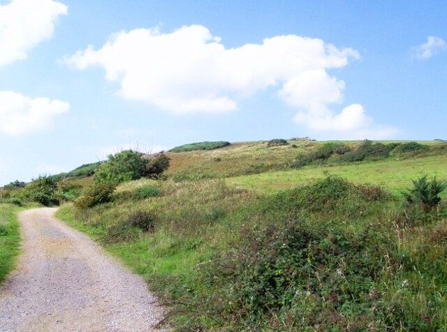 Castle Hill stands above Mottistone
The view from Mottistone Down over a lovely valley to the sea is breathtaking. To the west are the white cliffs of Compton Bay and the whole of the eastern cliffs as far as St Catherine's Point lie to the east. Many Bronze Age burial mounds follow the crest of the down.
The last stretch of the route passes Castle Hill. This hill is so called because Iron Age hill forts are often termed 'castles', though only the earth embankments remain.
This walk has a wide variety of habitats. The woods are full of birdsong; wrens, blackbirds, thrushes and woodpeckers are all likely to be seen. Primroses, bluebells and violets grow to form a glowing carpets of colour. The National Trust has allowing the down to return to its natural state with low growing flowers and shrubs. It is famous for its pipits, ring ousels and falcons. The sides of the lanes are pitted with fox and rabbit holes, and overhung with ladies smock and wild arum.
Acknowledgment: Text derived from the Out and Out Series; Discovering the Countryside on Foot. Pictures courtesy of Wikipedia.


