Lindfield, Paxhill Park and East Mascalls
Strolling through pleasant countryside around a pretty village
Google Maps Open Source Maps| Statistics and Files | ||
|---|---|---|
| Start: Lindfield | Distance: 5.0 miles (8.0 km) | Climbing: 107 metres |
| Grid Ref: TQ 34578 25177 | Time: 2-3 hours | Rating: Easy |
| GPX Route File | Google Earth File | About Lindfield |
| Statistics | |
|---|---|
| Start: Lindfield | Distance: 5.0 miles (8.0 km) |
| Climbing: 107 metres | Grid Ref: TQ 34578 25177 |
| Time: 2-3 hours | Rating: Easy |
| GPX Route File | Google Earth File |
Ordnance Survey Explorer Map (1:25,000)
The Walk:
Lindfield means 'open land with lime trees', and pollarded limes are still in evidence in the main street of this picturesque village, which also has a large common and pond, some fine buildings and a 14th century church.
The village, which is now essentially a thriving suburb of the town of Haywards Heath, existed in AD 477, when it was known to the Saxons as Lindefelde. It was a thriving place in the Middle Ages and was the site of many fairs and markets. The August Sheep Fair, with over 40,000 beast grazed in pens on the common, was the largest of its kind in the country.
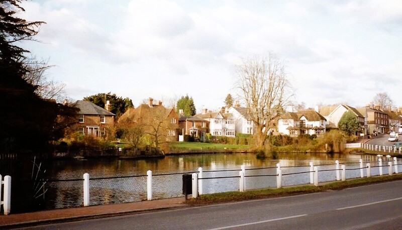 Lindfield Pond
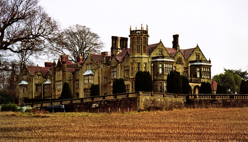 Paxhill Park
This works starts by the village pond and soon passes the Stand Up Inn. This was formerly the tap house for Durrant's Brewery. The brewery owner did not want his workers drinking when they should be working, so he provided no seats, hence the name of Stand Up Inn. Durrant's closed down in 19O6, and the pub was later refurbished.
Other pubs in Lindfield include the Bent Arms, used by Edward VII when he visited the village, and the Red Lion, a rest stop for coaches on the London to Brighton run.
On the edge of the village are The Thatched Cottage and Old Place. In Tudor times these buildings were home to the leading local family, the Chaloners. As the family went into decline, so did the houses. The line died out in the 17th century, but the buildings remained, albeit in a poor state of disrepair. They were used as poor houses in the 19th century, but it was only when a local man, Charles Eamer Kempe, bought Old Place in 1875, that restoration work began.
Not far away, on Spring Lane, is an old spring. This was in use for at least 200 years, until the 1930's, then lost. It was rediscovered only in 1989. Visitors were then welcome to go down the steps to recover to the culvert.
On the road out of town, you cross the River Ouse. Seeing it now, it is hard to believe that it was once a major trade route. A series of locks and weirs were built between 1796 and 1811, making the river navigable for much of its course.
The route takes to the fields and passes Paxhill Park, a fine house built in 1595 by Nivian Board, whose initials are over the main entrance. In World War Two, it was taken over by the army. In 1944, Montgomery stayed there in the run up to D-Day and addressed thousands of Canadian troops on Lindfield Common. King George V visited the house that same year.
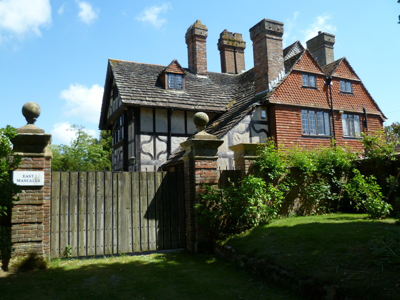 East Mascalls
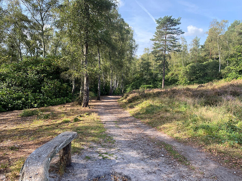 Sussex Diamond Way
Further along on the walk is another well restored house, East Mascalls, named after the family who lived there in the 16th century. In ruins for many years, it was restored in 19O2.
The walk back to Linfield briefly follows the River Ouse by using the Sussex Diamond Way footpath, then heads across fields to re-enter the village by the Church of All Saints, whose broach spire is visible for miles around.
Until 1845, the Church of All Saints belonged to the Archbishop of Canterbury. But in that year it passed to the See of Chichester. Before a parish priest was installed, a monk visited from Lewes to conduct the services. The room where he lodged is above the porch.
Nearby is Church House. This was once the Tiger Inn, which served as the hostelry for the church. In the days when people travelled many miles from outlying villages for services, it provided welcome refreshment for members of the congregation and for their horses.
Acknowledgment: Text derived from the Out and Out Series; Discovering the Countryside on Foot. Pictures courtesy of Wikipedia.


