Broad Chalke, Fovant Down, Chiselbury Hill Fort and Compton Down
From the Ebble valley to unique chalk carvings and an iron age hillfort on Fovant Down
Google Maps Open Source Maps| Statistics and Files | ||
|---|---|---|
| Start: Broad Chalke | Distance: 5.8 miles (9.3 km) | Climbing: 220 metres |
| Grid Ref: SU 03845 25696 | Time: 3 hours | Rating: Moderate |
| GPX Route File | Google Earth File | About Broad Chalke |
| Statistics | |
|---|---|
| Start: Broad Chalke | Distance: 5.8 miles (9.3 km) |
| Climbing: 220 metres | Grid Ref: SU 03845 25696 |
| 3 hours | Rating: Moderate |
| GPX Route File | Google Earth File |
Ordnance Survey Explorer Map (1:25,000)
The Walk: This is a delightfully peaceful country walk in the valley of the River Ebble, a little river threading through the chalk downs, giving magnificent views of another valley, the Nadder, surrounded by curving hillsides and woodlands. Just below the crest of the down are the Fovant Badges, carved by troops stationed here during the First World War. The route follows an ancient path to Chiselbury Iron Age hill fort.
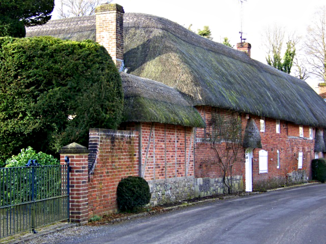 Cottages in Broad Chalke
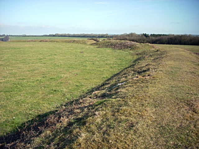 Chiselbury Hill Fort
Broad Chalke is a charming village with thatched stone-built houses and gardens, criss-crossed by the Ebble stream. The mainly 13th century Church of All Saints has a fine 15th century entrance arch and inside there is part of a 9th century Saxon preaching cross. The grave of famous designer, Cecil Beaton, is in the churchyard. Close by is the King's Old Rectory, which was once the home of John Aubrey, author of Brief Lives.
The walk takes you out of the village, along a green track for two miles before reaching Fovant Down. Here you will come across the unique sight of the Fovant Badges. During the First World War, men of several regiments were stationed in this area and they carved their regiment badges in the chalk hillside. These include the Royal Wiltshire Yeomanry, the Wiltshire Regiment and the Australian Imperial Force. The Australian troops also carved an outline map of their homeland. A wonderful view of all the badges can be had from a viewing platform in Fovant village.
A short way away is the Chiselbury Hill Fort. This is a very well preserved, early Iron Age fort with a single ring of embankments enclosing a large central area, capable of housing a whole village and its livestock. The track leading past it along the ridge is much earlier in origin, possibly used by traders in the Bronze Age. These chalk downs are ungrazed and therefore, rick in flowers, including several varieties of orchids and wild clematis. Many species of bird share the habitat, including Herons which can be seen fishing in the clear chalk streams.
Acknowledgment: Text derived from the Out and Out Series; Discovering the Countryside on Foot. Pictures courtesy of Wikipedia.


