Cheddar Gorge
From Cheddar, along the heights above the gorge to the fringe of the Mendip hills
Google Maps Open Source Maps| Statistics and Files | ||
|---|---|---|
| Start: Cheddar | Distance: 5.0 miles (8.0 km) | Climbing: 395 metres |
| Grid Ref: ST 46183 53672 | Time: 3 hours | Rating: Moderate |
| GPX Route File | Google Earth File | About Cheddar Gorge |
| Statistics | |
|---|---|
| Start: Cheddar | Distance: 5.0 miles (8.0 km) |
| Climbing: 395 metres | Grid Ref: ST 46183 53672 |
| Time: 3 hours | Rating: Moderate |
| GPX Route File | Google Earth File |
Ordnance Survey Explorer Map (1:25,000)
The Walk: The walk begins in the popular tourist resort of Cheddar, well known for its cheeses, caves and the gorge. The start of the walk leads up to the top of the gorge by Jacob's Tower, built in 1908 so that visitors who climbed Jacob's Ladder could have a good view from the top. It still provides an excellent panorama of the gorge, Cheddar Reservoir, the Mendip Hills and the Somerset Levels.
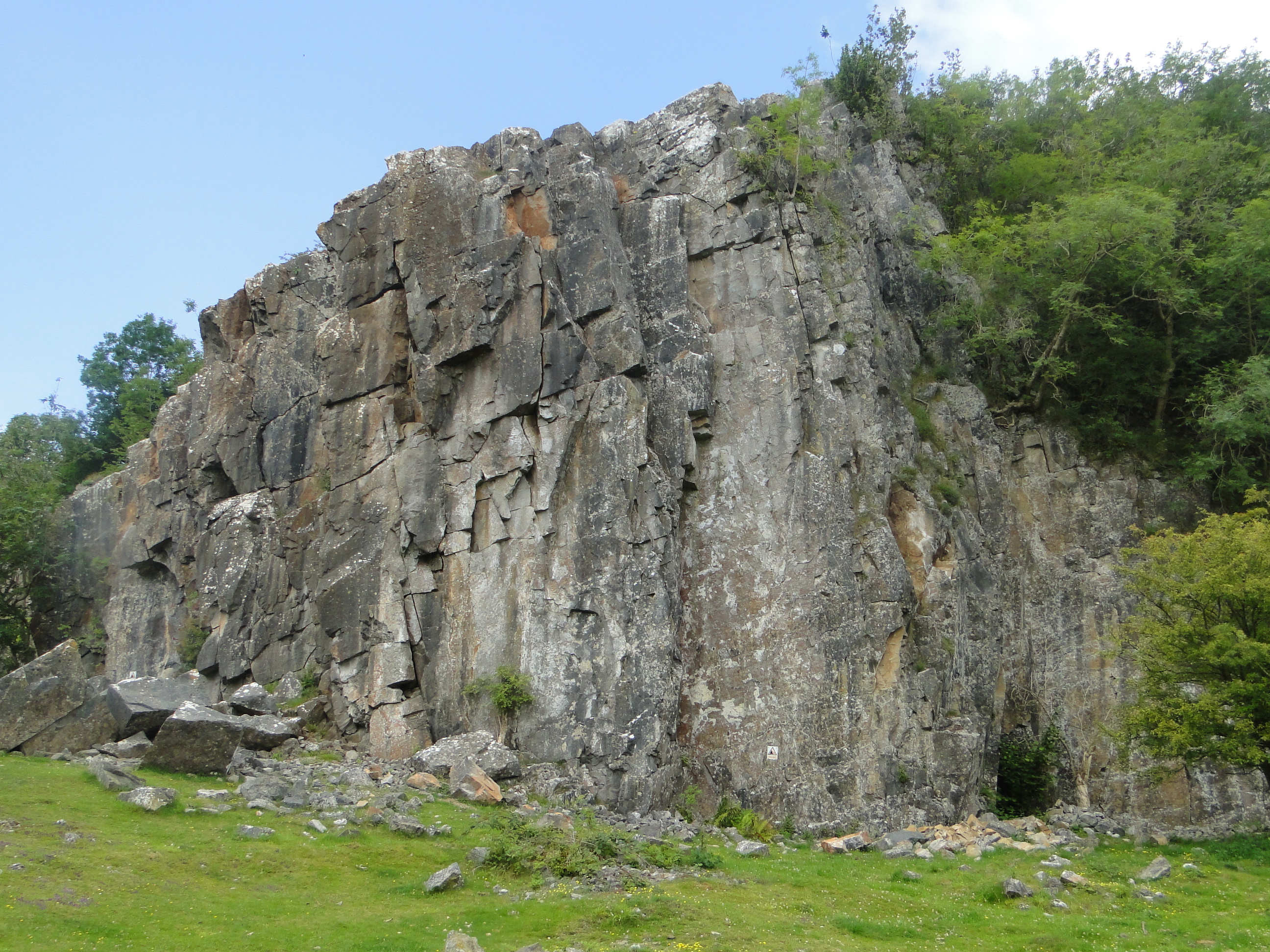 Black Rock
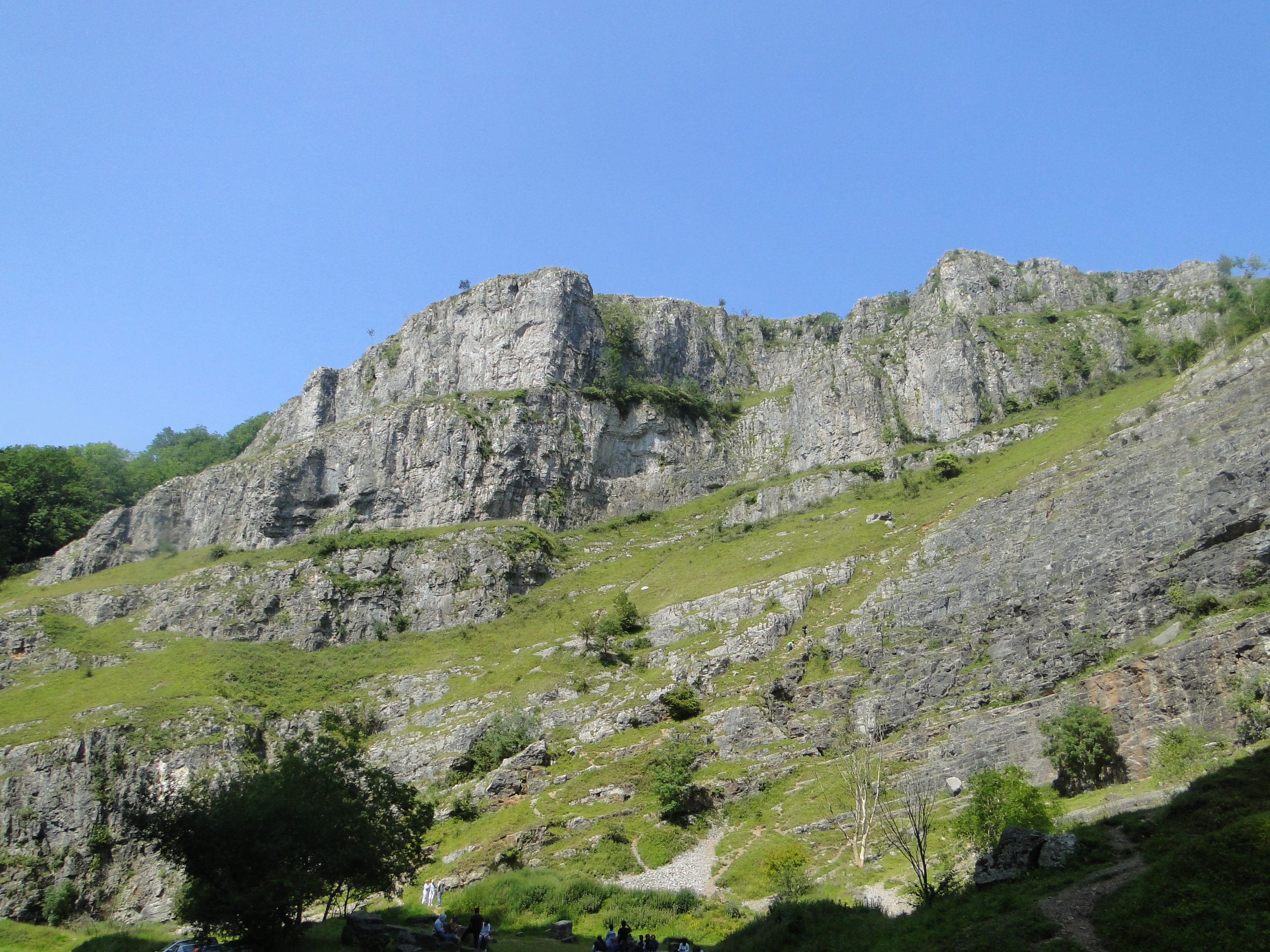 Cheddar Gorge
Cheddar Gorge is a great cleft in the rocks rising to almost 1,000 feet above the road running through the center of the gorge. It was cut by a river thousands of years ago, which then found an easier route underground. Today the river emerges only at the downstream end of the gorge. The river also carved out the magnificent cave system of 400 caverns for which Cheddar is famous. Walkers should however note that the gorge is precipitous and they should be very careful when near the rim. From the highest point of the gorge, the walk continues as a well defined track through the bracken and shrubs, then joins the West Mendip Way just before going steeply downhill through woodland. After crossing the main road, the path enters the Somerset Trust for Nature Conservation Reserve. There are a number of waymarked trails in the area.
The walk continues on by following the former quarry track with a 250 year old drystone wall alongside. It reaches the disused Black Rock Quarry at the foot of which is an old limekiln. In its working days, this was loaded with alternate layers of fuel and stone through the round hole at the top and then allowed to burn for several days. The lime for building and agriculture was taken out through the arched opening at the bottom. After the quarry, the path becomes a broad grassy track, winding down a lovely rocky valley before disappearing briefly into an old coppiced woodland.
Beyond the edge of the woodland, the nature of the walk changes to wide, grassy fields bordered by limestone walls. This pleasant gentle walk through farmland lasts until the path begins to turn downhill again back to Cheddar, with fine views across the circular reservoir. There are also glimpses of the promontories and cliffs of the gorge to enjoy here. The final part of the walk is down a narrow, stony path that plunges through dense woodland. It is well defined, but could become slippery in wet weather. The path leads down to the edge of the town.
Acknowledgment: Text derived from the Out and Out Series; Discovering the Countryside on Foot. Pictures courtesy of Wikipedia.


