Holford, The Great Road, Beacon Hill and Smith's Combe
A walk on open moors with broad vistas in the Quantock Hills
Google Maps Open Source Maps| Statistics and Files | ||
|---|---|---|
| Start: Holford | Distance: 5.4 miles (8.7 km) | Climbing: 385 metres |
| Grid Ref: ST 15459 41047 | Time: 3 hours | Rating: Moderate |
| GPX Route File | Google Earth File | About the Quantock Hills |
| Statistics | |
|---|---|
| Start: Holford | Distance: 5.4 miles (8.7 km) |
| Climbing: 385 metres | Grid Ref: ST 15459 41047 |
| Time: 3 hours | Rating: Moderate |
| GPX Route File | Google Earth File |
Ordnance Survey Explorer Map (1:25,000)
The Walk: A contrasting landscape of open heathland and wooded valleys characterise this walk. It leads from the deep cleft of Hodder's Combe to the moorland of Beacon Hill, with its panoramic views, back down to the narrow valley of Smith's Combe and on through fields. The village of Holford at the start is soon left behind, and the path crosses the footbridge at Hodder's Combe, where a stream rushes and tumbles over a small waterfall.
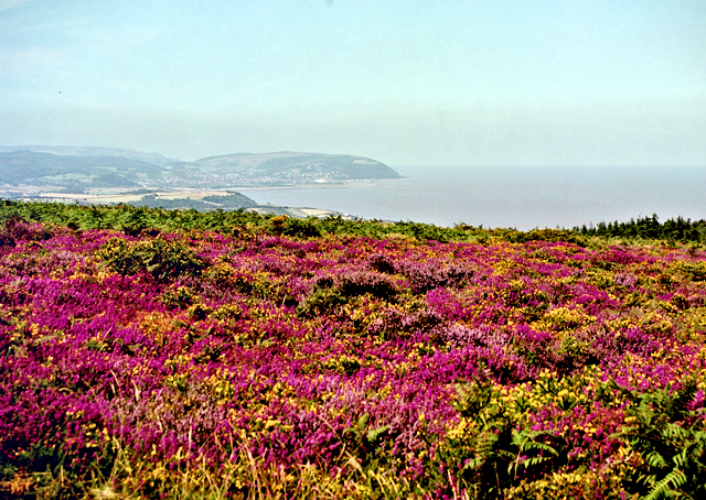 View from Beacon Hill to the coast
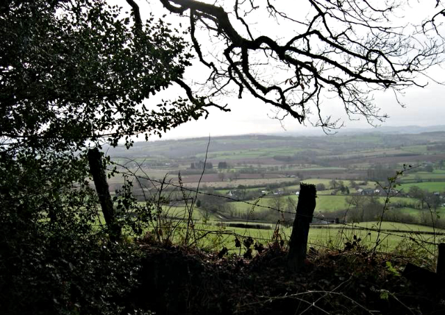 Quantock's view from near Smith's Combe
From Hodder's Combe the walk follows a rough, tree lined track leading to the summit of Longstone Hill. Clearly marked by banks on either side, at times reinforced by dry stone walls in the typical herring bone pattern of the region. What at first thought is a drove road was in fact the Great Road, from Holford to West Quantoxhead, a route the mail coaches took. Extra horses were laid on for the steep climb and then detached at the top of the hill and led back down again. As the pathway runs clear of the trees, it reaches open moorland of gorse, heather and bracken, with superb views over the Bristol Channel on a clear day.
The open moor is criss crossed with paths and bridleways and is a popular horse riding area. At the brow of the hill, the view opens out to the west across the wide expanses of Exmoor. The climb culminates at Beacon Hill, at 1,017 feet (310 metres), the highest point in the Quantocks. The next section of the walk, down Smith's Combe, offers a complete contrast. The way downhill begins as a broad, grassy track and leads into a narrow valley of broad leaved trees with a little stream.
At the end of Smith's Combe the path returns to agricultural land as it opens out to give a marvellous view down to the sea, which is just a mile away. Having come down to sea level, there is a short but sharp climb round the shoulder of a hill. The path then runs on a dividing line between farmland and moorland. The final section leads through fields where, in late summer, it is not unusual to see deer grazing on the remains of harvested cornfields. Finally the walk returns into Holford.
Acknowledgment: Text derived from the Out and Out Series; Discovering the Countryside on Foot. Pictures courtesy of Wikipedia.


