Malmsmead, Badgworthy Water, Southern Wood and Lorna Doone Farm
To the ruggedness of Exmoor, following in the footsteps of the lawless Doone family
Google Maps Open Source Maps| Statistics and Files | ||
|---|---|---|
| Start: Malmsmead | Distance: 6.5 miles (10.4 km) | Climbing: 302 metres |
| Grid Ref: SS 79143 47778 | Time: 3 hours | Rating: Moderate |
| GPX Route File | Google Earth File | About Exmoor |
| Statistics | |
|---|---|
| Start: Malmsmead | Distance: 6.5 miles (10.4 km) |
| Climbing: 302 metres | Grid Ref: SS 79143 47778 |
| Time: 3 hours | Rating: Moderate |
| GPX Route File | Google Earth File |
Ordnance Survey Explorer Map (1:25,000)
The Walk: This walk will appeal to all those who want to hunt out the secret valley where the villainous Doone family of Richard Doddridge Blackmores celebrated novel, Lorna Doone lived. It is, however, an enjoyable walk in its own right, starting in a gentle river valley, then climbing up to the open expanses of Exmoor, with wide vistas across the bare landscape and over to the rugged Devon coast.
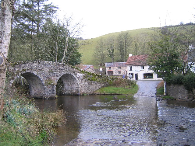 Malmsmead Bridge and the old ford
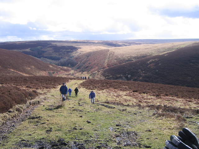 Scenery on Exmoor near Malmsmead Hill
The walk begins in the village of Malmsmead. Here, beside the ford, is Lorna Doone Farm, which could have served as a model, not for the Doone's, but for the book's Ridd's family farm. The first section of walking is on a quiet country road which soon gives way to a rough bridleway. At first the route takes you along the flank of the valley with high banks on either side. Where gaps appear there are views down to the busy stream of Badgworthy Water, with woodland on the opposite bank. This is a holloway, an old sunken lane. The path makes its way down to the river by the footbridge to Cloud Farm, a Natural History centre. The path past the farm leads to Oare, where RD Blackmore's grandfather was parson. This route, however, continues to follow the increasingly remote river valley and past the memorial stone to RD Blackmore, which was erected in 1969.
The walk now threads its way alongside the busy river through woodland. The river flows in a series of small waterfalls through the darkest part of the woodland. Valleys such as this are typical of the region. The underlying rock of Exmoor is ancient, formed out of mud and sand of the seabed when the whole area was covered by ocean some 350 million years ago. Over the ages the rivers have bitten even deeper into the land, so that even a modest stream like Badgworthy Water has cut a great cleft. The loamy, well drained soil allows plants to flourish. The result is a typical deep sided and wooded combe.
Beyond the combe of Badgworthy Water the land becomes rougher and the views open out to the seemingly featureless wastes of the Exmoor uplands. Soon you reach Hoccombe Combe, today a few humps and scattered stones but once the site of a medieval village. Now the character of the route changes, leaving the shelter of valleys to climb up to tussocky grass and heather of Exmoor upland country. It is a landscape in which hills have been worn into smooth gentle curves by the actions of wind and rain; an undulating featureless landscape of grassland and heather. Beautiful in good weather, bleak and foreboding in bad weather. If visibility is good though, the views from the high moor are magnificent, spreading over the landscape and all the way down to the rugged coast. Eventually this awesome moor is left behind with a descent back down to Lorna doone Farm ands Malmsmead.
Acknowledgment: Text derived from the Out and Out Series; Discovering the Countryside on Foot. Pictures courtesy of Wikipedia.


