Burrington Combe, Rock of Ages and Dolebury Warren
Over Dolebury Hill to an Iron Age hillfort
Google Maps Open Source Maps| Statistics and Files | ||
|---|---|---|
| Start: Burrington Combe | Distance: 5.2 miles (8.3 km) | Climbing: 298 metres |
| Grid Ref: ST 47643 58785 | Time: 2-3 hours | Rating: Moderate |
| GPX Route File | Google Earth File | Dolebury Warren |
| Statistics | |
|---|---|
| Start: Burrington Combe | Distance: 5.2 miles (8.3 km) |
| Climbing: 298 metres | Grid Ref: ST 47643 58785 |
| Time: 2-3 hours | Rating: Moderate |
| GPX Route File | Google Earth File |
Ordnance Survey Explorer Map (1:25,000)
The Walk: Burrington Coombe is a smaller version of the famous Cheddar Gorge, formed by an ancient river, which thousands of years ago found a new underground route. Not far from the start of the walk, the massive rock with the deep cleft down the middle provided shelter in the 18th century for the Reverend Augustus Toplady and was the inspiration for his famous hymn, Rock of Ages. The cave on the hillside below the rock, Aveline's Hole was occupied at the end of the Ice Age about 1,000 years ago.
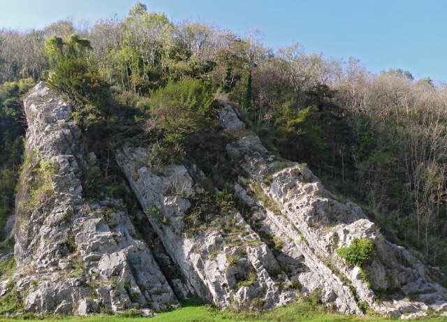 Rock of Ages
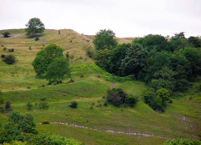 Dolebury Hill
Climbing the hill, you emerge from the woodland to a broad expanse of bracken covered moor. A large dip to the end left of the track leads to the entrance to Rod's Pot. This is one of a whole series of caves with which the Mendip Hills, a popular area for pot holders, are riddled. This is an area of rough moorland, liberally sprinkled with hawthorn.
At the crown of the hill, the bracken gives way to the grassland of Dolebury Warren, an area now in the care of the National Trust. Rabbit warrens were once an important part of the rural economy. They were, however, generally the preserves of the lord of the manor and the rabbits were valued both for their pelts and for their meat.
As you walk the close cropped grassland, there are magnificent views out over the Mendip Hills and the surrounding countryside. On the horizon, the most obvious features are the high banks that mark the presence of Dolebury Hill Fort. This hill fort was constructed in the Iron Age, a period which lasted from around 500 BC until the time of the Roman occupation.
 Dolebury Camp
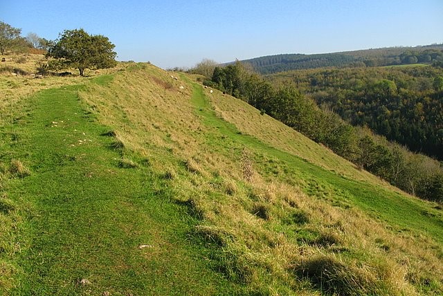 The southern ramparts
The Celtic tribes of Britain used such hill top sites for defensive purposes, supplementing the natural advantages of steep slopes by enclosing the settlement with massive ramparts and deep ditches. Not all the bumps and hollows that can be seen on this site are the marks left by these Iron Age settlers, however; in later years there was a good deal of lead mining in the hills.
The gap at the far end of the ramparts marks the original west gate, which, because the approach is so steep, has less elaborate defences than that at the east. On the northern side of the hill, the open moorland gives way to often dense woodland, a mixture of broad leaf trees and conifers where wood pigeon, pheasant and squirrels can frequently be seen.
From Dolebury Warren, after dropping down from the hill, the path rises and falls following a switch back course along the north side of the hill before coming out on the path back to Burlington Coombe.
Acknowledgments: Text derived from the Out and Out Series; Discovering the Countryside on Foot. Pictures courtesy of Wikipedia.


