Calstone Wellington, Morgan's Hill and Cherhill Hill
A walk along a Roman road to a monument and a white horse
Google Maps Open Source Maps| Statistics and Files | ||
|---|---|---|
| Start: Calstone Wellington | Distance: 6.5 miles (10.4 km) | Climbing: 291 metres |
| Grid Ref: SU 02162 68578 | Time: 3 hours | Rating: Moderate |
| GPX Route File | Google Earth File | Calstone Wellington |
| Statistics | |
|---|---|
| Start: Calstone Wellington | Distance: 6.5 miles (10.4 km) |
| Climbing: 291 metres | Grid Ref: SU 02162 68578 |
| Time: 3 hours | Rating: Moderate |
| GPX Route File | Google Earth File |
Ordnance Survey Explorer Map (1:25,000)
The Walk: Calstone Wellington is a tiny, isolated village beside a wooded valley sheltered by the northwestern rim of the North Wessex Downs. It is part of the Bowood estate, the family home of the Marquess of Lansdowne. The Georgian Bowood House can be seen on the opposite hillside, two miles west of the town of Calne. The village must once have been much more extensive than it is now, and its position points to a fascinating history. Some distance from any through routes, the original settlement was made on the spring line. Springs occur when the water seeping down the chalk layer meets a harder surface, usually on the lowest slopes. The little River Marden rises out of the down at Calstone to provide the villagers with the water today, just as it did when the first farmers settled here during prehistoric times.
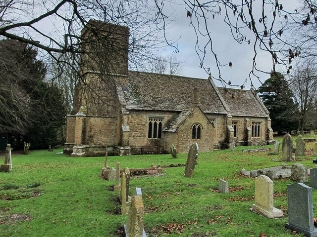 Calstone Wellington Church
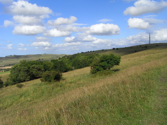 Morgan's Hill
In the churchyard, the discovery of a Bronze Age brooch, decorated with spirals, is evidence of the areas long habitation, Early Iron Age field systems terrace nearby Cherhill Down and later Celtic peoples, coming under Roman influence must also have lived here. Romano-British pottery has been found in the valley, just south of Manor Farm.
On the down above Calstone Wellington lies the beautifully cared for St Mary's Church, and this is well worth a visit. In the south window of the chancel there is a panel containing fragments of medieval glass, glowing with colour. The walls of the church are covered with old graffiti, with some of the dates and initials carved in the stone dating back to the early 17th century. The north porch is quite large, with stone benches on either side and a tiny round window. It is said to have been used in the past as the local lockup in the absence of a gaol.
This area of the North Wessex Downs is dotted with round Bronze Age burial mounds or barrows. Invaders with knowledge of bronze smelting reached this area around 1800 BC. A wealthy society developed as trade in salt, bronze, Baltic amber, Irish gold and Whitby jet flourished along the trackways.
The burial mounds vary a little in their construction, as you will see. They can be bell, bowl or disc shaped. Bodies were sometimes cremated and buried with grave goods, including finely worked bronze and gold daggers and bracelets and necklaces of blue faience beads from Egypt. Collections of these grave goods can be seen in the Wiltshire Museum in Devizes.
Running west from the Thames valley to Bath, the splendid embanked Roman road is the equivalent of today's A4. You can clearly see the construction method employed. The road had to be wide (ten legionaries had to be able to march abreast), embanked and, in this case, terraced along the side of the down. The surface had to be hard and flat for quick and easy marching and the passing of chariots and wagons. Having made the terrace, surplus earth was heaped along the centre; large heavy stones were laid over this and these, in turn, were topped with a rammed layer of crushed stones and flints.
The fenced, ungrazed margins of the road are exceptionally rich in wild plants. Among them you can possibly see pink and white wild candytuft, yellow sprays of ladies bedstraw, tall blue clustered bellflowers and pyramid and bee orchids. The Roman road and the surrounding downs are designated as a Nature Reserve. Animals include foxes, badgers and hares. Kestrels and buzzards hover overhead. Butterflies include chalkhill blues, dark green frittalaries and the lovely marbled white.
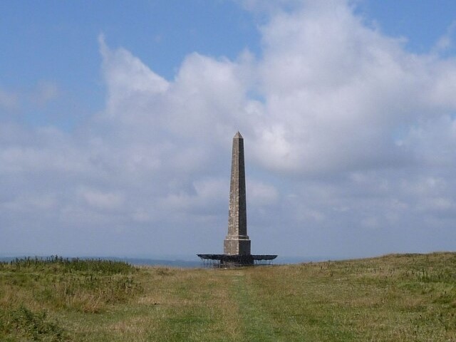 Lansdowne Monument
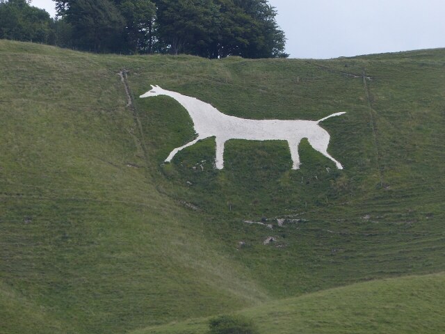 Cherhill White Horse
Intersecting with the Roman road, the great ditch of the Wansdyke was probably dug by Celtic tribes during the Iron Age to mark their territorial boundaries. Later Christianised peoples called the ditch 'Woden's Dyke', believing it to be the work of the devil.
Commanding the crest of Oldbury Hill, the Iron Age hillfort of Oldbury Camp encloses 25 acres of land and is defended by double banks and ditches. The Iron Age tribes constructed these forts to defend their settlements. They were fine warriors and expert slingshots, but no match for the Roman legions and their new ballistic weapons, who set about conquering Wessex after the Claudian invasion of AD45.
Shortly after Oldbury Camp, you arrive at the Lansdowne Monument. Alternatively known as the Cherhill Monument, the third Marquess of Lansdowne erected this column to commemorate one of his ancestors, Sir William Petty, a 17th century economist. Looking out to the right of the Monument, you will see the white horse, carved out of the turf on the steep hillside where it falls away beneath the hillfort ramparts.
It was cut in 1780 when landowners were perhaps inspired by new interest in the historic white horse on the Oxfordshire Downs near Uffington. The Cherhill White Horse was the creation of Dr Christopher Alsop of Calne. Dr Alsop is said to have shouted his instructions through a megaphone from the middle of Cherhill village to the workmen on the down, who then planted white flags to mark the outline. The result is a well proportioned animal, 140 feet long. Originally, the horse's eye was set with bottles, which must have sparkled attractively in the sunlight. But these have since disappeared.
Acknowledgments: Text derived from the Out and Out Series; Discovering the Countryside on Foot. Pictures courtesy of Wikipedia.


