Duckpool, Stanbury, Woodford and Coombe
A walk combining the most attractive elements of Cornish scenery
Google Maps Open Source Maps| Statistics and Files | ||
|---|---|---|
| Start: Duckpool | Distance: 5.5 miles (8.8 km) | Climbing: 330 metres |
| Grid Ref: SS 20240 11699 | Time: 2-3 hours | Rating: Moderate |
| GPX Route File | Google Earth File | About Duckpool |
| Statistics | |
|---|---|
| Start: Duckpool | Distance: 5.5 miles (8.8 km) |
| Climbing: 330 metres | Grid Ref: SS 20240 11699 |
| Time: 2-3 hours | Rating: Moderate |
| GPX Route File | Google Earth File |
Ordnance Survey Explorer Map (1:25,000)
The Walk: Duckpool, where the walk begins, is a little rocky bay which is seen at its most dramatic in rough weather, when the waves crash against the cliffs. The first part of the walk follows the route of the South West Coast Path and begins with a steep climb to the top of the cliffs. The path itself is narrow and rocky, but the effort of climbing is well rewarded by magnificent views along the coast. There is also an intriguing close up view of the array of vast white dishes of the nearby GCHQ Bude satellite tracking station.
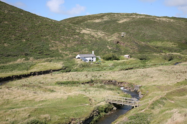 Duckpool Cottage
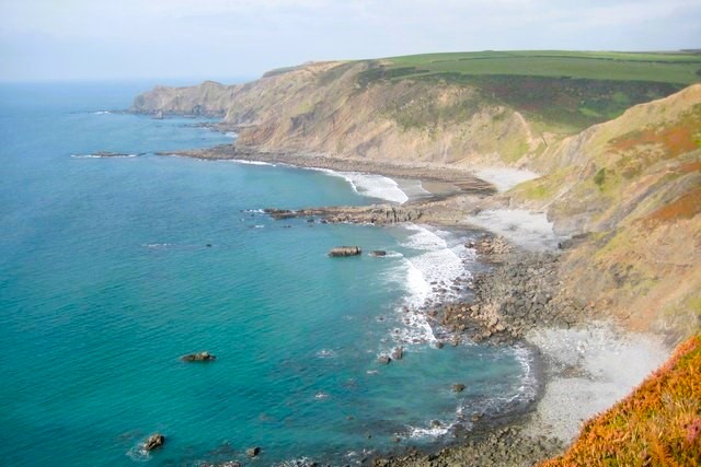 Stanbury Beach
Beyond this point is an area of coarse grass, gorse and heather, with a large population of stonechats swooping very low over the bushes. Field boundaries consist of low stone walls built into earthen banks that are topped by shrubs, stunted and distorted by the wind.
The descent from the cliff-top walk is comparatively gentle and leads down to a grassy path beside a stream. The path takes on more and more of the character of a green lane, stony under foot and running between banks and hedgerows. The upper part of this lane is bordered by dense clusters of blackberry bushes, a paradise in autumn.
There is a brief interlude of walking down a roadway, but this ends at Stanbury Manor Farm. The house itself is easily recognised as an old manor house with its solid stone walls and massive chimneys. The path leads through the farm grounds, past an ornamental lily pond, to go off through the fields to Eastaway. This too was the site of a manor house, but the old manor has long since been replaced. Here you follow another green lane that soon opens out into a footpath across the fields to Woodford. The village of Eastaway is a mixture of old and new picturesque cottages and sturdy farm houses.
The footpath now leads across fields before descending a steep path through dense woodland to the river valley. This is an area of broadleaf wood dominated by birch with a spattering of oak and sycamore, and a busy little stream forming an accompaniment to the walk. Soon the valley opens out and reaches the hamlet of Coombe.
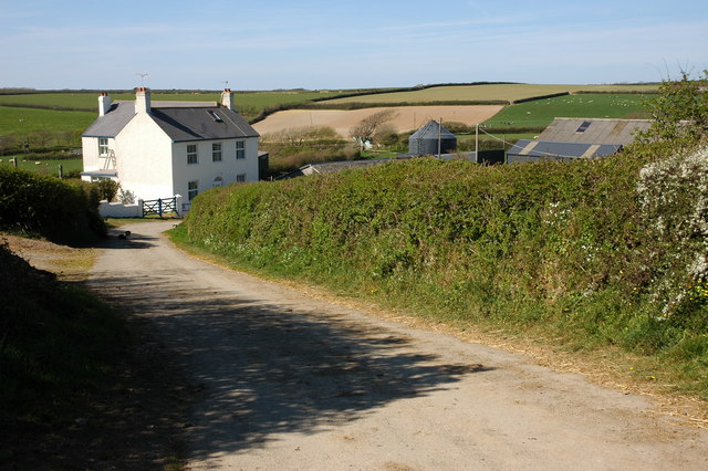 Woodford
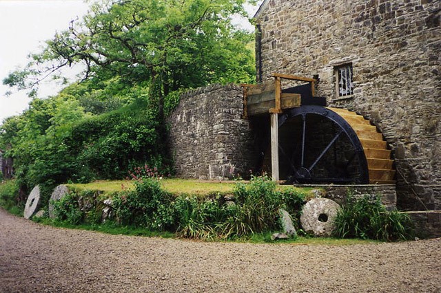 Coombe Mill
All this area was once part of the Great Stowe Barton estate, which belonged to the Grenville family. Its most famous member was Sir Richard Grenville, who, as captain of the Revenge, fought the Spaniards off the Azores in 1591. The Grenvilles were instrumental in restoring Charles II to the throne, and as a reward, Sir John Grenville was made Earl of Bath. His great house has gone, but the estates survive.
The old water mill, which was once used to grind corn and work a sawmill, still stands. For a time Coombe was home to the eccentric Reverend Robert Stephen Hawker of Morwenstow, who stayed in Hawker's Cottage, just across the Ford. He is best known as the founder of the Harvest Festival service.
Today, much of the area around Coombe is owned by the National Trust and the hamlet leased by the Landmark Trust. The road passes through a ford, but walkers can keep dry by crossing on the footbridge. For the final section of the walk, the valley broadens out as the river flows down to the sea at Duckpool.
Acknowledgments: Text derived from the Out and Out Series; Discovering the Countryside on Foot. Pictures courtesy of Wikipedia.


