Fingle Bridge, Teign Valley, Castle Drogo and Cranbrook Castle
Walk in the deep gorge cut by the River Teign under Castle Drogo
Google Maps Open Source Maps| Statistics and Files | ||
|---|---|---|
| Start: Fingle Bridge | Distance: 5.1 miles (8.2 km) | Climbing: 381 metres |
| Grid Ref: SX 74321 89968 | Time: 3 hours | Rating: Moderate |
| GPX Route File | Google Earth File | About Fingle Bridge |
| Statistics | |
|---|---|
| Start: Fingle Bridge | Distance: 5.1 miles (8.2 km) |
| Climbing: 381 metres | Grid Ref: SX 74321 89968 |
| Time: 3 hours | Rating: Moderate |
| GPX Route File | Google Earth File |
Ordnance Survey Explorer Map (1:25,000)
The Walk: The walk begins by the narrow packhorse bridge across the River Teign. Fingle Bridge probably dates from the 16th century, when the woods were used for charcoal burning and a grain mill stood at the river's edge. It would have been used to carry packhorses across the deep gorge. The sides of the gorge are covered by woodland, mainly oak and birch. The river itself is fast flowing, swirling between massive boulders. Near the start of the walk, the river is crossed by a weir, which now serves only produce a small picturesque waterfall. Originally however, water was diverted from above the weir to turn the wheels of a grain mill at Fingle Bridge which has long since been destroyed.
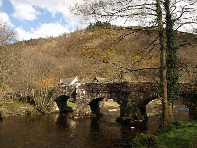 Fingle Bridge
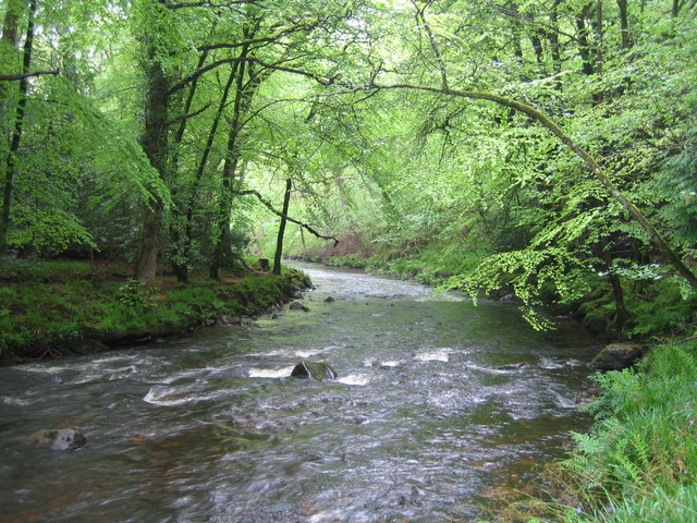 River Teign
The path undulates, sometimes closely following the river's edge and in other places rising high above it, to give wider views of the rushing waters. The opposite bank rises steeply to a high hill, densely covered by a mixture of conifers and broadleaf trees. The walk itself passes mainly through deciduous woodland, in which there is an unusually high concentration of mature holly trees. At Sharp Tor, the path climbs up to rough limestone crags, and there are splendid views of the river valley below, before the route drops down again to the riverside Walk. The trees then begin to thin out to reveal the beautifully lush moorland of gorse and bracken.
Across the water is what looks like, at first glance, to be a water mill with an arch over a leat, or artificial channel, running out from the river. This is in fact a small hydro-electric station that was used to supply power to Castle Drogo.
Castle Drogo itself stands at the rim of the gorge. This vast gaunt granite house was built for Julius Charles Drewe, founder of the Home and Colonial Stores. The architect was Edwin Lutyens. Work began in 1910 but building was not completed until 1930. It is now in the care of the National Trust and open to visitors.
A little way beyond the hydro-electric station is the weir. Above it, water was led off to the turbines. Square pans are built into the weir to enable migrating salmon and sea trout to make their way upstream via this watery ladder. After the weir, the turbulent river becomes calmer and the gorge begins to widen out. The now placid waters are a favourite spot for herons. A simple iron footbridge crosses the river, and the walk continues along a broad track that runs between the rough grassland of Whiddon Park and a small stream, contained in its course by stone walls built out of massive boulders.
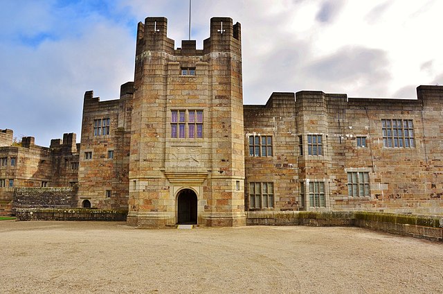 Castle Drogo
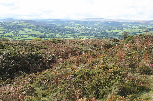 The view south from Cranbrook Castle
The track eventually arrives at a roadway a typically West Country Lane bounded by high earth banks. The hedges are made out of every tree from beech to holly. More trees grow from the top of the bank, even surprisingly, tall pine trees.
The lane itself climbs steadily and in places quite steeply. As it ascends, the views improve until you can see across the patchwork of fields divided by dry stone walls to the rough, craggy slopes of Dartmoor. Along the way are a number of traditional farm houses built of local stone and equally impressive farm buildings of stone with slate roofs.
Leaving the road for the rough track that leads back to the start of the walk, the way passes Cranbrook Down. This is an area of gorse and bracken, topped by the Iron Age fortress of Cranbrook Castle. It was built in the centuries before the Roman invasion of Britain. The local Celts chose this site for its natural defences, high above the steep slope of the Teign gorge. The fort is reached by a short detour.
The final part of the walk plunges steeply down the gorge through woodland. Breaks in the cover give views across to the shapely Hill of Prestonbury Common, topped by a second Iron Age hillfort.
Acknowledgments: Text derived from the Out and Out Series; Discovering the Countryside on Foot. Pictures courtesy of Wikipedia.


