Powerstock and Eggardon Hill
A walk through hidden valleys to a famous viewpoint
Google Maps Open Source Maps| Statistics and Files | ||
|---|---|---|
| Start: Powerstock | Distance: 5.8 miles (9.3 km) | Climbing: 306 metres |
| Grid Ref: SY 51645 96181 | Time: 3 hours | Rating: Moderate |
| GPX Route File | Google Earth File | About Powerstock |
| Statistics | |
|---|---|
| Start: Powerstock | Distance: 5.8 miles (9.3 km) |
| Climbing: 306 metres | Grid Ref: SY 51645 96181 |
| Time: 3 hours | Rating: Moderate |
| GPX Route File | Google Earth File |
Ordnance Survey Explorer Map (1:25,000)
The Walk: The village of Powerstock lies in an area of rounded hills, deep valleys and sunken lanes. The houses in this area resembled those of the Cotswolds because they are built of the same stone, oolitic limestone. There are narrow strips of hazel coppice on the steepest slopes. Harts tongue ferns and wild snowdrops grow in the banks of the lanes, and pennywort grows out of crevices in the walls. A delight of this walk, both at the beginning and towards the end, is the constant babbling of the streams in the valleys. Features to look out for are Dorset Gates, consisting of vertical iron bars set in a wooden framework, and hurdles made of wood with split hazel rods woven round pointed vertical stakes.
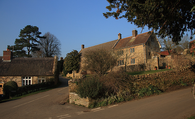 Powerstock
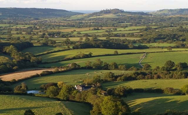 Countryside between Powerstock and Eggardon Hill
Rising to the east of this area and towering over it is Eggardon Hill, its summit encircled by the ramparts of an Iron Age Hill Fort. On the north side of the hill there is a narrow lane from which one can look out over an enchanted landscape of pastures, woodlands and overgrown hedges.
The ramparts of the hill fort were constructed in about 50 BC, and they are much larger and more impressive than those of the older hill forts on Lambert's Castle Hill and Pilsdon Pen. On a clear day you can see all the way to Dartmoor 60 miles away in the West and to the Isle of Wight 60 miles in the east. In Thomas Hardy's novel "The Trumpet Major", Eggardon Hill is called 'Haggerdon'.
From Eggardon Hill, the route descends to a later earthwork, the Norman motte and bailey known officially as Powerstock Castle and unofficially as 'Humpy Castle'.
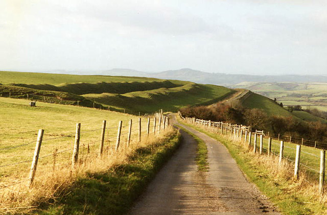 Approaching Eggardon Hill
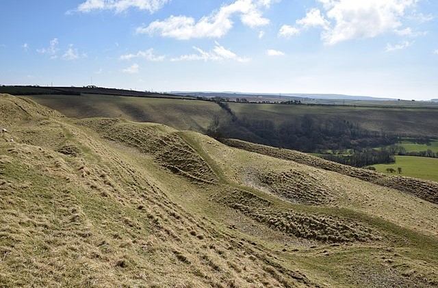 Eggardon Hill Fort
There is a tradition that King Athelstan had a palace on the site of Powerstock Castle, and that King John had a hunting lodge here. The motte was built on the oolitic limestone and consequently it has been considerably disturbed by quarrying. This is a small price to pay however, for the beautiful cottages built of stone that are found throughout this area.
Back in Powerstock, you will find an interesting church. Its oldest feature is the Norman chancel arch, which is decorated with chevron, diaper - or repeated diamond shapes - and cable moulding.
Acknowledgments: Text derived from the Out and Out Series; Discovering the Countryside on Foot. Pictures courtesy of Wikipedia.


