Lynmouth and Watersmeet
Along a steep sided valley and to a fishing village
Google Maps Open Source Maps| Statistics and Files | ||
|---|---|---|
| Start: Watersmeet | Distance: 4.2 miles (6.8 km) | Climbing: 477 metres |
| Grid Ref: SS 74330 48683 | Time: 2 hours | Rating: Moderate |
| GPX Route File | Google Earth File | About Lynmouth |
| Statistics | |
|---|---|
| Start: Watersmeet | Distance: 4.2 miles (6.8 km) |
| Climbing: 477 metres | Grid Ref: SS 74330 48683 |
| Time: 2 hours | Rating: Moderate |
| GPX Route File | Google Earth File |
Ordnance Survey Explorer Map (1:25,000)
The Walk: The walk passes over moorland with wide views along the Devon Coast and along the deep and beautiful wooded valley of the East Lyn River. It visits the popular resort of Lynmouth and the famous beauty spot of Waters Meet. The walk, as described, begins at the car park above the cafe in Waters Meet, but it could equally well begin from Lynmouth.
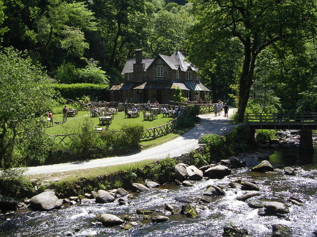 Watersmeet House
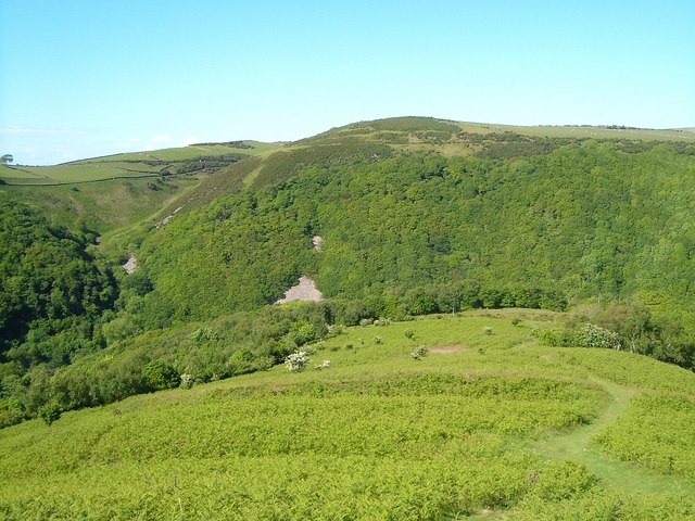 Myrtleberry Cleave
After a very short walk down the busy A39 Lynmouth Road, walkers join the footpath that leads uphill through woodland. Once clear of the woods, the path emerges at the low earthen ramparts of an Iron Age enclosure, Myrtleberry North Camp. It continues uphill to the open moorland of bracken and heather, the way being clearly marked by steps cut into the hillside.
As you climb steadily upwards, fine views appear. Looking back to the dark green cleft of the river valley and forward to the town of Lynton, perched on the cliffs high above the sea. Once the rim of the valley is reached, the path evens out to run on a ledge, a little way above the tree line. At times the views opens up so that you can look right down to the East Lyn River, a shining ribbon between the trees. Even at this height, you can hear the roar of the river as it rushes down between the rocks.
The best viewpoint is from a stone seat built beside the path in 1955. It is not a bad place to pause because a small stream has dug a deep coombe, or valley, into the hillside and the path is about to zig-zag down through the dense dark woodland, mainly oak and birch, before winding its way up the other side. Here the rock thrusts its way through the ground, presenting an interesting mixture of rock types owing to the fact that this valley represents a meeting between rounded sandstones and angular slates.
The efforts of climbing down into the little valley and up again is rewarded by some of the best views of the whole walk. Ahead one looks out to the coast and the village and bay of Lynmouth. Turning back, you are able to see the whole extent of the Lyn valley. The canopy of trees forms an almost complete cover, broken only by the river itself and the roadway that accompanies it.
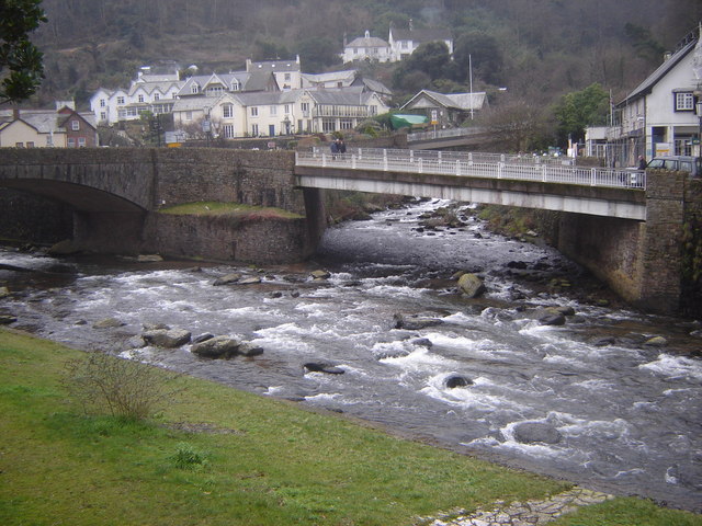
Shortly afterwards, the descent begins by a steep narrow path swinging round a rocky outcrop to make its way down through the woodland. As the path gets nearer to Lynmouth, it becomes more pronounced, bounded by mossy stone walls and bordered by impressive mature trees. Finally, the path emerges between attractive whitewashed stone cottages before the roadway and Lynmouth appear.
There has been a settlement here since before the Norman Conquest. For this is one of the few sheltered spots on this notoriously dangerous coast. It continued for centuries as a small fishing village, but early in the 19th century it began to acquire a new role as a seaside resort.
 Confluence of East and West Lyn Rivers
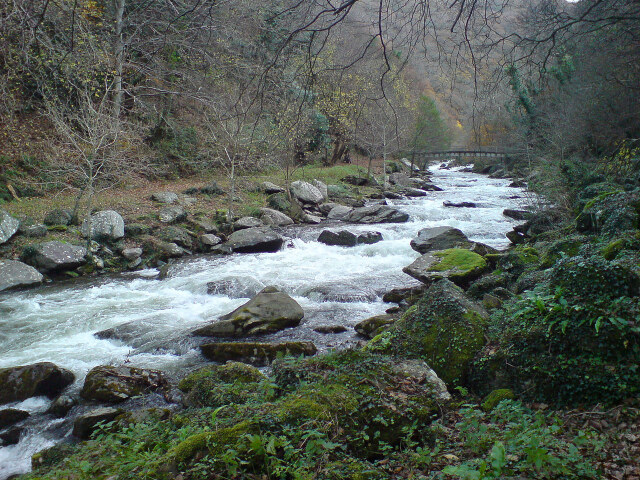 East Lyn River near Watersmeet
Among the early visitors to Lynmouth was the poet Shelley, who eloped and brought his young bride here in 1812. Other Romantic poets came and were enthusiastic about the scenery, helping to ensure its popularity. There are still features of the Victorian resort to be seen. In 1890 Lynmouth was linked with Lynton on the cliff tops above by a cliff railway that still runs. One of the most prominent landmarks by the harbour is the replica of the Reinish Tower built by a retired colonel and destroyed in the infamous 1952 flood.
The walk leaves the town by the riverside and its character changes from upland to river valley. A plaque near the start of the walk records the fact that the whole Waters Meet estate was given to the National Trust in 1936. The paths stays close to the East Lyn river, which rushes along between massive boulders, cascading in small falls over the rocks and spreading out into deep and clear pools. It is a famously picturesque river, but still retains some of the fierceness of the stream that burst into flood in 1952. There is a reminder of the 1952 Lynmouth Disaster by one of the footbridges, where a stonewear bottle set in the rock is all it remains of the Lynrock mineral water factory.
Beyond this point, the valley suddenly opens out. It is something of a surprise to come upon the house of Myrtleberry with its ornate Victorian greenhouse, followed by Watersmeet House, now the cafe. This spot appealed to the Reverend WS Halliday, who in 1832 built Watersmeet House, inscribing a poem by William Wordsworth above the door. It is not surprising that Waters Meet was much favoured by the Romantic Poets, for here, a waterfall rumbles below high crags, making a beautiful ending to the walk.
Acknowledgments: Text derived from the Out and Out Series; Discovering the Countryside on Foot. Pictures courtesy of Wikipedia.


