Studland, Black Down, Ballard Down and Old Harry Rocks
Across heathland and along the coast south of Studland Bay
Google Maps Open Source Maps| Statistics and Files | ||
|---|---|---|
| Start: Studland | Distance: 6.8 miles (10.9 km) | Climbing: 349 metres |
| Grid Ref: SZ 03741 82533 | Time: 3 hours | Rating: Moderate |
| GPX Route File | Google Earth File | About Studland |
| Statistics | |
|---|---|
| Start: Studland | Distance: 6.8 miles (10.9 km) |
| Climbing: 349 metres | Grid Ref: SZ 03741 82533 |
| Time: 3 hours | Rating: Moderate |
| GPX Route File | Google Earth File |
Ordnance Survey Explorer Map (1:25,000)
The Walk: The village of Studland is located in an area called the Isle of Purbeck. This is not an island, but part of the Dorset countryside bounded by the English Channel to the south and east, by Poole Harbour and the River Frome to the north, and by the stream called Luckford Lake to the west. As a result of its underlying geology, the area may be divided into four natural regions, each running from west to east. In the north is a relatively level area of heathland on the Bagshot beds. To the south of this is a long, narrow ridge of chalk called the Purbeck Hills. Then there is a valley of Wealden clay. Finally, there is an upland area of Purbeck and Portland beds that presents a rocky coastline to the south. This walk combines the sombre beauty of the heath with the more dramatic beauty of the Purbeck Hills.
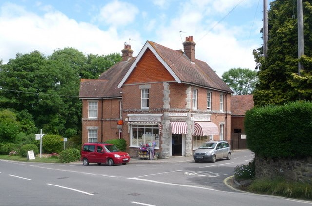 Village shop in Studland
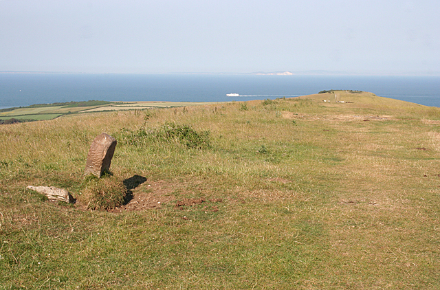 Ballard Down
In 1982 some of the most beautiful scenery in the country was bequeathed to the National Trust. This gift included Studland Heath, Ballard Down and part of the south coast of Purbeck. Studland is noted for its church, the interior of which retains many Norman features, including two rib-vaulted ceilings. To the south of the church is a stone cross bearing the inscription 'Spaceship Earth' and the date 1976. The most remarkable building in the village is its manor house, which is embellished with an enormous number of tiny stone-roofed gables.
Extending to the north from the village to the mouth of Poole Harbour is a magnificent sandy beach backed by sand dunes. Behind the dunes is the lake called the 'Little Sea', which was joined to the sea until 1850. On the shore of the lake are hides for bird watching. Poole Harbour itself is a large natural inlet that is linked to the sea by a narrow entrance only around 400 metres wide. The shore is fringed with sea lavender. Sea purslane grows along the margins of creeks while further out the mud flats are covered in rice grass.
The only island of any size in Poole Harbour is Brownsea Island, where red squirrels are found and where the first Boy Scout camp was held in 1907. There are also Round Island where Sir Thomas Beecham wrote the biography of Delius, Long Island, which was used as a hideout by Harry Paye the pirate, Green Island, which was formerly used as a pottery and Furzey Island, which was is now used for the extraction of oil.
In the Middle Ages, the Isle of Purbeck was an important source of marble, which was transported from Corfe Castle in the Purbeck Hills to Poole Harbour. The marble was then carried by sea to cathedrals all over the country. The Purbeck Marblers Road can still be traced.
On leaving Studland, the route passes through an attractive birch wood and crosses a little stream where hard ferns grow at the water's edge. When it leaves the wood, the path crosses the finest area of heathland in Dorset. Pale grey sand and is exposed and this becomes dark grey further on. Patches of gorse and bracken are interspersed by the dominant plant, heather with cross-leaved heath in the wetter areas. Purple moor grass also grows here, and in late summer, the yellow flower spikes of bog asphodel rise from the marshy area to the left of the path. The best time to see the heath is in autumn when it becomes a mixture of subtle colours.
The path leads to an enormous boulder called the Agglestone, which is 17 feet high. Boulders this size are common in mountainous areas, but in Dorset there is nothing else like it. It is also known as Devil's Anvil, or the Witchstone, and was even more impressive before it fell over onto its side in 1979. Here the sand is cream coloured and further on the ground is littered with fragments of brown heathstone. Before long, the route leaves the heath and follows the crest of the chalky escarpment of Ballard Down. In clear weather the white cliffs of the Isle of Wight are visible ahead. At one time they were joined to the mainland at Ballard Down.
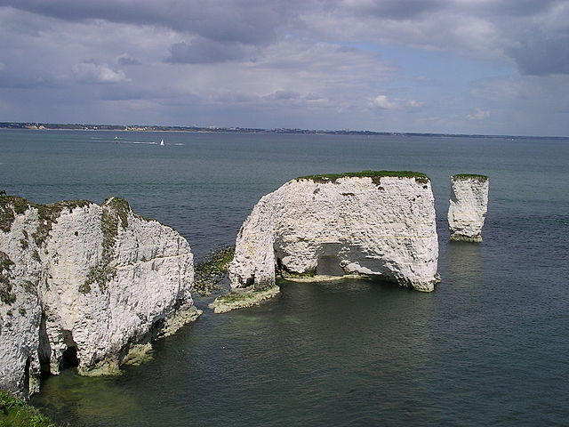 Old Harry Rocks
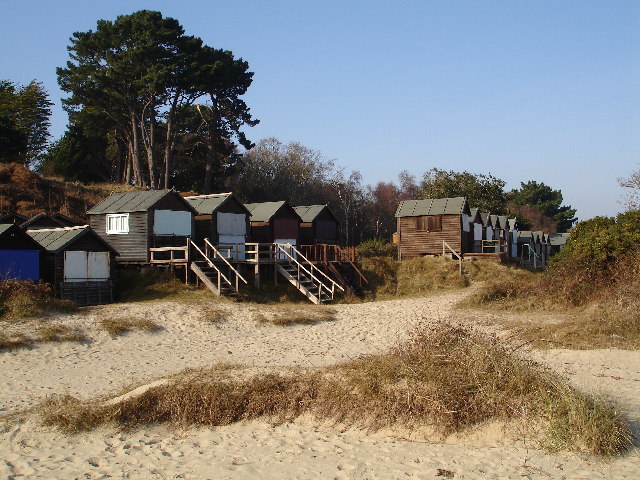 Beach huts at Studland
The route passes the Ulwell Barrow and an obelisk where an inscription says that the granite was transported from near the Mansion House in London and re-erected here in 1892. Further along the ridge, two tumuli are passed on the right. Soon there is sea on both sides and Durlston Head, with Durlston Castle in silhouette, can be seen beyond Peveril Point. Just before an Ordnance Survey column is reached the route crosses an ancient bank and ditch called a cross dyke.
Where the ridge reaches the sea there is spectacular coastal scenery with glistening white cliffs and three stacks, one beyond the other. These are 'The Pinnacle', 'The Haystack' and 'Old Harry'. Collectively these three individuals are called the 'Old Harry Rocks'. Cormorants are common here and the cliff top is bedecked in a multitude of wildflowers in the spring. Wild cabbages also grow on the cliff top.
As Handfast Point is approached the coastline becomes divided into small coves by narrow promontories. The third promontory is pierced by an arch. Between Handfast Point and Old Harry is the island called 'No Man's Land' which was joined to the mainland as recently as 1920. There are more promontories beyond Handfast Point. Here the rock is still chalk, but instead of dropping sheer into the sea, the cliffs are broken up by grassy ledges and the chalk is stained brown.
Before returning to Studland, the route passes by the edge of Studland Wood, where the dark green sharp pointed leaves of the butcher's broom grow. Before reaching the road the track passes close enough to Studland Manor for a good view of the house and its grounds. Afterwards the walk returns to the start but here a detour to explore Studland Bay is recommended if you have the stamina and the time.
Acknowledgments: Text derived from the Out and Out Series; Discovering the Countryside on Foot. Pictures courtesy of Wikipedia.


