Treen, Gurnard's Head and Porthmeor
Cliff walking on a dramatic north-west Cornish peninsula
Google Maps Open Source Maps| Statistics and Files | ||
|---|---|---|
| Start: Treen | Distance: 2.8 miles (4.4 km) | Climbing: 208 metres |
| Grid Ref: SW 43597 37563 | Time: 1-2 hours | Rating: Easy |
| GPX Route File | Google Earth File | About Gurnard's Head |
| Statistics | |
|---|---|
| Start: Treen | Distance: 2.8 miles (4.4 km) |
| Climbing: 208 metres | Grid Ref: SW 43597 37563 |
| Time: 1-2 hours | Rating: Easy |
| GPX Route File | Google Earth File |
Ordnance Survey Explorer Map (1:25,000)
The Walk: The West Penwith region of Cornwall is famed for its rugged coastline and colourful history. This walk goes through fields towards the coast and passes through an area where rich natural resources were once harvested, tin and copper from the rock; pilchards from the sea. After crossing the coastal path, Gurnard's Head, regarded as one of the most striking promontories in Cornwall, provides the highlight of this varied walk, offering superlative views of this wild and dramatic coastline.
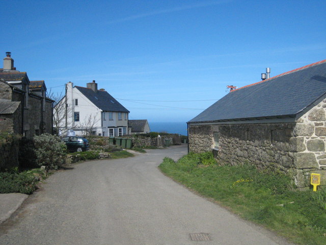 The village of Treen
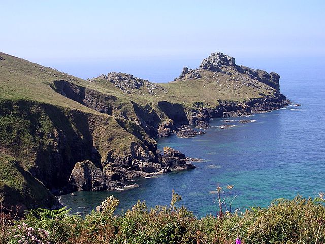 Gurnard’s Head
The early part of the walk goes through the hamlet of Treen to gain open, treeless fields leading towards Gurnard's Head. Before the coastal path is reached it is possible to see the mine workings that tumble down to Lean Head on the east side of Treen Cove. The long building above the sea is known as the 'Old Pilchard Factory'. Pilchards, once locally known as 'Fair Maids' were the basis of a flourishing industry during the last century. The Catholic observances of not eating meat on Friday ensured a thriving export trade of Pilchards, preserved in salt, to the Mediterranean.
Standing proud against the great Atlantic rollers, Gurnard's Head itself is an inspirational and exhilarating place. It protrudes from, and is lower than, the surrounding cliffs. The tip rises to form a distinctive bump of naked greenstone. It takes its modern name from the bulbous headed Gurnard, a fish common in these waters. Its Cornish name Trereen Dinas means castle on the high place, which refers to the castle that is sited here.
On the sheltered eastern slopes of the headland, the remains of 18 hut circles have been found. These now take the shape of circular grassy platforms. The tip of the promontory can be visited easily, but its rocky head can only be gained by a difficult scramble and is not recommended for those without climbing experience.
Gurnard's Head imparts a sense of being the last safe bastion Between the mainland and the great Atlantic Ocean. It must have seemed so during the terrible November gales of 1893 to a sailor who reached shore here, the only survivor of a steamer that sank with 25 crew.
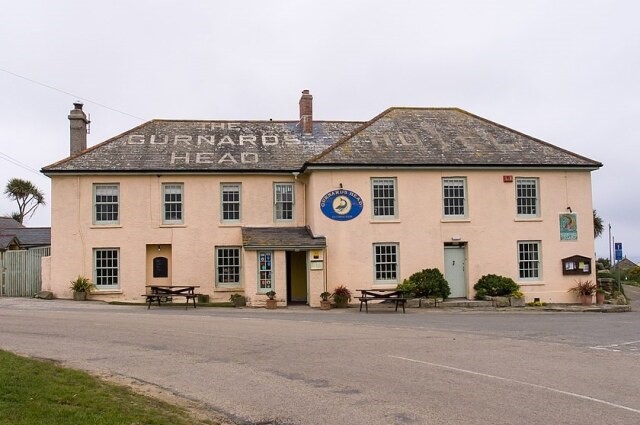 The Gurnard’s Head Inn
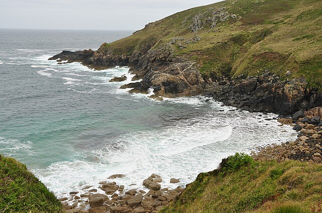 Porthmeor Cove
Walking from Gurnard's Head to the cliffs proves quite strenuous, though the coastal path is soon reached and the going is virtually horizontal. Looking back towards the cliff of Carn Gloose provides a breathtaking sight, for the cliff plunges vertically some 200 feet into the sea. The headlands of Robin's Rocks and Porthmeor Point are not quite so steep. Their ledges and slabs provide a preening point and home for shags and cormorants.
The rocky shore of the cove marks a change in character. For here the darker angular green stone, which is actually jet black in colour, gives way to the more rounded pink red granite. A small bridge leaves safely across the stream before the valley can be ascended to reach the old ruined mine buildings.
The mine buildings, now easy to see since the undergrowth has been cleared by the National Trust, were used to process tin ore from the nearby Carn Galver mine. They comprise water wheel pits, stamping pits and circular buddles (the bases for the revolving brushes which separated the crushed ore from the rock). The mine closed in 1871. Above these relics of a bygone edge the path no re-crosses the stream to rise up to Lower Porthmeor Farm.
From Lower Porthmeor Farm the walk continues to Higher Porthmeor Farm where an isolated standing stone stands in a field. The ancient menhir known as the Porthmeor Stone stands just over 2 metres tall and is of sturdy appearance. Its origin is unknown. From the Porthmeor Stone it is a short walk along the quiet country road back to the starting point of the walk in Treen.
Acknowledgments: Text derived from the Out and Out Series; Discovering the Countryside on Foot. Pictures courtesy of Wikipedia.


