Webber's Post, East Water, Bagley Combe and Dunkery Beacon
An Exmoor walk featuring the heather covered moorland of Dunkery Hill
Google Maps Open Source Maps| Statistics and Files | ||
|---|---|---|
| Start: Webber's Post | Distance: 5.9 miles (9.4 km) | Climbing: 423 metres |
| Grid Ref: SS 90295 43885 | Time: 3 hours | Rating: Moderate |
| GPX Route File | Google Earth File | About Exmoor |
| Statistics | |
|---|---|
| Start: Webber's Post | Distance: 5.9 miles (9.4 km) |
| Climbing: 423 metres | Grid Ref: SS 90295 43885 |
| Time: 3 hours | Rating: Moderate |
| GPX Route File | Google Earth File |
Ordnance Survey Explorer Map (1:25,000)
The Walk: This walk offers some of the best and most contrasting scenery on Exmoor. It starts in a deep wooded combe and then continues to the moorland of Dunkery Beacon, the highest point on Exmoor. The view from the car park gives a good idea of what lies ahead on the walk. The car park is at the edge of the deep valley cut by Horner Water, though the stream itself is lost from view beneath the mass of trees; over to the south the view is dominated by the ridge of hills culminating in Dunkery Beacon.
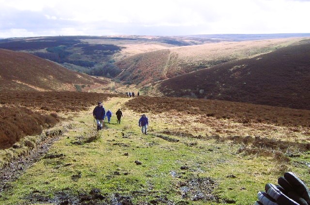 Climbing the Exmoor terrain
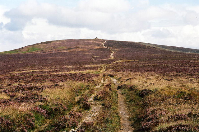 Dunkery Hill
The path leads steeply downhill through mixed woodland of oak, pine, and silver birch. It slopes down to Horner Water, which winds and splashes through the narrow valley, while the trees rise upon every side, climbing the steep hillside from the rim of the East Water valley. There is a splendid view of the whole combe and the hills beyond it, and here there is the first hint of the moorland that lies ahead as heather and fern put in an appearance.
The track begins a gradual descent back to the road that now runs alongside the stream. The route then leads uphill to emerge beside a beautiful example of drystone walling. Instead of the familiar higgly-piggly arrangement of irregular blocks, flat stones have been set on edge in regular courses, in a chevron pattern.
Further along the route, there is a change in the landscape. The woodland now gives way to green fields, where there may be deer grazing alongside the sheep and perhaps the native Exmoor pony too. As the climbing continues, pine and oak give way to beech. At the top of the hill is a particularly fine row of immense beech trees that seem, when they were saplings, to have grown from the top of a field bank. But now the roots have grown out around the stones so that the trees seem to stand on pedestals.
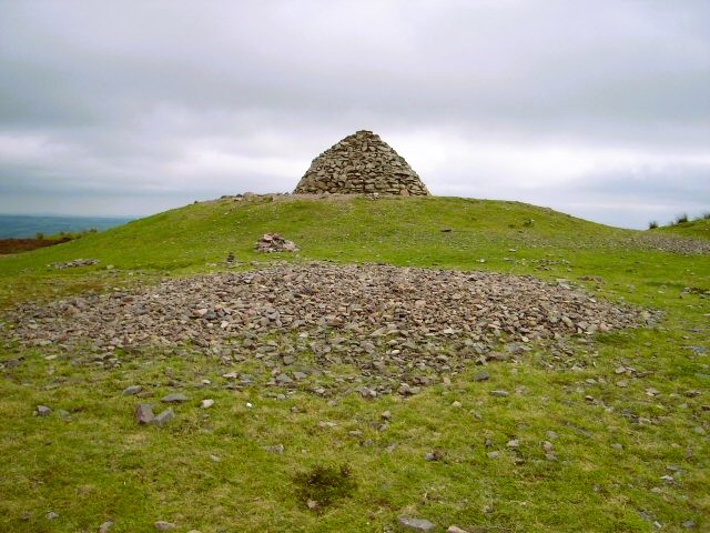 Dunkery Beacon
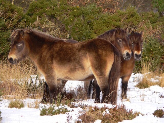 Exmoor Ponies
The walk now leaves the roadway from the rough path up to the top of Dunkery Beacon. At first it is a stony path that leads down to a little brook. But as it climbs again, it takes on the typical character of a moorland way. It is rough and stony, and it is clear to see how it has eaten into the black peat that shows on either side. This is open heather moorland with very little shelter.
The effort of making the climb to Dunkery Beacon is rewarded with magnificent views from the summit. Next to the tall cairn is a metal plate with direction lines indicating points that can be seen from the hill. On a clear day these include views across the Bristol Channel to the hills above Abergavenny in Wales, and to the tors of Dartmoor.
The path continues towards the road where yet more splendid views open up, this time taking in the west coast beyond Minehead and the nearby Dunkery Hill, which is topped by two prominent barrows known as Robin How and Joaney How. Beyond here, the walk continues back down to the starting point at Webber's Post.
Acknowledgments: Text derived from the Out and Out Series; Discovering the Countryside on Foot. Pictures courtesy of Wikipedia.


