Osmington, Dorset Coast Path, Bran Point and Coombe Bottom
Along the Dorset coastline to an old smugglers haunt
Google Maps Open Source Maps| Statistics and Files | ||
|---|---|---|
| Start: Osmington | Distance: 5.0 miles (8.0 km) | Climbing: 284 metres |
| Grid Ref: SY 72473 82970 | Time: 2 hours | Rating: Moderate |
| GPX Route File | Google Earth File | About Osmington |
| Statistics | |
|---|---|
| Start: Osmington | Distance: 5.0 miles (8.0 km) |
| Climbing: 284 metres | Grid Ref: SY 72473 82970 |
| Time: 2 hours | Rating: Moderate |
| GPX Route File | Google Earth File |
Ordnance Survey Explorer Map (1:25,000)
The Walk: Chalk cliffs leading down to secluded bays make this part of the Dorset coastline particularly attractive. Inland, there are small villages to explore and the Dorset Coast Path gives walkers excellent views in good weather. The high spot of the walk undoubtedly occurs just past Osmington Mills when the path suddenly bursts upon the cliff top and there is a view over a great expanse of sea to Weymouth.
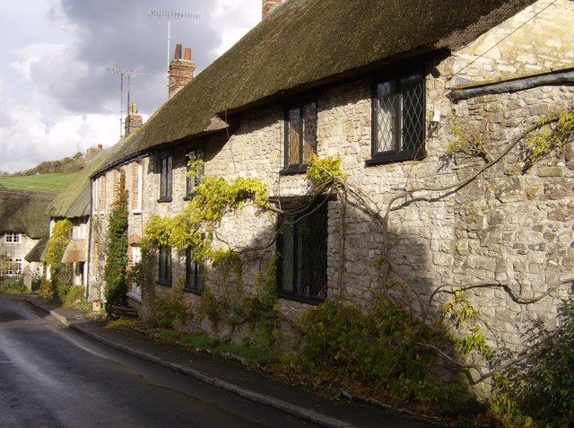 Cottages in Osmington
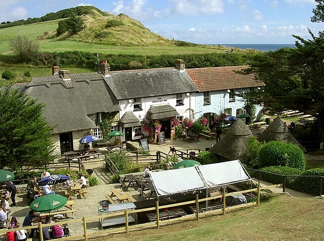 The Smugglers Inn at Osmington Mills
The route covers an area north east of Weymouth, where the scenery is very diverse due to differences in the underlying rocks. These change from Purbeck stone to Kimmeridge clay, to Corallian limestone, then to chalk. The rocks of the heathland area, the Bagshot Beds, are never far away.
Osmington is a village of thatched stone cottages and stone garden walls. The cottages are adorned with flowers and valerian grows outwards from the walls. One of the cottages has a thatched roof embellished with crescent shaped decorations called scallops. Adjoining the village churchyard are the ruins of the 17th century Manor House, where steps are laid down to a very old door with long iron hinges. In 1816, the artist John Constable spent his honeymoon in the village. He produced two paintings of the area, one entitled Osmington Village and the other Weymouth Bay.
From Osmington Mills, the route follows part of the Dorset Coast Path, which takes to the hills here to avoid the built-up area around Weymouth. From this height, there is a beautiful view to the left looking along a valley to Holworth. The Osmington White Horse can be clearly seen from here. This is the only White Horse chalk figure that has a rider - King George III, who was a regular visitor to this part of the country. There is a view of the Osmington White Horse towards the end of the walk, just past Pigston Barn. From here it is possible to see the chalk figure on the right of the chalk escarpment.
The Smugglers Inn at Osmington Mills is described on the signboard as a 13th century smuggler's haunt. But the present building is not as old as this. There used to be a clifftop path to the west from here, but from the far end of the car park, it is clear how this path has now completely disappeared, a result of erosion by the sea. This evidence of erosion makes it possible to imagine Britain becoming separated from France and the Isle of Wight from the mainland, over thousands of years.
Before long, the path passes through a thicket, when it emerges the headline of White Nothe comes into view ahead, with St Adhelms Head to the right of it. In the novel Moonfleet by J Meade Falkner, John Trenchard was carried up the cliff path to White Nothe by Elzevir Block. Along the shore there is a wreck of an old ship whose bare ribs are a favourite perch for cormorants. At Bran Point there is a series of ledges of Corallian limestone which dip away to the east.
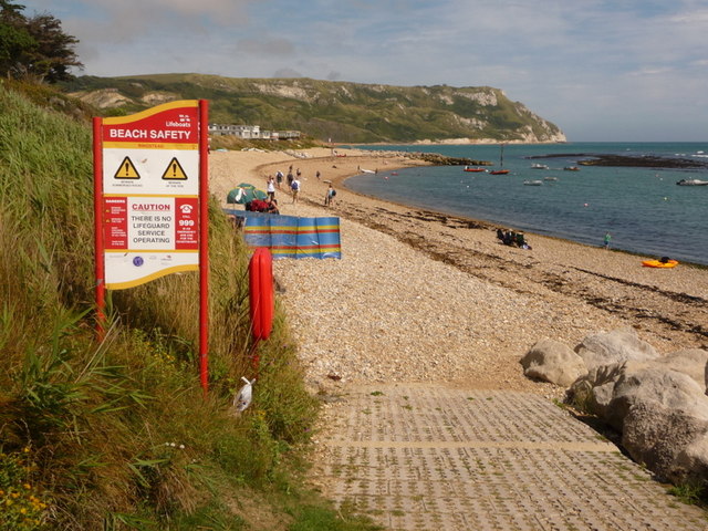 Ringstead Bay
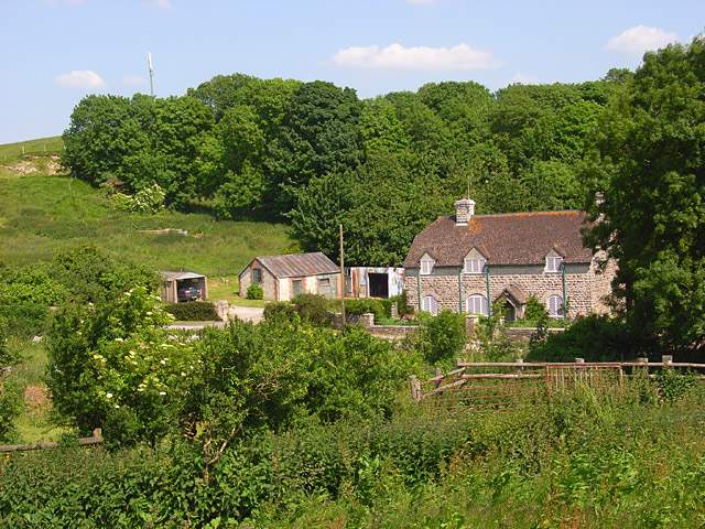 On the edge of Poxwell Big Wood
The path passes a meadow where birds foot trefoil grows. Then it descends into a little valley. Here the route turns into a wood where harts tongue fern and pendulous sedge flourish. Hart's tongue does not look like a fern, as it leaves are not divided into pinnae (feathery fronds). However, you can identify it as a fern by the fruiting bodies on the back of the leaves. Pendulous sedge may be recognised as a sedge by its triangular stems.
On leaving the wood, the route follows a lane through lush meadows backed by woodland. Another stretch of woodland comes later along in the route, but the vegetation is not as luxuriant here as in the valley. A wide variety of wildflowers grow in the valley, but pride of place must go to the nodding thistles with their big, round purple flower-heads. On the left is a quarry where the chalk may be seen dipping to the north. The chalk was formed over a period of thirty million years from the skeletons of tiny animals called diatoms that accumulated on the floor of the sea.
Along the right hand side of the valley, there are traces of ancient cultivation terraces called strip lynchets. Both sides of the valley are covered in gorse bushes, which attract stonechats. From the top of the hill, a Bronze Age burial mound (or tumulus) can be seen in a field on the left. There are 1,800 of these tumuli in Dorset.
The final section of the walk passes Pixon Barn, which is an isolated stone building with a slate roof and walled farmyard. As the route descends, it runs along the crest of a ridge with views on both sides. On the left, the Isle of Portland is linked to the mainland by no more than a narrow strip of shingle. On the right is a valley of Kimmeridge clay and you can see the liberty village of Sutton Poyntz. The Osmington White Horse is also visible, but it appears to be foreshortened because of the angle. Finally, the route follows a lane shaded by sycamore trees, which leads back into Osmington. A giant ammonite can be seen in a house wall, a common sight in this fossiliferous county.
Acknowledgments: Text derived from the Out and Out Series; Discovering the Countryside on Foot. Pictures courtesy of Wikipedia.


