Nynehead, Grand Western Canal, Tone and Runnington
Through rolling farmland and beside a disused canal
Google Maps Open Source Maps| Statistics and Files | ||
|---|---|---|
| Start: Nynehead | Distance: 5.3 miles (8.5 km) | Climbing: 95 metres |
| Grid Ref: ST 13711 22809 | Time: 2-3 hours | Rating: Easy |
| GPX Route File | Google Earth File | About Nynehead |
| Statistics | |
|---|---|
| Start: Nynehead | Distance: 5.3 miles (8.5 km) |
| Climbing: 95 metres | Grid Ref: ST 13711 22809 |
| Time: 2-3 hours | Rating: Easy |
| GPX Route File | Google Earth File |
Ordnance Survey Explorer Map (1:25,000)
The Walk: Nynehead, a small village with a spattering of thatched cottages, is the start and finishing point of this country stroll. The first part comes as something of a surprise for, instead of a conventional country lane, the road is like a miniature canyon with sandstone cliffs rearing up to 20 feet high on either side. Overhead, branches of trees meet to form a green roof. At the top of the hill, the stone gives way to banks and hedges.
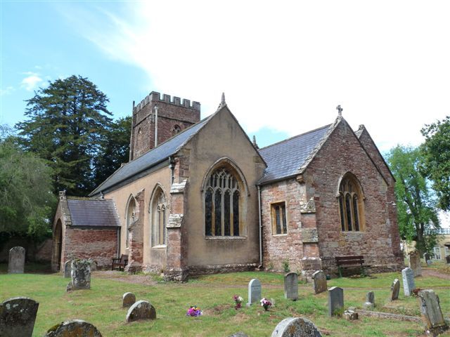 Nynehead Church
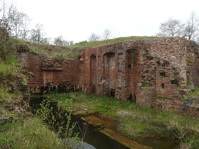 Disused Nynehead Boat Lift
The route soon leaves the road for a farm track. Through breaks in the hedge, you can see the Blackdown Hills and the tall obelisk of the Wellington Monument. The distant tower of Wellington church peeps up above the trees.
Alongside the River Tone is a trough constructed of thick iron plates. Once this was full of water, for it was an aqueduct built for the boats of the Grand Western Canal. The canal was begun in 1796 but never finished. Only 24 miles were built between Taunton and Tiverton and this section was built as a tub-boat canal along which the little boats were pulled in so called trains. For the next two miles the walk follows the line of the canal, although it is not always obvious. The cottage by the road once stood on a canal wharf and across the road is a section of canal that still contains water. It is used as an elongated duck pond.
Beyond this is an area of crumbling masonry walls with arched openings, the remains of a boat lift. Two caissons, like very large bathtubs, were joined by chains. A boat could float into the bottom tub and water would be added to the upper caisson until it began to descend and the other to rise.
Further on, there is a second rather grand aqueduct. The old canal is enclosed in a narrow strip of woodland, which rings with birdsong, occasionally obliterated by the sound of a train on the nearby railway line. Where the woods end is a patch of scrubland bright with Ragwort and Willow Herb. Following this, a tree shaded path leads down to the road to a complex of old industrial buildings that once included a woollen mill and dye house. The tall chimney marks the days when the machines were powered by steam.
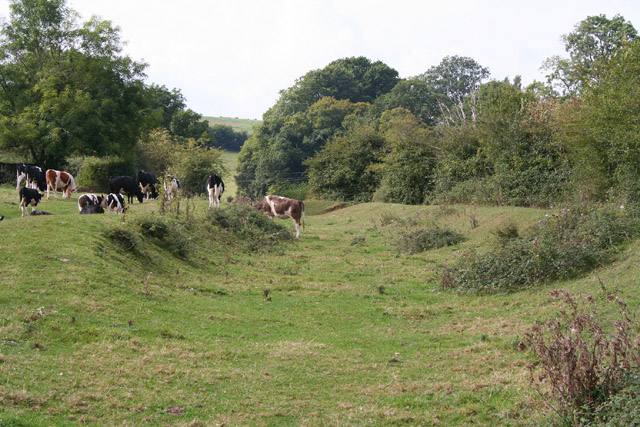 Walking the disused Grand Western Canal
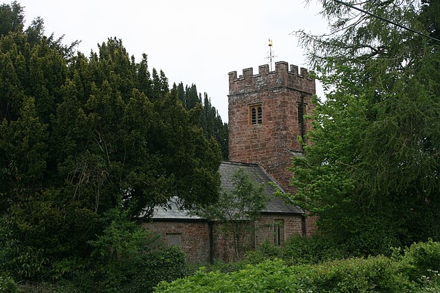 Runnington Church
Once across the river, the route runs along quiet country lanes through the scattered hamlet of Runnington (Langford Budville). After crossing a quiet country road, the route dives into a narrow and sometimes overgrown footpath running between hedges. The exuberant plant life make this section of the walk difficult sometimes, but it is a wonderful habitat for insects and abounds with butterflies and dragonflies.
Eventually, the path comes out by market gardens and heads off towards woodland, dominated by magnificent sweet chestnut trees. Finally, the route returns to the fields and past a grand house. This is Nynehead Court, which when passed, leads to the final steps of the walk, back into the heart of the village.
Acknowledgments: Text derived from the Out and Out Series; Discovering the Countryside on Foot. Pictures courtesy of Wikipedia.


