Oldbury-on-Severn, Cowhill and Littleton-upon-Severn
Along the bank of the broad River Severn and across fields to a hamlet
Google Maps Open Source Maps| Statistics and Files | ||
|---|---|---|
| Start: Littleton Warth | Distance: 6.1 miles (9.8 km) | Climbing: 58 metres |
| Grid Ref: ST 58833 91015 | Time: 2-3 hours | Rating: Easy |
| GPX Route File | Google Earth File | About Littleton |
| Statistics | |
|---|---|
| Start: Littleton Warth | Distance: 6.1 miles (9.8 km) |
| Climbing: 58 metres | Grid Ref: ST 58833 91015 |
| Time: 2-3 hours | Rating: Easy |
| GPX Route File | Google Earth File |
Ordnance Survey Explorer Map (1:25,000)
The Walk: The first section of the route leads alongside the River Severn. Once you are on top of the flood bank, a wide vista opens out ahead, and to your left is the river itself, with the high hills of Wales beyond it. At low tide, the wide expanse of Oldbury Sands is uncovered. This leaves a narrow channel known as Oldbury Channel near the shore. Between the flood bank and the water is an area of flat grassland, which is often flooded when the tide is high. The waters of the Severn can rise and fall by as much as 50 feet. To the South is the graceful span of the Severn Road Bridge. And to the north, the rather less graceful outline of the redundant Oldbury nuclear power station which is now subject to a long and drawn out decommissioning process.
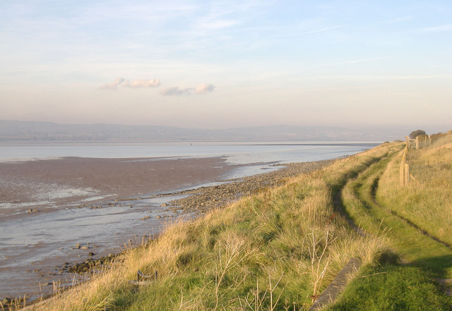 River Severn near Littleton Warth
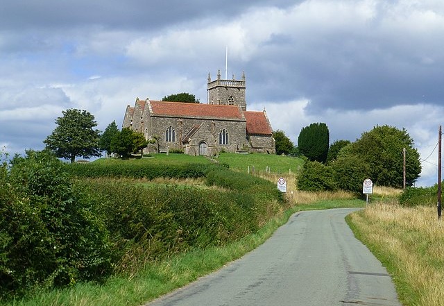 St Arilda's Church, Oldbury-on-Severn
The muddy banks and tidal waters are popular with waders and sea birds, while herons can occasionally be spotted by the streams on the landward side of the bank. A little further along the bank you can see what looks like a hurdle fence standing in the water at right angles to the shore. This is a salmon catch, a traditional means of capturing salmon as they make their way up the narrow channel.
Inland, to the right, is the prominent landmark of Oldbury Church. It has a bright red tiled roof and is perched on top of a hummocky hill. This section of the walk comes to an end at Oldbury Pill - 'pill' is a local name for a tidal inlet. The creek is filled with boats, mainly dinghies, but a few grander yachts as well.
The path turns inland to follow the creek and eventually arrives at the Anchor Inn on the outskirts of Oldbury-on-Severn. From here the small village is explored by following Church Lane and Camp Road to the site of an Iron Age fort called Oldbury Camp. Afterwards the walk returns to the Anchor Inn and then the quiet country lane is followed south, past Oldbury on Severn Primary School where a plaque announces that its erection in 1854 was funded by voluntary contributions and a government grant.
Beyond the school is the attractive Oldbury church of St Arilda whose nave and aisle are all that remain of the original 13th century building. In 1897 the church was devastated by fire but it was sensitively rebuilt to return it to its essential simplicity. The church has several 18th century tombstones decorated with rather chubby but attractive angels.
Soon after the church, the walk arrives at the tiny hamlet of Cowhill where there are a few businesses included a farm which diversifies in making locally produced ice cream. Near the farm the road is left behind as the walk continues in a southerly direction across fields towards Littleton-upon-Severn.
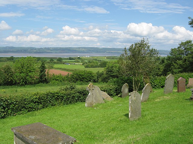 View to the Severn From St Arilda's Church
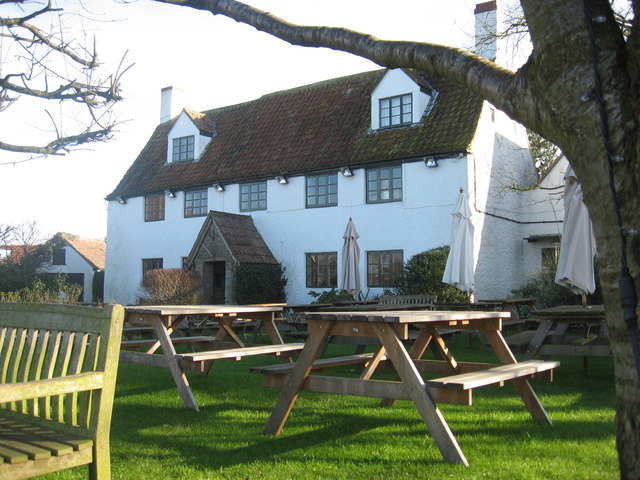 The White Hart Inn, Littleton-upon-Severn
You arrive on the outskirts of Littleton-upon-Severn beside a small plain church. At the roadway, the first of a number of old stone-built farms comes into view. The first one is the grandest, with its high gables and small windows topped by drip mouldings that are typical of 16th and 17th century design. Beyond it is a small triangle green, with an old hand operated water pump mounted on a brick base.
Soon the road turns to past the 16th century White Hart Inn with this inviting garden. This is an ideal place to stop, if the establishment is open for refreshments, before resuming on the final stage of the walk. This is by way of Rushden Lane which leads westwards back to the east shore of the River Severn.
Acknowledgments: Text derived from the Out and Out Series; Discovering the Countryside on Foot. Pictures courtesy of Wikipedia.


