All Cannings, Kennet and Avon Canal, Allington and Wansdyke
Through the Vale of Pewsey to hills and ancient earthworks
Google Maps Open Source Maps| Statistics and Files | ||
|---|---|---|
| Start: All Cannings | Distance: 5.5 miles (8.9 km) | Climbing: 197 metres |
| Grid Ref: SU 06927 61600 | Time: 2-3 hours | Rating: Moderate |
| GPX Route File | Google Earth File | The Wansdyke |
| Statistics | |
|---|---|
| Start: All Cannings | Distance: 5.5 miles (8.9 km) |
| Climbing: 197 metres | Grid Ref: SU 06927 61600 |
| Time: 2-3 hours | Rating: Moderate |
| GPX Route File | Google Earth File |
Ordnance Survey Explorer Map (1:25,000)
The Walk:
The fertile Vale of Pewsey lies between the Marlborough Downs and Salisbury Plain. Even today, it is quiet and remote. Its attractive villages are tucked away among narrow, twisting lanes, undisturbed by 21st century bustle. The whole area is marked by signs of Bronze and Iron Age settlements.
Rich farmland, canal banks and open downs provide a wide variety of birds and plant life. Kestrels hover over the downs and the banks of the Kennet and Avon canal are particularly rich in flowers such as flag irises.
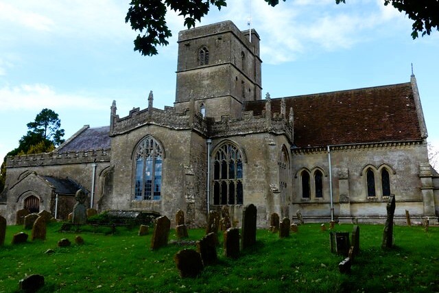 All Cannings Church
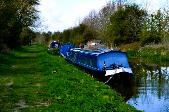 Kennet and Avon Canal
The village of All Cannings, mentioned in the Domesday Book as 'Caninge' is one of the prettiest villages of the Pewsey Vale. Attractive cottages of all dates, many half-timbered and thatched, are set behind grassy banks and among greens, and are often half hidden by their overflowing gardens. All Cannings has regularly won best kept village awards. The Church of All Saints dates back to Norman times and has a fascinating little wooden door halfway up the wall of the north transcept. It originally led to the rood screen. The Reverend T A Methuen was rector here for 60 years, and built the village school beside the church in 1833.
Samuel Taylor Coleridge, poet and essayist, visited Methuen at the rectory in 1817. This was the year in which the poet published his autobiography entitled 'Biographia Literaria'. With his appreciation of nature, he must have delighted in the beauty of the vale.
The restored Kennet and Avon Canal is a modern success story. Left to decay after the last working boat passed through it in 1951, teams and volunteers in the latter end of the last century restored its pumping stations, locks and aqueducts.
Great sheep fairs, to which shepherds brought their flocks from the surrounding area, were once held on Tan Hill. The view is marvellous, particularly over the Vale of Pewsey, which is dotted with hamlets.
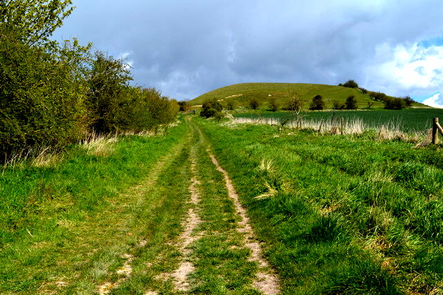 The path to Clifford's Hill
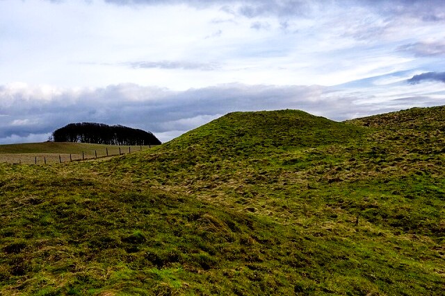 Rybury Hill Fort
The Wansdyke is a splendid bank and ditch, stretching 50 miles from Savernake Forest to Dundry Hill, south of Bristol. It possibly dates from Celtic times and marked the territorial boundary of the regional tribe or chieftain. Country people later could only attribute the making of such a long and useless ditch to the Devil, so they called it 'Woden's Dyke (the Anglo-Saxon war god Woden was identified with the Devil). In time, this became abbreviated to Wansdyke.
Rybury Camp is a well preserved Iron Age hillfort. It stands out from the line of the Downs, and must have been a fine vantage point dominating the Vale of Pewsey.
Acknowledgments: Text derived from the Out and Out Series; Discovering the Countryside on Foot. Pictures courtesy of Wikipedia.


