Great Torrington, Caddywell, Taddiport and Rolle Bridge
Explore the area surrounding the story of Tarka the Otter
Google Maps Open Source Maps| Statistics and Files | ||
|---|---|---|
| Start: South Street | Distance: 5.5 miles (9.0 km) | Climbing: 296 metres |
| Grid Ref: SS 49343 19068 | Time: 2-3 hours | Rating: Moderate |
| GPX Route File | Google Earth File | Great Torrington |
| Statistics | |
|---|---|
| Start: South Street | Distance: 5.5 miles (9.0 km) |
| Climbing: 296 metres | Grid Ref: SS 49343 19068 |
| Time: 2-3 hours | Rating: Moderate |
| GPX Route File | Google Earth File |
Ordnance Survey Explorer Map (1:25,000)
The Walk:
Rising close to the source of the River Tamar, the River Torridge twists and turns to reach the sea at Bideford. Its lush, wooded middle reaches, to the south-east of Great Torrington, were the setting for many scenes in Henry Williamson's classic Tarka the Otter. The river and the Commons that encircle two-thirds of the town bless Great Torrington with a rich range of wildlife habitats.
The Commons cover about 365 acres and are latticed with over 20 miles of public paths and tracks of varying quality.
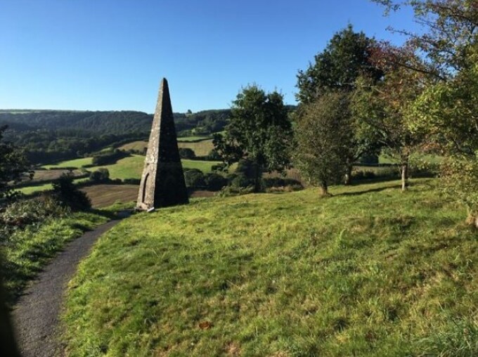 Waterloo Monument, Great Torrington Common
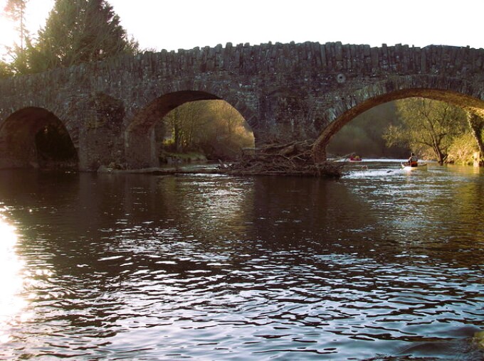 Taddiport Bridge
This walk follows some of the better routes. Soon after starting, you step through a stone arch and the land drops away almost 200 feet into a deep-gouged valley, through which the River Torridge weaves like a languid serpent. Hedged fields clothe the humped hills ahead and thick woodland greens the valley sides. It is tempting to sit on a bench and stare, but there is much more to see further on.
The curtain wall here is Georgian, but stands on a castle site dating from Norman times. The last castle, built in 1340, was destroyed in the Civil War. A schoolhouse was built over the castle's chapel and is now the Eric Palmer Community Centre.
The path drops past the curious monument commemorating the Battle of Waterloo, and follows a sweeping bend in the river before squeezing tightly between the A386 on the left and the river on the right.
This section is part of the Rolle Road, once the 7.5 mile long Rolle Canal. It was abandoned in 1870 due to competition from the new railway line from Bideford to Great Torrington. The canal's financier, Lord Rolle, also paid for New Bridge at Town Mills. Once a water-powered grist mill, Town Mills is perhaps best known as Tarka's hiding place when the final hunt gathered. Otters still live in the river, but are unlikely to be spotted by day as they are largely nocturnal.
Fine deciduous woodland stands behind the mill. Tall silver birch reach for light in gaps of the heavy canopy of oak and ash near the stream. In the clearings, and by the woodland fringe tracks, you may see the dark green fritillary. Almost as big as a red admiral, it is one of the three largest British butterfly species. It flies in July and August, but like many of the fritillaries, is becoming increasingly scarce.
Up the hill towards Caddywell, the route swings left at a modernised building. This was once a tannery, and was situated deep in the open country due to the foul stench of the pits of dog excrement used in the tanning process. An old, local saying suggested that you could smell a tanner long before you could see him.
From here, you head back along the River Torridge all the way to the bridge linking Great Torrington with the village of Taddiport. Look out for dragonflies here, particularly the largest British species, the emperor. The present 17th century stone bridge is unusual in that all the stone blocks have their longest sides placed vertically rather than horizontally. There has been a bridge here since at least the 13th century; it once gave access to a leper hospital on the opposite bank.
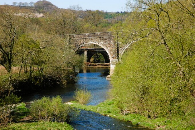 Rolle Bridge and Rothern Bridge
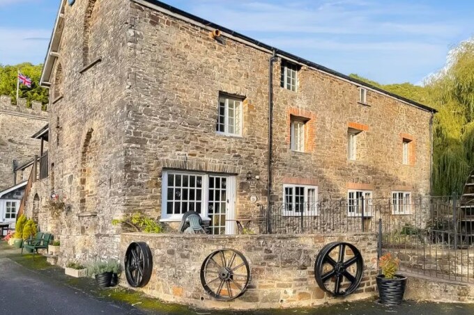 Town Mills, Great Torrington
The little chapel of St Mary Magdalene was used by the lepers. A stained glass window from later years is inscribed in their memory. The colony farmed its own land; two of their strip fields can be seen after leaving the bridge on the ascent towards Torridge View.
The walk continues through the town's western limits to the high Commons. An unmarked section, known as Barmaid's Walk, is said to be the well-trodden route taken by a Victorian barmaid and her many gentlemen friends!
Returning to the town, the path emerges at the rear of the factory which produces Dartington Glass. Free tours around the factory to see glass being blown and cut can be taken during the summer months.
The heart of the town is worth walking in its own right. Palmer House in New Street was built for a three times mayor of Torrington, John Palmer. He was the brother-in-law of Sir Joshua Reynolds, the portrait painter and both he and Samuel Johnson stayed here.
Close by is St Michael's Church. Thomas Wolsey, later Archbishop of Canterbury, was appointed rector here by Henry VIII. The town suffered badly in the Civil War, and St Michael's was accidently blown up in 1646, killing 200 Royalist prisoners held inside. The church was rebuilt in 1651 and restarting the mid-19th century, though parts of the original still stand.
Acknowledgments: Text derived from the Out and Out Series; Discovering the Countryside on Foot. Pictures courtesy of Wikipedia.


