Stourpaine, Hambledon Hill, Iwerne Courtney or Shroton and Hod Hill
Magnificent views from two hilltop forts and a riverside path
Google Maps Open Source Maps| Statistics and Files | ||
|---|---|---|
| Start: Stourpaine | Distance: 6.4 miles (10.3 km) | Climbing: 332 metres |
| Grid Ref: ST 86006 09357 | Time: 3 hours | Rating: Moderate |
| GPX Route File | Google Earth File | About Stourpaine |
| Statistics | |
|---|---|
| Start: Stourpaine | Distance: 6.4 miles (10.3 km) |
| Climbing: 332 metres | Grid Ref: ST 86006 09357 |
| Time: 3 hours | Rating: Moderate |
| GPX Route File | Google Earth File |
Ordnance Survey Explorer Map (1:25,000)
The Walk:
This varied walk visits several ancient sites in north Dorset. You begin by the church in Stourpaine. This was rebuilt in 1858, but contains a kneeling statue of an earlier vicar, who had it erected in 1670 a few years before he died.
In the field behind the church are some mounds, all that remain of a medieval building and a moat. The route follows a grassy track out of the village. It descends to ash woods that border the River Stour, under the steep west slope of Hod Hill. Kingfishers nest along the river, and water lilies grow in profusion.
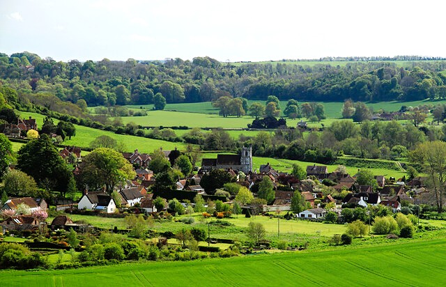 Stourpaine
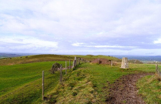 Hambledon Hill
You emerge onto a road and soon turn left up a spur of Hambledon Hill. Where the track reaches level ground at the top of the hill, a wood is just visible on your left. This is one of the most extensive yew forests in Europe, and it possibly has origins in the Iron Age.
An area of rough ground at the edge of Coombe Wood indicates the boundaries of a Neolithic settlement, predating the more obvious Iron Age fortifications on the northern heights of Hambeldon Hill by 3,000 years. Where the trig point stands, there was once a large enclosure, and the Neolithic dead were left to decompose in the open air in the surrounding ditches.
The hillfort was built in about 500BC. On the steep northern slopes, the indentations of hut circles can be made out in the turf. The fort was abandoned in AD43, when the second Augusta Legion, under Titus Vespasian, who later became Emperor, invaded Dorset.
Its history did not end there. In August 1645, 2,000 locals known as the Dorset Clubmen, assembled on Hambledon Hill under the leadership of the Rector of Compton Abbas. They opposed the forces of the Civil War, which were destroying their land. Their banners declared 'if you offer to plunder or take our cattle, be assured we will bid you battle'. Cromwell thought little of this protest and put the clubmen to flight with 50 well-trained dragoons, A century later, James Wolfe trained his soldiers here in preparation for their capture of Quebec on the Plains of Abraham.
From the summit, there is a spectacular view over the Vale of Blackmore, once a huge tract of medieval forest. Today, the clay soils make this green fertile area the domain of the dairy farmer, just as it was in Thomas Hardy's day. Rising out of the vale to the north-east are Melbury Hill and Fontmell Down, which, with Hambledon Hill, mark the northern edge of the chalk band that runs across the county.
 Iwerne Courtney or Shroton
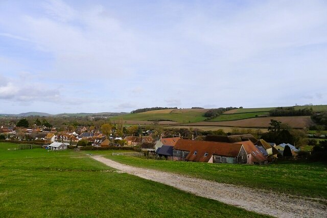
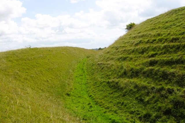 Hillfort embankments on Hod Hill
Descending from the trig point, you reach a crossing track by a walled wood. To the left is the village of Iwerne Courtney or Shroton. Shroton is the old part of the village, referred to in Domesday Book as 'Sheriff's Town' in 1261. It was granted a weekly market and a twice yearly fair.
The church is true Gothic, rebuilt in 1610. It supposedly held 300 captured Clubmen overnight after their abortive stand on Hambleton Hill. Behind it are some unusual thatched barns. Shroton House, built in the 18th century, stands at the north end of the village.
To the south, as the route climbs Hod Hill, another Iron Age fort, you pass through an entrance made by the Romans after they captured the fort in 43 AD. Roman ballistas were discovered in abundance near the remains of the largest Iron Age hut, suggesting they made the precise attack on the chief of the settlement.
The Romans built their own camp in the north-west corner of the fort. It housed 600 infantrymen and 250 cavalrymen, and was in use until 51 AD. Many Iron Age and Roman objects have been found; most are now in the British Museum.
There's southern slope of the hillfort have never been cultivated. This area of undisturbed chalkland is home to a range of orchids, and a wide variety of butterflies, including the marsh fritillary. At the bottom of Hod Hill is the River Iwerne, no more than a shallow stream, which you follow back into Stourpaine.
Acknowledgments: Text derived from the Out and Out Series; Discovering the Countryside on Foot. Pictures courtesy of Wikipedia.


